Area Overview for E10 6EP
Photos of E10 6EP

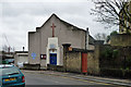
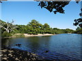
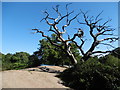
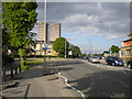
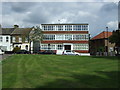
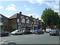
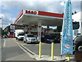
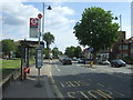
54 photos from this area
Area Information
Key information about the E10 6EP including its size, population, and administrative classification.
- Area Type
- Postcode
- Area Size
- 3.2 hectares
- Population
- 1666
- Population Density
- 5646 people/km²
House Prices in E10 6EP
42
Properties
£492,767
Average Sold Price
£80,000
Lowest Price
£955,000
Highest Price
Showing 42 properties
| Address | Type | Beds | Baths | Last Sale Price | Last Sale Date | |
|---|---|---|---|---|---|---|
| 103 Nottingham Road, Leyton, E10 6EP | Terraced | 3 | 1 | £877,500 | Aug 2025 | |
| 36 Nottingham Road, Leyton, E10 6EP | Terraced | 1 | 2 | £955,000 | Jan 2025 | |
| 63 Nottingham Road, Leyton, E10 6EP | Terraced | 4 | 2 | £920,000 | May 2023 | |
| 71 Nottingham Road, Leyton, E10 6EP | Terraced | 3 | 2 | £745,000 | Sep 2022 | |
| 91 Nottingham Road, Leyton, E10 6EP | Terraced | 3 | 2 | £900,000 | Aug 2022 | |
| 46 Nottingham Road, Leyton, E10 6EP | house | 3 | 1 | £660,000 | Sep 2021 | |
| 67 Nottingham Road, Leyton, E10 6EP | house | - | - | £808,000 | Sep 2021 | |
| 51 Nottingham Road, Leyton, E10 6EP | house | - | - | £675,000 | Jun 2021 | |
| 73 Nottingham Road, Leyton, E10 6EP | Terraced | 3 | 1 | £750,000 | Feb 2021 | |
| 65 Nottingham Road, Leyton, E10 6EP | Terraced | 3 | 1 | £495,000 | Aug 2019 |
Page 1 of 5
Energy Efficiency in E10 6EP
Amenities
Schools
| Rank | School | Type | Entry gender | Ages |
|---|
Explore more schools in this area
Go to Schools tabDemographics
Household Size
Family (3-5 people)
most common
Accommodation Type
Houses
most common
Tenure
71
majority
Ethnic Group
White
most common
Religion
N/A
most common
Household Composition
N/A
most common
Age
47
median
Adults (30-64 years)
most common
Household Deprivation
N/A
with no deprivation
NS-SEC
38
in Lower managerial occupations
Explore more demographic insights in this area
Go to Demographics tabPlanning
Planning Constraints
- Flood RiskPremium
- Ramsar Wetland SitesPremium
- Area of Outstanding Natural BeautyPremium
- Protected Nature ReservePremium
- Protected WoodlandPremium