Area Overview for E10 6DJ
Photos of E10 6DJ

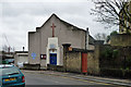
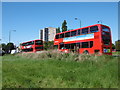
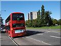
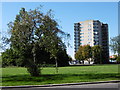
54 photos from this area
Area Information
Key information about the E10 6DJ including its size, population, and administrative classification.
- Area Type
- Postcode
- Area Size
- 1.3 hectares
- Population
- 1666
- Population Density
- 5646 people/km²
House Prices in E10 6DJ
54
Properties
£376,526
Average Sold Price
£64,000
Lowest Price
£882,000
Highest Price
Showing 54 properties
| Address | Type | Beds | Baths | Last Sale Price | Last Sale Date | |
|---|---|---|---|---|---|---|
| 104 Matlock Road, Leyton, E10 6DJ | house | - | - | £700,000 | Nov 2025 | |
| 70 Matlock Road, Leyton, E10 6DJ | Terraced | 4 | 1 | £882,000 | Aug 2024 | |
| 97 Matlock Road, Leyton, E10 6DJ | Terraced | 4 | 2 | £780,000 | Oct 2023 | |
| 64 Matlock Road, Leyton, E10 6DJ | Terraced | 3 | 1 | £742,500 | Aug 2023 | |
| 92 Matlock Road, Leyton, E10 6DJ | Terraced | 3 | 1 | £670,000 | Jun 2023 | |
| 96 Matlock Road, Leyton, E10 6DJ | house | - | - | £590,500 | Dec 2021 | |
| 90 Matlock Road, Leyton, E10 6DJ | Terraced | - | - | £600,000 | Sep 2019 | |
| 72 Matlock Road, Leyton, E10 6DJ | Terraced | 3 | 1 | £600,000 | Jan 2018 | |
| 119 Matlock Road, Leyton, E10 6DJ | Terraced | 5 | 2 | £595,000 | Dec 2017 | |
| 85 Matlock Road, Leyton, E10 6DJ | Terraced | 4 | 1 | £435,000 | Sep 2015 |
Page 1 of 6
Energy Efficiency in E10 6DJ
Amenities
Schools
| Rank | School | Type | Entry gender | Ages |
|---|
Explore more schools in this area
Go to Schools tabDemographics
Household Size
Family (3-5 people)
most common
Accommodation Type
Houses
most common
Tenure
71
majority
Ethnic Group
White
most common
Religion
N/A
most common
Household Composition
N/A
most common
Age
47
median
Adults (30-64 years)
most common
Household Deprivation
N/A
with no deprivation
NS-SEC
38
in Lower managerial occupations
Explore more demographic insights in this area
Go to Demographics tabPlanning
Planning Constraints
- Flood RiskPremium
- Ramsar Wetland SitesPremium
- Area of Outstanding Natural BeautyPremium
- Protected Nature ReservePremium
- Protected WoodlandPremium