Area Overview for E10 6BS
Photos of E10 6BS

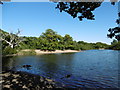
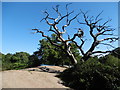
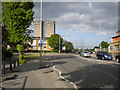
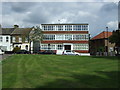
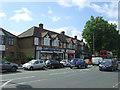
54 photos from this area
Area Information
Key information about the E10 6BS including its size, population, and administrative classification.
- Area Type
- Postcode
- Area Size
- 8699 m²
- Population
- 1666
- Population Density
- 5646 people/km²
House Prices in E10 6BS
52
Properties
£396,954
Average Sold Price
£74,000
Lowest Price
£825,000
Highest Price
Showing 52 properties
| Address | Type | Beds | Baths | Last Sale Price | Last Sale Date | |
|---|---|---|---|---|---|---|
| 150C Essex Road, Leyton, E10 6BS | Detached | - | - | £480,000 | Apr 2025 | |
| 139 Essex Road, Leyton, E10 6BS | Flat | 2 | 1 | £400,000 | Apr 2024 | |
| 137 Essex Road, Leyton, E10 6BS | Terraced | 3 | 1 | £825,000 | Jun 2022 | |
| 139A Essex Road, Leyton, E10 6BS | Flat | - | - | £473,000 | Sep 2021 | |
| 136 Essex Road, Leyton, E10 6BS | house | - | - | £582,500 | Jun 2021 | |
| 127 Essex Road, Leyton, E10 6BS | Terraced | 4 | 2 | £550,000 | Oct 2019 | |
| 133 Essex Road, Leyton, E10 6BS | Terraced | 3 | 1 | £545,000 | Aug 2018 | |
| 119 Essex Road, Leyton, E10 6BS | Semi-detached | 3 | 1 | £630,000 | Aug 2017 | |
| 128 Essex Road, Leyton, E10 6BS | Terraced | 5 | - | £637,500 | Oct 2015 | |
| 131 Essex Road, Leyton, E10 6BS | Terraced | 2 | 1 | £475,000 | Mar 2015 |
Page 1 of 6
Energy Efficiency in E10 6BS
Amenities
Schools
| Rank | School | Type | Entry gender | Ages |
|---|
Explore more schools in this area
Go to Schools tabDemographics
Household Size
Family (3-5 people)
most common
Accommodation Type
Houses
most common
Tenure
71
majority
Ethnic Group
White
most common
Religion
N/A
most common
Household Composition
N/A
most common
Age
47
median
Adults (30-64 years)
most common
Household Deprivation
N/A
with no deprivation
NS-SEC
38
in Lower managerial occupations
Explore more demographic insights in this area
Go to Demographics tabPlanning
Planning Constraints
- Flood RiskPremium
- Ramsar Wetland SitesPremium
- Area of Outstanding Natural BeautyPremium
- Protected Nature ReservePremium
- Protected WoodlandPremium