Area Overview for E10 6EJ
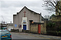
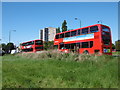
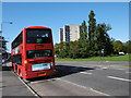
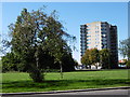
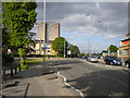
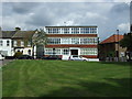
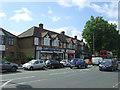
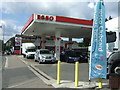
Photos of E10 6EJ


Area Information
E10 6EJ is a compact residential postcode area in England, covering 9,449 square metres and home to 1,984 residents. Its high population density of 209,971 people per square kilometre reflects its small, tightly knit character. Living here means navigating a dense urban environment where proximity to amenities and transport hubs is a defining feature. The area’s demographics suggest a mature community, with a median age of 47 and a majority of residents aged 30–64. This suggests a stable, established population, likely drawn to the area’s practicality and accessibility. The presence of multiple schools, including Barclay Primary School with an outstanding Ofsted rating, indicates a family-friendly orientation. While the area lacks natural landscapes, its strategic location near Leyton and Walthamstow offers a blend of urban convenience and connectivity. Residents here are likely to value the mix of retail, transport options, and educational facilities within walking distance, making E10 6EJ a practical choice for those prioritising accessibility over open space.
- Area Type
- Postcode
- Area Size
- 9449 m²
- Population
- 1984
- Population Density
- 9856 people/km²
The property market in E10 6EJ is characterised by a 50% home ownership rate, with houses forming the primary accommodation type. This suggests a mix of owner-occupied properties and rental units, though the exact proportion of rentals is not specified. Given the area’s small size and high population density, housing stock is likely limited, making it a competitive market for buyers. The prevalence of houses over flats or apartments may appeal to those seeking more space in a compact setting. However, the lack of specific data on property prices or availability means buyers must consider the area’s constraints. For those prioritising proximity to schools, transport, and retail, E10 6EJ’s immediate surroundings offer practical advantages, though the small footprint may limit options for expansion or renovation.
House Prices in E10 6EJ
Showing 1 properties
| Address | Type | Beds | Baths | Last Sale Price | Last Sale Date | |
|---|---|---|---|---|---|---|
| School House, Essex Road, Leyton, E10 6EJ | commercial | - | - | - | - |
Energy Efficiency in E10 6EJ
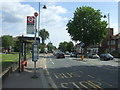
The lifestyle in E10 6EJ is defined by its proximity to a range of amenities. Retail options include M&S Whipps and Tesco Leyton, offering everyday shopping needs. The Whipps Cross Bus Interchange serves as a central hub for local travel, while nearby rail and metro stations connect residents to wider London. Ferry services, including East India Pier and Canary Wharf Pier, provide alternative transport routes, and London City Airport is within reach. The area’s compact size means these amenities are accessible on foot or by short journeys. This density of services supports a convenient, urban lifestyle, though the lack of green spaces may be a drawback for those seeking outdoor recreation. The mix of retail, transport, and connectivity options ensures daily life is efficient, catering to both practical needs and urban living.
Amenities
Schools
E10 6EJ is served by several schools, including Barclay Infants’ School and Barclay Junior School, both primary institutions catering to younger children. Barclay Primary School, listed twice in the data, holds an outstanding Ofsted rating, a significant draw for families. The presence of Leyton Sixth Form College adds to the area’s educational diversity, providing options for older students. This mix of primary and post-16 education suggests a well-rounded system for families at different stages. The concentration of schools within a short distance reduces the need for long commutes, enhancing the area’s appeal for parents. The outstanding rating at Barclay Primary School, in particular, indicates a high standard of education, which can be a decisive factor for homebuyers prioritising schooling.
| Rank | School | Type | Entry gender | Ages |
|---|
Explore more schools in this area
Go to Schools tabDemographics
The community in E10 6EJ is predominantly composed of adults aged 30–64, with a median age of 47. This suggests a mature population, likely with established careers and families. Home ownership stands at 50%, with houses being the primary accommodation type. This contrasts with areas where rental properties dominate, indicating a mix of long-term residents and those seeking to buy. The predominant ethnic group is Asian, reflecting the area’s cultural diversity. While no specific deprivation data is provided, the high population density and compact size suggest a community that may face challenges related to space and infrastructure. However, the presence of multiple schools and transport links implies efforts to support quality of life. The demographic profile aligns with a neighbourhood that balances stability with the need for modern amenities and connectivity.
Household Size
Accommodation Type
Tenure
Ethnic Group
Religion
Household Composition
Age
Household Deprivation
NS-SEC
Explore more demographic insights in this area
Go to Demographics tabPlanning
Planning Constraints
- Flood RiskPremium
- Ramsar Wetland SitesPremium
- Area of Outstanding Natural BeautyPremium
- Protected Nature ReservePremium
- Protected WoodlandPremium