Area Overview for BR2 9LG
Photos of BR2 9LG
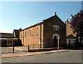
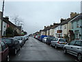
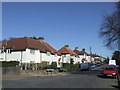
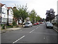
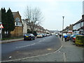
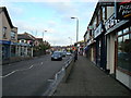
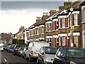
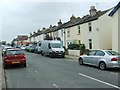
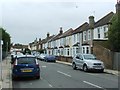
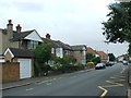
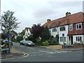
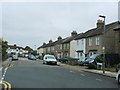
68 photos from this area
Area Information
Key information about the BR2 9LG including its size, population, and administrative classification.
- Area Type
- Postcode
- Area Size
- 7216 m²
- Population
- 1792
- Population Density
- 6068 people/km²
House Prices in BR2 9LG
28
Properties
£382,545
Average Sold Price
£148,500
Lowest Price
£742,500
Highest Price
Showing 28 properties
| Address | Type | Beds | Baths | Last Sale Price | Last Sale Date | |
|---|---|---|---|---|---|---|
| 49 Godwin Road, Bromley, BR2 9LG | Semi-detached | 2 | 1 | £415,000 | Feb 2025 | |
| 41 Godwin Road, Bromley, BR2 9LG | Terraced | 3 | 2 | £552,000 | Nov 2023 | |
| 39 Godwin Road, Bromley, BR2 9LG | Terraced | 3 | 1 | £560,000 | Aug 2023 | |
| 53 Godwin Road, Bromley, BR2 9LG | Semi-detached | 2 | 2 | £515,000 | May 2023 | |
| 25 Godwin Road, Bromley, BR2 9LG | Semi-detached | 3 | 3 | £742,500 | Dec 2022 | |
| 43 Godwin Road, Bromley, BR2 9LG | Semi-detached | 2 | - | £518,000 | Jun 2022 | |
| 33 Godwin Road, Bromley, BR2 9LG | Terraced | 2 | - | £583,000 | Jan 2021 | |
| 1 Godwin Road, Bromley, BR2 9LG | Terraced | 3 | 1 | £475,000 | Aug 2020 | |
| 45 Godwin Road, Bromley, BR2 9LG | house | - | - | £370,000 | May 2018 | |
| 55 Godwin Road, Bromley, BR2 9LG | house | - | - | £400,000 | Nov 2017 |
Page 1 of 3
Energy Efficiency in BR2 9LG
Amenities
Schools
| Rank | School | Type | Entry gender | Ages |
|---|
Explore more schools in this area
Go to Schools tabDemographics
Household Size
Family (3-5 people)
most common
Accommodation Type
Houses
most common
Tenure
77
majority
Ethnic Group
White
most common
Religion
N/A
most common
Household Composition
N/A
most common
Age
47
median
Adults (30-64 years)
most common
Household Deprivation
N/A
with no deprivation
NS-SEC
45
in Lower managerial occupations
Explore more demographic insights in this area
Go to Demographics tabPlanning
Planning Constraints
- Flood RiskPremium
- Ramsar Wetland SitesPremium
- Area of Outstanding Natural BeautyPremium
- Protected Nature ReservePremium
- Protected WoodlandPremium