Area Overview for BR2 9LL
Photos of BR2 9LL
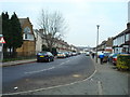
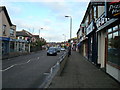
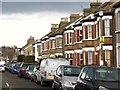
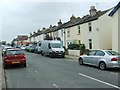
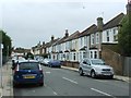
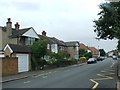
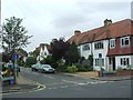
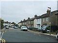
68 photos from this area
Area Information
Key information about the BR2 9LL including its size, population, and administrative classification.
- Area Type
- Postcode
- Area Size
- 1.3 hectares
- Population
- 2271
- Population Density
- 6623 people/km²
House Prices in BR2 9LL
48
Properties
£382,197
Average Sold Price
£60,000
Lowest Price
£650,000
Highest Price
Showing 48 properties
| Address | Type | Beds | Baths | Last Sale Price | Last Sale Date | |
|---|---|---|---|---|---|---|
| 44 Gundulph Road, Bromley, BR2 9LL | Semi-detached | 3 | 1 | £554,000 | Dec 2025 | |
| 24 Gundulph Road, Bromley, BR2 9LL | Detached | 3 | 1 | £460,000 | Aug 2025 | |
| 25 Gundulph Road, Bromley, BR2 9LL | Terraced | 3 | 1 | £600,000 | Jul 2025 | |
| 1A Gundulph Road, Bromley, BR2 9LL | house | 3 | 1 | £625,000 | Mar 2025 | |
| 35 Gundulph Road, Bromley, BR2 9LL | Terraced | 3 | 1 | £567,000 | Jun 2022 | |
| 10 Gundulph Road, Bromley, BR2 9LL | Retail | 4 | 3 | £611,500 | Feb 2022 | |
| 40 Gundulph Road, Bromley, BR2 9LL | Retail | 4 | 2 | £650,000 | Feb 2022 | |
| 48 Gundulph Road, Bromley, BR2 9LL | Semi-detached | 3 | - | £530,000 | Oct 2021 | |
| 3 Gundulph Road, Bromley, BR2 9LL | house | - | - | £396,000 | Sep 2021 | |
| 33 Gundulph Road, Bromley, BR2 9LL | Terraced | 3 | 1 | £595,000 | Jun 2021 |
Page 1 of 5
Energy Efficiency in BR2 9LL
Amenities
Schools
| Rank | School | Type | Entry gender | Ages |
|---|
Explore more schools in this area
Go to Schools tabDemographics
Household Size
Family (3-5 people)
most common
Accommodation Type
Flats
most common
Tenure
58
majority
Ethnic Group
White
most common
Religion
N/A
most common
Household Composition
N/A
most common
Age
47
median
Adults (30-64 years)
most common
Household Deprivation
N/A
with no deprivation
NS-SEC
49
in Lower managerial occupations
Explore more demographic insights in this area
Go to Demographics tabPlanning
Planning Constraints
- Flood RiskPremium
- Ramsar Wetland SitesPremium
- Area of Outstanding Natural BeautyPremium
- Protected Nature ReservePremium
- Protected WoodlandPremium