Area Overview for BR1 2RA
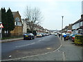
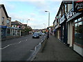
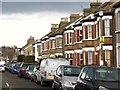
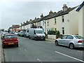
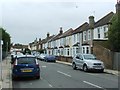
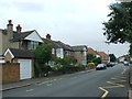
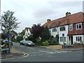
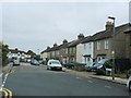
Photos of BR1 2RA
Area Information
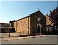
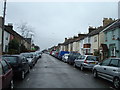
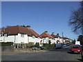
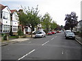
Living in BR1 2RA means residing within a compact residential cluster defined by the BR1 2RA postcode. This specific area covers 2071 square metres and supports a population of 1792 people. The density is significantly higher than the national average, creating a tightly knit environment where neighbours are close at hand. The location sits within the Bromley Common and Holwood Ward, part of the London Borough of Bromley, approximately 9.5 miles southeast of Charing Cross. The ward's history dates back to its origins as common land owned by the Bishops of Rochester before enclosure in 1826. Rapid suburban development followed the arrival of the railway in 1858, with substantial growth occurring by 1901. Residential expansion concentrated around Hastings Road and later Chatterton Road. Today, the area remains a distinct community shaped by Victorian and twentieth-century influences. You will find yourself in a setting where historical landmarks like Holy Trinity Church and St Luke's Church stand alongside modern amenities. The area functions as a settled neighbourhood with established patterns of life. Prospective buyers seeking a defined, residential environment with historical depth will find BR1 2RA offers a specific character. The proximity to Bromley Common also provides access to open space that acts as a green lung for the wider district.
- Area Type
- Postcode
- Area Size
- 2071 m²
- Population
- 1792
- Population Density
- 6068 people/km²
The property market in BR1 2RA is characterised by a predominantly owner-occupied landscape, with 77 percent of households owning their homes. This high figure indicates that the area appeals to buyers seeking long-term stability rather than short-term rentals. The accommodation type is almost exclusively houses, which fits the historical narrative of suburban expansion that began after the railway arrived in 1858. You are looking at a market where the stock has evolved from cottage-style accommodation around Chatterton Road to more modern iterations. The small size of the postcode area, covering only 2071 square metres, means supply is limited and demand likely competes for specific properties. This concentration creates a tight local market where individual properties hold significant value. The high ownership rate suggests that when a property becomes available, it is likely to attract serious buyers from within the community or those moving into the Bromley Common and Holwood Ward. Investors looking for high turnover might find this environment less dynamic than in younger rental hotspots. Homeownership here represents an anchor in a neighbourhood defined by its residential nature.
House Prices in BR1 2RA
Showing 6 properties
| Address | Type | Beds | Baths | Last Sale Price | Last Sale Date | |
|---|---|---|---|---|---|---|
| 160 Homesdale Road, Bromley, BR1 2RA | Semi-detached | 2 | 1 | £435,000 | Mar 2021 | |
| 158 Homesdale Road, Bromley, BR1 2RA | house | 3 | 1 | £226,000 | Jun 2011 | |
| 156 Homesdale Road, Bromley, BR1 2RA | Semi-detached | 4 | 2 | £284,000 | Apr 2006 | |
| 162 Homesdale Road, Bromley, BR1 2RA | Detached | - | - | - | - | |
| 160A Homesdale Road, Bromley, BR1 2RA | house | - | - | - | - | |
| 164 Homesdale Road, Bromley, BR1 2RA | Detached | - | - | - | - |
Energy Efficiency in BR1 2RA
Daily life in BR1 2RA offers practical convenience through a range of nearby amenities. Residents have access to five retail outlets, including Tesco Bromley, Co-op Bromley, and Waitrose Bromley, ensuring you can find all necessary groceries and household goods without travelling far. Transport links allow easy access to five rail stations such as Bickley Station and Bromley South Station, plus five metro stops including Beckenham Road Tram Stop. Two airports, Biggin Hill Airport and London Biggin Hill Airport, provide aviation access just beyond the immediate perimeter. There is also a ferry connection at Greenwich Pier for those interested in water travel. While the area is residential, these facilities are within practical reach for regular use. The historical transport routes like Hastings Road still influence current accessibility patterns. You can combine errands in town with local schooling in Raglan. The presence of multiple supermarkets supports varied shopping habits, from budget selections at Co-op to premium finds at Waitrose. This blend of immediate retail and broader transport options means you do not have to sacrifice convenience for the character of neighbourhood living.
Amenities
Schools
Families living in BR1 2RA benefit from immediate access to several educational institutions. Raglan Primary School operates nearby and holds a good Ofsted rating, providing a secure environment for young learners. You can also find Raglan Junior School and Raglan Infant School in the vicinity, creating a cohesive grouping of educational provision. The repetition of Raglan Primary School in records confirms its strong presence in the local catchment. This concentration of Raglan institutions simplifies choices for parents, ensuring children remain close to home throughout their early education. The mix of infant and junior provision suggests a comprehensive approach to early schooling. Proximity to these facilities supports families who value walkability and a consistent school environment. While the data highlights Raglan schools specifically, their established nature within the area implies a mature curriculum and local reputation. For those prioritising education when buying homes in BR1 2RA, the availability of these specific schools provides a clear advantage over areas with fewer options. The presence of multiple institutions within a small cluster reduces travel time and fosters a strong sense of community among students and parents alike.
| Rank | School | Type | Entry gender | Ages |
|---|
Explore more schools in this area
Go to Schools tabDemographics
The community within BR1 2RA is dominated by adults, with the most common age range falling between 30 and 64 years. The median age across the postcode is 47, indicating a mature population structure. Home ownership stands at 77 percent, reflecting a strong tendency for residents to buy rather than rent. The prevailing accommodation type consists of houses, which aligns with the area's historical development as a suburban district. The predominant ethnic group is White, though the area reflects the broader demographic composition of Greater London. A high ownership rate suggests financial stability among locals and long-term roots in the neighbourhood. This demographic profile points to a settled community likely focused on family life and stability. The absence of significant student or transient populations contributes to a consistent social fabric. Residents in this age bracket often prioritise quiet streets, reliable local services, and good school access. The housing stock supports these needs with a focus on detached and semi-detached properties. Understanding these demographics helps clarify who currently defines the culture of BR1 2RA and what expectations new residents might share with existing inhabitants.
Household Size
Accommodation Type
Tenure
Ethnic Group
Religion
Household Composition
Age
Household Deprivation
NS-SEC
Explore more demographic insights in this area
Go to Demographics tabPlanning
Planning Constraints
- Flood RiskPremium
- Ramsar Wetland SitesPremium
- Area of Outstanding Natural BeautyPremium
- Protected Nature ReservePremium
- Protected WoodlandPremium