Area Overview for BR1 5SE
Photos of BR1 5SE
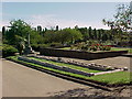
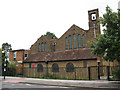
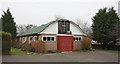
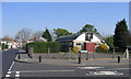
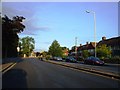
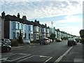
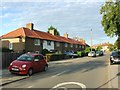
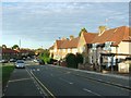
68 photos from this area
Area Information
Key information about the BR1 5SE including its size, population, and administrative classification.
- Area Type
- Postcode
- Area Size
- 3.5 hectares
- Population
- 1669
- Population Density
- 4822 people/km²
House Prices in BR1 5SE
44
Properties
£294,483
Average Sold Price
£65,000
Lowest Price
£525,000
Highest Price
Showing 44 properties
| Address | Type | Beds | Baths | Last Sale Price | Last Sale Date | |
|---|---|---|---|---|---|---|
| 267 Whitefoot Lane, Bromley, BR1 5SE | Terraced | 3 | 1 | £525,000 | Jul 2025 | |
| 215 Whitefoot Lane, Bromley, BR1 5SE | Terraced | 2 | 1 | £350,000 | Mar 2025 | |
| 239 Whitefoot Lane, Bromley, BR1 5SE | Terraced | 3 | 1 | £480,000 | Feb 2024 | |
| 209 Whitefoot Lane, Bromley, BR1 5SE | Terraced | 3 | 2 | £440,000 | Oct 2023 | |
| 237 Whitefoot Lane, Bromley, BR1 5SE | house | - | - | £480,000 | Oct 2022 | |
| 257 Whitefoot Lane, Bromley, BR1 5SE | Terraced | 2 | 2 | £475,000 | Sep 2022 | |
| 271 Whitefoot Lane, Bromley, BR1 5SE | house | - | - | £430,000 | Feb 2022 | |
| 263 Whitefoot Lane, Bromley, BR1 5SE | house | - | - | £395,000 | Jun 2021 | |
| 201 Whitefoot Lane, Bromley, BR1 5SE | Terraced | 3 | 2 | £370,000 | Jun 2019 | |
| 221 Whitefoot Lane, Bromley, BR1 5SE | Terraced | 2 | 1 | £325,000 | Dec 2018 |
Page 1 of 5
Energy Efficiency in BR1 5SE
Amenities
Schools
| Rank | School | Type | Entry gender | Ages |
|---|
Explore more schools in this area
Go to Schools tabDemographics
Household Size
Family (3-5 people)
most common
Accommodation Type
Houses
most common
Tenure
50
majority
Ethnic Group
White
most common
Religion
N/A
most common
Household Composition
N/A
most common
Age
47
median
Adults (30-64 years)
most common
Household Deprivation
N/A
with no deprivation
NS-SEC
26
in Lower managerial occupations
Explore more demographic insights in this area
Go to Demographics tabPlanning
Planning Constraints
- Flood RiskPremium
- Ramsar Wetland SitesPremium
- Area of Outstanding Natural BeautyPremium
- Protected Nature ReservePremium
- Protected WoodlandPremium