Area Overview for BR1 5SQ
Photos of BR1 5SQ
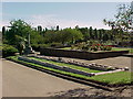
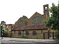
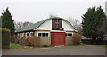
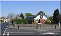
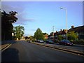
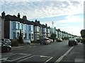
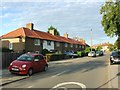
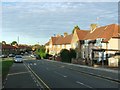
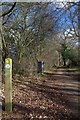
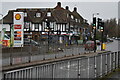
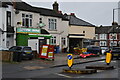
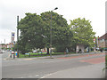
68 photos from this area
Area Information
Key information about the BR1 5SQ including its size, population, and administrative classification.
- Area Type
- Postcode
- Area Size
- 1.9 hectares
- Population
- 1321
- Population Density
- 5456 people/km²
House Prices in BR1 5SQ
47
Properties
£280,399
Average Sold Price
£59,750
Lowest Price
£467,500
Highest Price
Showing 47 properties
| Address | Type | Beds | Baths | Last Sale Price | Last Sale Date | |
|---|---|---|---|---|---|---|
| 278 Whitefoot Lane, Bromley, BR1 5SQ | Terraced | 3 | 1 | £385,000 | Apr 2024 | |
| 282 Whitefoot Lane, Bromley, BR1 5SQ | house | - | - | £430,000 | Sep 2021 | |
| 252 Whitefoot Lane, Bromley, BR1 5SQ | house | - | - | £394,000 | Jun 2021 | |
| 220 Whitefoot Lane, Bromley, BR1 5SQ | house | - | - | £345,000 | Aug 2020 | |
| 258 Whitefoot Lane, Bromley, BR1 5SQ | Terraced | 4 | - | £467,500 | Aug 2020 | |
| 250 Whitefoot Lane, Bromley, BR1 5SQ | Terraced | 5 | 2 | £405,000 | Dec 2018 | |
| 208 Whitefoot Lane, Bromley, BR1 5SQ | house | - | - | £347,000 | Jun 2018 | |
| 266 Whitefoot Lane, Bromley, BR1 5SQ | Terraced | 3 | 1 | £356,000 | May 2018 | |
| 202 Whitefoot Lane, Bromley, BR1 5SQ | Terraced | 3 | 1 | £406,000 | Feb 2018 | |
| 260 Whitefoot Lane, Bromley, BR1 5SQ | Terraced | 3 | - | £410,000 | Jul 2017 |
Page 1 of 5
Energy Efficiency in BR1 5SQ
Amenities
Schools
| Rank | School | Type | Entry gender | Ages |
|---|
Explore more schools in this area
Go to Schools tabDemographics
Household Size
Family (3-5 people)
most common
Accommodation Type
Houses
most common
Tenure
45
majority
Ethnic Group
black_total
most common
Religion
N/A
most common
Household Composition
N/A
most common
Age
47
median
Adults (30-64 years)
most common
Household Deprivation
N/A
with no deprivation
NS-SEC
23
in Lower managerial occupations
Explore more demographic insights in this area
Go to Demographics tabPlanning
Planning Constraints
- Flood RiskPremium
- Ramsar Wetland SitesPremium
- Area of Outstanding Natural BeautyPremium
- Protected Nature ReservePremium
- Protected WoodlandPremium