Area Overview for BR1 5EU
Photos of BR1 5EU
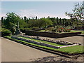
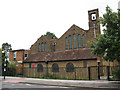
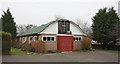
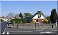
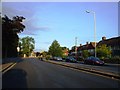
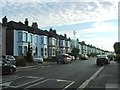
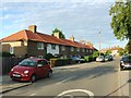
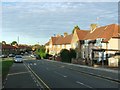
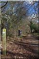
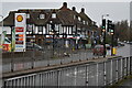
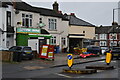
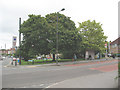
68 photos from this area
Area Information
Key information about the BR1 5EU including its size, population, and administrative classification.
- Area Type
- Postcode
- Area Size
- 8026 m²
- Population
- Not available
- Population Density
- Not available
House Prices in BR1 5EU
36
Properties
£262,650
Average Sold Price
£52,000
Lowest Price
£422,500
Highest Price
Showing 36 properties
| Address | Type | Beds | Baths | Last Sale Price | Last Sale Date | |
|---|---|---|---|---|---|---|
| 26 Cranmore Road, Bromley, BR1 5EU | house | 3 | 1 | £385,000 | Sep 2024 | |
| 1 Cranmore Road, Bromley, BR1 5EU | Terraced | 3 | 1 | £360,000 | Aug 2024 | |
| 7 Cranmore Road, Bromley, BR1 5EU | Terraced | 3 | 1 | £365,000 | Dec 2023 | |
| 32 Cranmore Road, Bromley, BR1 5EU | Terraced | 3 | 1 | £401,000 | Aug 2023 | |
| 42 Cranmore Road, Bromley, BR1 5EU | house | - | - | £422,500 | Apr 2022 | |
| 44 Cranmore Road, Bromley, BR1 5EU | house | - | - | £386,000 | Jun 2021 | |
| 5 Cranmore Road, Bromley, BR1 5EU | house | - | - | £315,000 | Mar 2021 | |
| 18 Cranmore Road, Bromley, BR1 5EU | house | - | - | £375,000 | Oct 2020 | |
| 2 Cranmore Road, Bromley, BR1 5EU | Flat | 1 | 1 | £218,000 | Jan 2020 | |
| 4 Cranmore Road, Bromley, BR1 5EU | Terraced | 2 | 1 | £305,000 | Jan 2020 |
Page 1 of 4
Energy Efficiency in BR1 5EU
Amenities
Schools
| Rank | School | Type | Entry gender | Ages |
|---|
Explore more schools in this area
Go to Schools tabDemographics
Household Size
Family (3-5 people)
most common
Accommodation Type
Houses
most common
Tenure
42
majority
Ethnic Group
White
most common
Religion
N/A
most common
Household Composition
N/A
most common
Age
47
median
Adults (30-64 years)
most common
Household Deprivation
N/A
with no deprivation
NS-SEC
24
in Lower managerial occupations
Explore more demographic insights in this area
Go to Demographics tabPlanning
Planning Constraints
- Flood RiskPremium
- Ramsar Wetland SitesPremium
- Area of Outstanding Natural BeautyPremium
- Protected Nature ReservePremium
- Protected WoodlandPremium