Area Overview for BR1 5SF
Photos of BR1 5SF
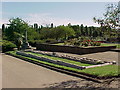
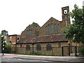
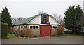
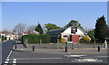
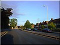
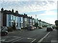
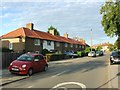
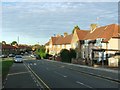
68 photos from this area
Area Information
Key information about the BR1 5SF including its size, population, and administrative classification.
- Area Type
- Postcode
- Area Size
- 1.6 hectares
- Population
- 1669
- Population Density
- 4822 people/km²
House Prices in BR1 5SF
55
Properties
£270,616
Average Sold Price
£68,000
Lowest Price
£871,578
Highest Price
Showing 55 properties
| Address | Type | Beds | Baths | Last Sale Price | Last Sale Date | |
|---|---|---|---|---|---|---|
| 414 Whitefoot Lane, Bromley, BR1 5SF | Terraced | 3 | 1 | £380,000 | Apr 2024 | |
| 386 Whitefoot Lane, Bromley, BR1 5SF | Terraced | 3 | 1 | £450,000 | Jan 2023 | |
| 430 Whitefoot Lane, Bromley, BR1 5SF | Retail | 3 | 1 | £436,500 | Feb 2022 | |
| 422 Whitefoot Lane, Bromley, BR1 5SF | Terraced | 3 | 1 | £871,578 | Dec 2021 | |
| 480 Whitefoot Lane, Bromley, BR1 5SF | Detached | - | - | £166,760 | Aug 2021 | |
| 426 Whitefoot Lane, Bromley, BR1 5SF | house | - | - | £443,000 | Jun 2021 | |
| 456 Whitefoot Lane, Bromley, BR1 5SF | Terraced | 4 | 1 | £350,000 | Aug 2018 | |
| 434 Whitefoot Lane, Bromley, BR1 5SF | house | 3 | 1 | £348,000 | Jan 2018 | |
| 412 Whitefoot Lane, Bromley, BR1 5SF | Terraced | 2 | 1 | £400,000 | Jun 2017 | |
| 418 Whitefoot Lane, Bromley, BR1 5SF | Terraced | 3 | - | £380,000 | Feb 2017 |
Page 1 of 6
Energy Efficiency in BR1 5SF
Amenities
Schools
| Rank | School | Type | Entry gender | Ages |
|---|
Explore more schools in this area
Go to Schools tabDemographics
Household Size
Family (3-5 people)
most common
Accommodation Type
Houses
most common
Tenure
50
majority
Ethnic Group
White
most common
Religion
N/A
most common
Household Composition
N/A
most common
Age
47
median
Adults (30-64 years)
most common
Household Deprivation
N/A
with no deprivation
NS-SEC
26
in Lower managerial occupations
Explore more demographic insights in this area
Go to Demographics tabPlanning
Planning Constraints
- Flood RiskPremium
- Ramsar Wetland SitesPremium
- Area of Outstanding Natural BeautyPremium
- Protected Nature ReservePremium
- Protected WoodlandPremium