Area Overview for BR1 5SH
Photos of BR1 5SH
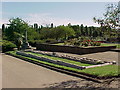
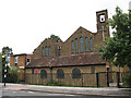
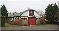
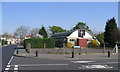
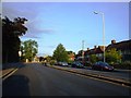
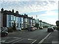
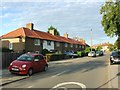
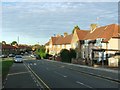
68 photos from this area
Area Information
Key information about the BR1 5SH including its size, population, and administrative classification.
- Area Type
- Postcode
- Area Size
- 1.1 hectares
- Population
- 1669
- Population Density
- 4822 people/km²
House Prices in BR1 5SH
46
Properties
£220,478
Average Sold Price
£64,000
Lowest Price
£375,000
Highest Price
Showing 46 properties
| Address | Type | Beds | Baths | Last Sale Price | Last Sale Date | |
|---|---|---|---|---|---|---|
| 39 Whitefoot Terrace, Bromley, BR1 5SH | Terraced | 2 | 1 | £352,000 | Sep 2025 | |
| 16 Whitefoot Terrace, Bromley, BR1 5SH | Terraced | 2 | 1 | £358,000 | Feb 2023 | |
| 30 Whitefoot Terrace, Bromley, BR1 5SH | Terraced | 2 | 1 | £375,000 | Feb 2023 | |
| 35 Whitefoot Terrace, Bromley, BR1 5SH | house | - | - | £333,000 | Jan 2023 | |
| 31 Whitefoot Terrace, Bromley, BR1 5SH | house | - | - | £330,000 | Dec 2021 | |
| 2 Whitefoot Terrace, Bromley, BR1 5SH | Terraced | 3 | 1 | £312,500 | Nov 2020 | |
| 40 Whitefoot Terrace, Bromley, BR1 5SH | Terraced | 2 | 1 | £320,000 | Dec 2019 | |
| 4 Whitefoot Terrace, Bromley, BR1 5SH | house | - | - | £318,000 | Jun 2018 | |
| 9 Whitefoot Terrace, Bromley, BR1 5SH | Terraced | 1 | 1 | £232,500 | Jan 2015 | |
| 22 Whitefoot Terrace, Bromley, BR1 5SH | Terraced | 3 | 1 | £227,000 | Mar 2014 |
Page 1 of 5
Energy Efficiency in BR1 5SH
Amenities
Schools
| Rank | School | Type | Entry gender | Ages |
|---|
Explore more schools in this area
Go to Schools tabDemographics
Household Size
Family (3-5 people)
most common
Accommodation Type
Houses
most common
Tenure
50
majority
Ethnic Group
White
most common
Religion
N/A
most common
Household Composition
N/A
most common
Age
47
median
Adults (30-64 years)
most common
Household Deprivation
N/A
with no deprivation
NS-SEC
26
in Lower managerial occupations
Explore more demographic insights in this area
Go to Demographics tabPlanning
Planning Constraints
- Flood RiskPremium
- Ramsar Wetland SitesPremium
- Area of Outstanding Natural BeautyPremium
- Protected Nature ReservePremium
- Protected WoodlandPremium