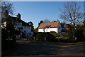
Area Overview for SG13 8UJ
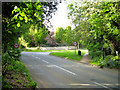
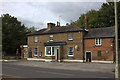
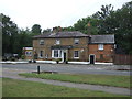
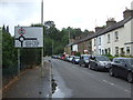
Photos of SG13 8UJ


Area Information
Living in SG13 8UJ means residing in a compact residential cluster defined by its specific postcode boundary. This small area covers exactly 8,212 square metres, creating a tightly knit environment for its 1,303 residents. The high population density results in a community where neighbours are rarely far apart, fostering an immediate sense of connection between households. You are buying into a location with a clear identity as a focused residential zone rather than a sprawling suburb. The limited land area dictates that daily life revolves around walking short distances to local hubs or relying on nearby transport links for wider travel. While the small footprint might suggest a lack of open space within the immediate boundary, the surrounding Hertfordshire landscape offers relief just beyond the street. Prospective buyers must consider the concentrated nature of this cluster when planning their daily routines. The area functions as a distinct pocket of living within the broader Hertford context, characterised by proximity and defined limits. Understanding the scale of SG13 8UJ helps you appreciate how convenience is achieved through density rather than spaciousness. Your perspective of the area will depend on whether you value the intensity of a small cluster or prefer more geographical spread.
- Area Type
- Postcode
- Area Size
- 8212 m²
- Population
- 1303
- Population Density
- 3790 people/km²
The property market in SG13 8UJ is defined by the specific mix of housing stock available within this small cluster. Flats constitute the predominant accommodation type, meaning most listings will be apartments rather than houses. This configuration suits the high population density found within the 8,212 square metres of land. With 46% of the population owning their homes, the area has a healthy balance between owner-occupiers and landlords. The fact that less than half of residents own their property indicates a steady rental sector operating alongside private sales. Buyers looking for ground-floor independence may find limited options compared to areas dominated by semi-detached houses or terraced homes. The flat-heavy profile often appeals to professionals or downsizers who prefer low-maintenance living. William Hill and local letting agents will find a supply that matches the demand for urban-style living within commuting distance of major London hubs. Prospective purchasers should look carefully at location-specific views within the flat block rather than assuming garden space is standard. The market dynamics reflect a micro-community where tenancy stability is key due to the low turnover of such a dense postcode. Your search should focus on verifying the long-term lease terms and service charges associated with the flat lifestyle in SG13 8UJ.
House Prices in SG13 8UJ
Showing 6 properties
| Address | Type | Beds | Baths | Last Sale Price | Last Sale Date | |
|---|---|---|---|---|---|---|
| 1, Highfield Court, Highfield Road, Hertford, SG13 8UJ | Land | - | - | £832,000 | Apr 2021 | |
| 2, Highfield Court, Highfield Road, Hertford, SG13 8UJ | house | - | - | £350,000 | Aug 2006 | |
| 3, Highfield Court, Highfield Road, Hertford, SG13 8UJ | house | - | - | £348,000 | Sep 2004 | |
| 4, Highfield Court, Highfield Road, Hertford, SG13 8UJ | Flat | - | - | £180,000 | Dec 1998 | |
| Highfield House, 2 Highfield Road, Hertford, SG13 8UJ | Detached | 6 | 3 | £244,000 | Aug 1998 | |
| 5, The Stables, Highfield Court, Highfield Road, Hertford, SG13 8UJ | house | - | - | - | - |
Energy Efficiency in SG13 8UJ
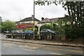
Your daily life in SG13 8UJ benefits from a selection of retail and transport hubs located within practical reach. Five retail venues sit nearby, including M&S Hertford, Hertford South Angel, Aldi Hertford, and Tesco Hertford. These supermarkets and high street chains offer everything from daily groceries to weekly shopping in one trip without needing a car. Five railway stations provide rail connections, including Hertford East, Hertford North, and Ware Railway Station. These stations act as gateways to London and the wider country, allowing you to commute seamlessly from your front door. The proximity to Hertford East and Hertford North means you have frequent train options without traveling far. This mix of retail and rail options creates a convenient lifestyle where work, food, and travel commute intersect easily. You do not need to plan complex journeys for basic errands or getting to the city. The availability of major chains like Aldi and M&S adds stability to your shopping routine. Your week will involve moving between these well-known brands and the train stations with minimal effort.
Amenities
Schools
Families living near SG13 8UJ have access to Richard Hale School, which appears as both a primary and an academy within the immediate vicinity. The school holds a Good Ofsted rating for its academy status, providing a verified standard of education for local children. This dual classification suggests the institution serves multiple age groups or has undergone conversion while maintaining strong performance. Since Richard Hale School is the only educational facility listed for this area, options for secondary education may require travel to nearby towns like Ware or Hertford. Primary education is conveniently close, ensuring younger children can attend safely from this postcode. The concentration of educational provision in one named supplier means parents have a single local decision rather than a complex choice of several schools. If you require a specific curriculum or faith-based education, current data does not detail those specifics for Richard Hale School beyond its legal type and rating. You must research the school's admission policy separately to ensure it meets your family's requirements. The presence of a good-rated academy is a positive factor for families moving into SG13 8UJ who prioritise academic performance.
| Rank | School | Type | Entry gender | Ages |
|---|
Explore more schools in this area
Go to Schools tabDemographics
The community character of SG13 8UJ is shaped by a mature and stable population profile. The median age across the area stands at 47 years, indicating a resident base that is predominantly middle-aged. The most common age range consists of adults between 30 and 64 years old, suggesting a workforce that has established their careers and families. House ownership accounts for 46% of households in this postcode, while the remaining homes likely include long-term rentals. This split suggests a mixed market where established families coexist with renters. The accommodation type data identifies flats as the prevailing style of housing, which aligns with the high density you encounter on the streets. The predominant ethnic group is White, reflecting the traditional demographic makeup of the broader Hertford region. There is no indication of significant deprivation affecting quality of life within these specific boundaries. The age structure implies a need for amenities that cater to working adults and perhaps some retired individuals. Families with school-age children form a notable segment of the population given the age distribution. You should expect a neighbourhood where residents are suitably aged for a range of social activities and work commitments rather than a youthful or elderly-only enclave.
Household Size
Accommodation Type
Tenure
Ethnic Group
Religion
Household Composition
Age
Household Deprivation
NS-SEC
Explore more demographic insights in this area
Go to Demographics tabPlanning
Planning Constraints
- Flood RiskPremium
- Ramsar Wetland SitesPremium
- Area of Outstanding Natural BeautyPremium
- Protected Nature ReservePremium
- Protected WoodlandPremium