Area Overview for SG13 8EN
Photos of SG13 8EN

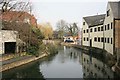
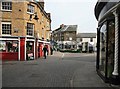

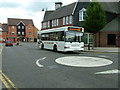
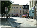
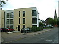
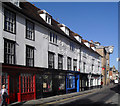
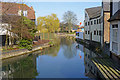

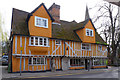
100 photos from this area
Area Information
Key information about the SG13 8EN including its size, population, and administrative classification.
- Area Type
- Postcode
- Area Size
- 3.4 hectares
- Population
- 1303
- Population Density
- 3790 people/km²
House Prices in SG13 8EN
26
Properties
£394,252
Average Sold Price
£231,154
Lowest Price
£523,450
Highest Price
Showing 26 properties
| Address | Type | Beds | Baths | Last Sale Price | Last Sale Date | |
|---|---|---|---|---|---|---|
| 21, Isabella House, Hale Road, Hertford, SG13 8EN | Flat | 1 | 1 | £290,000 | Dec 2025 | |
| 7, Isabella House, Hale Road, Hertford, SG13 8EN | Flat | - | - | £257,700 | Nov 2023 | |
| 15, Isabella House, Hale Road, Hertford, SG13 8EN | Flat | 1 | 1 | £330,000 | Dec 2022 | |
| 1, Isabella House, Hale Road, Hertford, SG13 8EN | Flat | - | - | £310,000 | Jun 2021 | |
| 16, Isabella House, Hale Road, Hertford, SG13 8EN | Flat | 1 | - | £320,000 | Jun 2021 | |
| 13, Isabella House, Hale Road, Hertford, SG13 8EN | Flat | 1 | 1 | £299,950 | Sep 2020 | |
| 8, Isabella House, Hale Road, Hertford, SG13 8EN | Flat | - | - | £402,500 | Apr 2019 | |
| 10, Isabella House, Hale Road, Hertford, SG13 8EN | Flat | - | - | £345,000 | Jan 2019 | |
| 6, Isabella House, Hale Road, Hertford, SG13 8EN | Flat | - | - | £352,500 | Nov 2018 | |
| 24, Isabella House, Hale Road, Hertford, SG13 8EN | Flat | - | - | £400,000 | Oct 2018 |
Page 1 of 3
Energy Efficiency in SG13 8EN
Amenities
Schools
| Rank | School | Type | Entry gender | Ages |
|---|
Explore more schools in this area
Go to Schools tabDemographics
Household Size
One person
most common
Accommodation Type
Flats
most common
Tenure
46
majority
Ethnic Group
White
most common
Religion
N/A
most common
Household Composition
N/A
most common
Age
47
median
Adults (30-64 years)
most common
Household Deprivation
N/A
with no deprivation
NS-SEC
49
in Lower managerial occupations
Explore more demographic insights in this area
Go to Demographics tabPlanning
Planning Constraints
- Flood RiskPremium
- Ramsar Wetland SitesPremium
- Area of Outstanding Natural BeautyPremium
- Protected Nature ReservePremium
- Protected WoodlandPremium