Area Overview for SG13 7JR
Photos of SG13 7JR
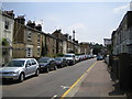


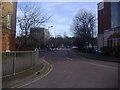
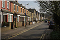


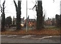


35 photos from this area
Area Information
Key information about the SG13 7JR including its size, population, and administrative classification.
- Area Type
- Postcode
- Area Size
- 7717 m²
- Population
- 2185
- Population Density
- 4391 people/km²
House Prices in SG13 7JR
37
Properties
£242,098
Average Sold Price
£41,000
Lowest Price
£400,000
Highest Price
Showing 37 properties
| Address | Type | Beds | Baths | Last Sale Price | Last Sale Date | |
|---|---|---|---|---|---|---|
| 2 The Spinney, Hertford, SG13 7JR | Flat | - | - | £340,000 | May 2025 | |
| 16 The Spinney, Hertford, SG13 7JR | Flat | 1 | 1 | £270,000 | May 2025 | |
| 19 The Spinney, Hertford, SG13 7JR | Flat | 1 | 1 | £280,000 | Nov 2024 | |
| 5 The Spinney, Hertford, SG13 7JR | Flat | 4 | 2 | £400,000 | Sep 2023 | |
| 29 The Spinney, Hertford, SG13 7JR | Flat | - | - | £399,500 | Mar 2023 | |
| 17 The Spinney, Hertford, SG13 7JR | Flat | 2 | 1 | £365,000 | Aug 2022 | |
| 7 The Spinney, Hertford, SG13 7JR | Flat | - | - | £315,000 | Feb 2019 | |
| 22 The Spinney, Hertford, SG13 7JR | Flat | - | - | £300,000 | Mar 2018 | |
| 30 The Spinney, Hertford, SG13 7JR | Flat | - | - | £400,000 | Dec 2017 | |
| 6 The Spinney, Hertford, SG13 7JR | Flat | - | - | £380,000 | Apr 2017 |
Page 1 of 4
Energy Efficiency in SG13 7JR
Amenities
Schools
| Rank | School | Type | Entry gender | Ages |
|---|
Explore more schools in this area
Go to Schools tabDemographics
Household Size
Two person
most common
Accommodation Type
Houses
most common
Tenure
63
majority
Ethnic Group
White
most common
Religion
N/A
most common
Household Composition
N/A
most common
Age
47
median
Adults (30-64 years)
most common
Household Deprivation
N/A
with no deprivation
NS-SEC
52
in Lower managerial occupations
Explore more demographic insights in this area
Go to Demographics tabPlanning
Planning Constraints
- Flood RiskPremium
- Ramsar Wetland SitesPremium
- Area of Outstanding Natural BeautyPremium
- Protected Nature ReservePremium
- Protected WoodlandPremium