Area Overview for PE38 0AJ
Photos of PE38 0AJ
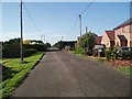
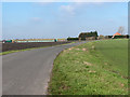
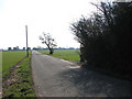
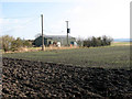
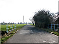
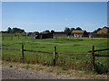
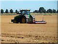
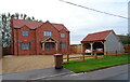
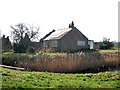
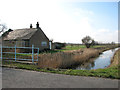
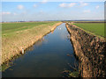
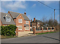
16 photos from this area
Area Information
Key information about the PE38 0AJ including its size, population, and administrative classification.
- Area Type
- Postcode
- Area Size
- 58.5 hectares
- Population
- 1682
- Population Density
- 39 people/km²
House Prices in PE38 0AJ
70
Properties
£298,506
Average Sold Price
£100,000
Lowest Price
£565,000
Highest Price
Showing 70 properties
| Address | Type | Beds | Baths | Last Sale Price | Last Sale Date | |
|---|---|---|---|---|---|---|
| Willowcroft, 72 The Drove, Barroway Drove, PE38 0AJ | Bungalow | 2 | 1 | £195,000 | Apr 2025 | |
| Wish Cottage, 62 The Drove, Barroway Drove, PE38 0AJ | Land | 3 | - | £135,000 | Jul 2024 | |
| The Lilacs, 74 The Drove, Barroway Drove, PE38 0AJ | Bungalow | 3 | 1 | £295,000 | Jun 2024 | |
| Blue Jays, 68 The Drove, Barroway Drove, PE38 0AJ | Bungalow | 3 | 2 | £355,000 | Jan 2023 | |
| Rose Cottage, 59 The Drove, Barroway Drove, PE38 0AJ | Detached | 3 | 1 | £565,000 | Mar 2022 | |
| Green Acres, 37 The Drove, Barroway Drove, PE38 0AJ | Bungalow | - | - | £272,500 | Jul 2021 | |
| Palen Lodge, 23 The Drove, Barroway Drove, PE38 0AJ | Chalet | 4 | 2 | £442,500 | Mar 2021 | |
| 32 The Drove, Barroway Drove, PE38 0AJ | Detached | 4 | 3 | £425,000 | Jul 2020 | |
| Rivendell, 64 The Drove, Barroway Drove, PE38 0AJ | Detached | 4 | - | £245,000 | Jul 2020 | |
| Bumblebee Farm, 34 The Drove, Barroway Drove, PE38 0AJ | Land | - | - | £195,000 | Jun 2020 |
Page 1 of 7
Energy Efficiency in PE38 0AJ
Amenities
Schools
| Rank | School | Type | Entry gender | Ages |
|---|
Explore more schools in this area
Go to Schools tabDemographics
Household Size
Two person
most common
Accommodation Type
Houses
most common
Tenure
75
majority
Ethnic Group
White
most common
Religion
N/A
most common
Household Composition
N/A
most common
Age
47
median
Adults (30-64 years)
most common
Household Deprivation
N/A
with no deprivation
NS-SEC
28
in Lower managerial occupations
Explore more demographic insights in this area
Go to Demographics tabPlanning
Planning Constraints
- Flood RiskPremium
- Ramsar Wetland SitesPremium
- Area of Outstanding Natural BeautyPremium
- Protected Nature ReservePremium
- Protected WoodlandPremium