Area Overview for PE38 0AG
Photos of PE38 0AG
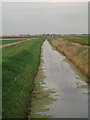

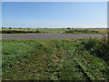
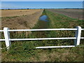
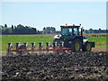
20 photos from this area
Area Information
Key information about the PE38 0AG including its size, population, and administrative classification.
- Area Type
- Postcode
- Area Size
- 3.1 km²
- Population
- 1682
- Population Density
- 39 people/km²
House Prices in PE38 0AG
12
Properties
£303,833
Average Sold Price
£202,500
Lowest Price
£479,000
Highest Price
Showing 12 properties
| Address | Type | Beds | Baths | Last Sale Price | Last Sale Date | |
|---|---|---|---|---|---|---|
| Sycamore Place, Lady Drove, Barroway Drove, PE38 0AG | Detached | 4 | 3 | £479,000 | Mar 2022 | |
| Orchard Farm House, Lady Drove, Barroway Drove, PE38 0AG | Detached | - | - | £230,000 | Mar 2017 | |
| Field View, Lady Drove, Barroway Drove, PE38 0AG | Detached | - | - | £202,500 | Apr 2012 | |
| Coots View, Lady Drove, Barroway Drove, PE38 0AG | Chalet | 5 | - | - | - | |
| 2, Tile Farm Cottages, Lady Drove, Barroway Drove, PE38 0AG | Semi-detached | - | - | - | - | |
| 1, Tile Farm Cottages, Lady Drove, Barroway Drove, PE38 0AG | Semi-detached | - | - | - | - | |
| Foxbury, Lady Drove, Barroway Drove, PE38 0AG | Detached | - | - | - | - | |
| Redgate House, Lady Drove, Barroway Drove, PE38 0AG | house | - | - | - | - | |
| Caravan At, Orchard Farm, Lady Drove, Barroway Drove, PE38 0AG | Mobile Home | - | - | - | - | |
| Poplar Farm, Lady Drove, Barroway Drove, PE38 0AG | house | - | - | - | - |
Page 1 of 2
Energy Efficiency in PE38 0AG
Amenities
Schools
| Rank | School | Type | Entry gender | Ages |
|---|
Explore more schools in this area
Go to Schools tabDemographics
Household Size
Two person
most common
Accommodation Type
Houses
most common
Tenure
75
majority
Ethnic Group
White
most common
Religion
N/A
most common
Household Composition
N/A
most common
Age
47
median
Adults (30-64 years)
most common
Household Deprivation
N/A
with no deprivation
NS-SEC
28
in Lower managerial occupations
Explore more demographic insights in this area
Go to Demographics tabPlanning
Planning Constraints
- Flood RiskPremium
- Ramsar Wetland SitesPremium
- Area of Outstanding Natural BeautyPremium
- Protected Nature ReservePremium
- Protected WoodlandPremium