Area Overview for PE38 0BA
Photos of PE38 0BA
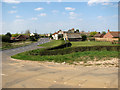
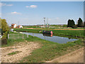
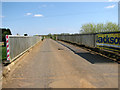
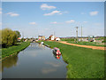
100 photos from this area
Area Information
Key information about the PE38 0BA including its size, population, and administrative classification.
- Area Type
- Postcode
- Area Size
- 69.5 hectares
- Population
- 1682
- Population Density
- 39 people/km²
House Prices in PE38 0BA
34
Properties
£235,969
Average Sold Price
£65,000
Lowest Price
£690,000
Highest Price
Showing 34 properties
| Address | Type | Beds | Baths | Last Sale Price | Last Sale Date | |
|---|---|---|---|---|---|---|
| Greenbank, Downham Road, Salters Lode, PE38 0BA | Semi-detached | 3 | 1 | £215,000 | Jun 2025 | |
| Fenland, Downham Road, Salters Lode, PE38 0BA | Terraced | 2 | 1 | £135,000 | Feb 2025 | |
| Barnum, Downham Road, Salters Lode, PE38 0BA | Semi-detached | 3 | 1 | £212,000 | Nov 2023 | |
| Lavender Farm, Downham Road, Salters Lode, PE38 0BA | Detached | 5 | 4 | £690,000 | Sep 2023 | |
| Olives Rest, Downham Road, Salters Lode, PE38 0BA | house | - | - | £575,000 | Jun 2023 | |
| Fieldway, Downham Road, Salters Lode, PE38 0BA | Terraced | 2 | 1 | £120,000 | Aug 2020 | |
| Willow House, Downham Road, Salters Lode, PE38 0BA | Detached | 3 | 1 | £200,000 | Oct 2019 | |
| Chapel Farmhouse, Downham Road, Salters Lode, PE38 0BA | Detached | 4 | 2 | £270,000 | May 2019 | |
| King Mill House, Downham Road, Salters Lode, PE38 0BA | Detached | 4 | - | £245,000 | Aug 2014 | |
| Post Mill House, Downham Road, Salters Lode, PE38 0BA | Detached | 4 | - | £210,000 | Jul 2014 |
Page 1 of 4
Energy Efficiency in PE38 0BA
Amenities
Schools
| Rank | School | Type | Entry gender | Ages |
|---|
Explore more schools in this area
Go to Schools tabDemographics
Household Size
Two person
most common
Accommodation Type
Houses
most common
Tenure
75
majority
Ethnic Group
White
most common
Religion
N/A
most common
Household Composition
N/A
most common
Age
47
median
Adults (30-64 years)
most common
Household Deprivation
N/A
with no deprivation
NS-SEC
28
in Lower managerial occupations
Explore more demographic insights in this area
Go to Demographics tabPlanning
Planning Constraints
- Flood RiskPremium
- Ramsar Wetland SitesPremium
- Area of Outstanding Natural BeautyPremium
- Protected Nature ReservePremium
- Protected WoodlandPremium