Area Overview for NR33 9BE
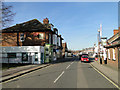
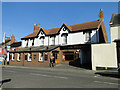
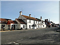
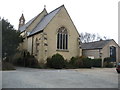
Photos of NR33 9BE

Area Information
Living in NR33 9BE means residing within a tightly knit residential cluster defined by a specific postcode boundary. This small area covers just 1.2 hectares, creating an environment where neighbours are often close to one another. A population of 1,455 people occupies this space, resulting in a very high density of 120,257 people per square kilometre. Despite the compact size, the location serves as a established home for families and adults seeking a settled community life. The environment is characterised by houses rather than apartments, a fact that defines the physical character of the neighbourhood. Residents enjoy a setting that prioritises domestic stability over the spread-out nature of larger suburbs. The concentration of homes in this specific postcode creates a distinct footprint within the wider region. Daily life revolves around the immediate surroundings where residents interact frequently due to the proximity of neighbours. This compact nature ensures that local amenities and transport links, such as the nearby railway stations, are accessible without long commutes. For those considering the move, the defined boundaries of NR33 9BE offer a clear sense of place and community identity.
- Area Type
- Postcode
- Area Size
- 1.2 hectares
- Population
- 1455
- Population Density
- 3718 people/km²
The housing market in NR33 9BE is characterised by a significant shift towards ownership rather than renting. With 84% of residents owning their homes, the area functions primarily as an owner-occupied market. This statistic indicates that speculative investment or private rental schemes have a minimal footprint in this specific postcode. The accommodation type data confirms that houses are the standard dwelling form, with very few flats or apartments available for purchase. Buyers looking for detached or semi-detached properties will find this the most suitable locality. The concentration of owner-occupied homes suggests a stable market where properties are often passed down or retained for long periods. This contrasts sharply with areas where rental demand drives prices and turnover. Prospective buyers should expect a neighbourhood where families live in dedicated housing rather than shared spaces. The lack of rental stock means that investors looking for short-term lets will face limited options. Instead, the market rewards those seeking a foothold in a established residential zone. The housing stock reflects the needs of families and empty nesters who prioritise space and stability.
House Prices in NR33 9BE
Showing 32 properties
| Address | Type | Beds | Baths | Last Sale Price | Last Sale Date | |
|---|---|---|---|---|---|---|
| 45 Ashfield Crescent, Lowestoft, NR33 9BE | Semi-detached | 3 | 1 | £172,000 | Mar 2024 | |
| 39 Ashfield Crescent, Lowestoft, NR33 9BE | Terraced | 3 | 1 | £197,500 | Aug 2023 | |
| 7 Ashfield Crescent, Lowestoft, NR33 9BE | house | 3 | 1 | £163,000 | Aug 2023 | |
| 15 Ashfield Crescent, Lowestoft, NR33 9BE | Terraced | 3 | 1 | £170,000 | Sep 2021 | |
| 13 Ashfield Crescent, Lowestoft, NR33 9BE | house | - | - | £140,000 | Sep 2021 | |
| 47 Ashfield Crescent, Lowestoft, NR33 9BE | Semi-detached | 3 | - | £137,500 | Jun 2019 | |
| 11 Ashfield Crescent, Lowestoft, NR33 9BE | house | - | - | £120,000 | Jan 2019 | |
| 21 Ashfield Crescent, Lowestoft, NR33 9BE | Terraced | 3 | 1 | £127,500 | Nov 2018 | |
| 49 Ashfield Crescent, Lowestoft, NR33 9BE | Semi-detached | 3 | 1 | £128,000 | Mar 2018 | |
| 9 Ashfield Crescent, Lowestoft, NR33 9BE | house | - | - | £100,000 | Nov 2013 |
Energy Efficiency in NR33 9BE
Residents of NR33 9BE have practical access to a range of retail and transport options within a short distance. Five notable retailers are within practical reach, including Co-op Pinewood, Lidl Oulton, and Asda Lowestoft. These venues provide essential groceries and daily necessities without requiring long car journeys. Transport links are equally accessible, with five rail stations identified as nearby, including Oulton Broad South Railway Station. This station offers direct connections to major cities, reducing the time spent commuting for work. Beccles Airport is another landmark available to most residents, presenting a specific option for regional travel. The proximity of these amenities defines the local lifestyle, blending convenience with the quiet of a residential postcode. Residents can shop for fresh food at Lidl or Co-op, then head to the railway station if a commute is needed. The layout supports a balance between suburban relaxation and urban accessibility. Families can rely on these established businesses for most daily requirements.
Amenities
Schools
Families living in NR33 9BE have direct access to Dell Primary School, which is consistently listed in the local records. This institution operates as a primary school and holds a 'good' Ofsted rating, confirming its standard of education. The presence of a single primary provider within the immediate vicinity defines the early education landscape for residents in this postcode. There are no secondary schools listed in the provided data for this specific area, meaning children will require transport to neighbouring towns for secondary education. The 'good' rating of Dell Primary School reassures parents that the foundational stage of schooling meets high regulatory standards. Families must plan for the school run to this specific location as the nearest educational facility. The concentration of education resources is typical for a very small residential cluster where schools serve a wider catchment. Parents in NR33 9BE rely on this established primary institution before exploring other schools for older children. The clear rating data allows families to make informed decisions without ambiguity.
| Rank | School | Type | Entry gender | Ages |
|---|
Explore more schools in this area
Go to Schools tabDemographics
The community in NR33 9BE is dominated by adults, with the median age recorded at 47 years. Most residents fall into the 30 to 64 age range, indicating a mature demographic that values stability and established neighbourhoods. Home ownership stands at 84%, which reflects a strong preference for owning a property rather than renting. This high rate suggests that many households have been settled in the area for considerable periods. Houses form the predominant accommodation type, aligning with the typical needs of an older household demographic. The population is largely homogeneous, with the White ethnic group being the predominant demographic within the boundaries. This demographic profile points to a quiet, traditional area where residents likely share similar lifestyles and community expectations. The high proportion of owner-occupied homes contributes to a stable environment where tenants know their neighbours and feel invested in the local plans. Families and couples in mid-life are the primary occupiers of these properties. The low presence of younger residents or students distinguishes this postcode from university towns or transient rental zones. Residents here are looking for a permanent home base rather than a temporary living arrangement.
Household Size
Accommodation Type
Tenure
Ethnic Group
Religion
Household Composition
Age
Household Deprivation
NS-SEC
Explore more demographic insights in this area
Go to Demographics tabPlanning
Planning Constraints
- Flood RiskPremium
- Ramsar Wetland SitesPremium
- Area of Outstanding Natural BeautyPremium
- Protected Nature ReservePremium
- Protected WoodlandPremium