Area Overview for NR29 5QL
Photos of NR29 5QL
Area Information
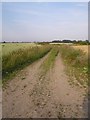
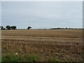
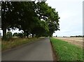
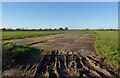
Living in NR29 5QL offers a distinct experience defined by its manageable scale and quiet surroundings. This specific postcode covers a residential cluster of only 23.6 hectares, making it one of the smaller study areas in the region. The population stands at 1814 people, creating an intimate neighbourhood where the community feels closely knit. You will find this area generally suited to those who prefer a slower pace of life away from the rush of larger towns. The low population density of 122 people per square kilometre suggests spaciousness and a lack of traffic congestion. Although the area is small, it provides a tangible sense of home with defined boundaries and local familiarity. Residents here enjoy a clear understanding of their immediate environment without the confusion of sprawling urban sprawl. The compact nature of the postcode means that daily essentials are often within walking distance or a short drive. You are not dealing with a vague district but a specific, identifiable pocket of the countryside. This character appeals to individuals seeking stability and a connection to their local geography.
- Area Type
- Postcode
- Area Size
- 23.6 hectares
- Population
- 1814
- Population Density
- 122 people/km²
The property market in NR29 5QL is characterised by a predominance of traditional, owner-occupied housing. With an 82% home ownership rate, the vast majority of the 1814 residents own their homes. This suggests a market with a high proportion of established dwellings rather than new builds or recently acquired rentals. The accommodation type is strictly houses, as no flats or apartments are recorded for this postcode. This means buyers looking for this location must seek detached, semi-detached, or terraced houses typical of the East of England. You are not competing in a high-volume rental market here; instead, you are looking at an area where people have invested in permanent residences. The low density of 122 people per square kilometre further indicates that these houses are likely spaced out rather than built in terrace blocks. For someone wishing to buy homes in NR29 5QL, the landscape is tailored towards family-sized properties or single-pitch bungalows suitable for retirees. The absence of rental stock implies that vacancy rates might be low due to high retention of existing owners.
House Prices in NR29 5QL
Showing 29 properties
| Address | Type | Beds | Baths | Last Sale Price | Last Sale Date | |
|---|---|---|---|---|---|---|
| Cairn, Malthouse Lane, Ludham, NR29 5QL | Bungalow | 3 | 2 | £450,000 | Jul 2025 | |
| The Oaks, Malthouse Lane, Ludham, NR29 5QL | house | - | - | £385,000 | Sep 2021 | |
| Unicorn Cottage, Malthouse Lane, Ludham, NR29 5QL | Bungalow | 4 | 1 | £300,000 | Mar 2021 | |
| Malthouse Farmhouse, Malthouse Lane, Ludham, NR29 5QL | Cottage | 4 | 2 | £545,000 | Nov 2020 | |
| Greenbanks, Malthouse Lane, Ludham, NR29 5QL | Bungalow | 4 | 3 | £275,000 | May 2019 | |
| 4 Malthouse Lane, Ludham, NR29 5QL | house | - | - | £210,600 | Dec 2018 | |
| 2 Malthouse Lane, Ludham, NR29 5QL | house | 4 | - | £322,000 | Sep 2017 | |
| The Bungalow, Malthouse Lane, Ludham, NR29 5QL | Bungalow | 3 | 2 | £225,000 | Nov 2015 | |
| Bien-venue, Malthouse Lane, Ludham, NR29 5QL | Semi-detached | - | - | £192,000 | Sep 2015 | |
| Broads Venture, Malthouse Lane, Ludham, NR29 5QL | Bungalow | 3 | 2 | £240,000 | Dec 2014 |
Energy Efficiency in NR29 5QL
Daily life in NR29 5QL centres on a limited circle of amenities that cover essential retail and transport needs. Your nearest shopping options include Morrisons Daily and two branches of East of England Co-operative Co. These five retail outlets provide basic grocery requirements and household essentials without the need to travel to a major town centre. For those requiring public transport, you have access to two railway stations: Acle Railway Station and Hoveton & Wroxham Railway Station. These stations offer rail links to larger Norfolk hubs and beyond, ensuring you are not completely isolated from the rest of the county. Additionally, Wroxham leisure centre is within reach for one of your community activities. This combination of supermarkets and rail access creates a self-sufficient mini-ecosystem for everyday living. While you will not find a wide range of diverse dining or entertainment venues immediately adjacent, the core necessities are present. The lifestyle is defined by convenience and functionality rather than luxury or variety. You will find that a car is likely necessary to utilise the rail stations fully, as well as to explore the wider region beyond the 23.6 hectare cluster.
Amenities
Schools
Families considering homes in NR29 5QL have access to Potter Heigham First School as the nearest educational institution. This facility serves as a primary school for local children. As a primary school, it caters to pupils typically aged four to eleven, providing essential early education before students move to secondary institutions in larger towns. The data confirms only this one school is listed within immediate reach for this specific postcode. Because NR29 5QL is a residential cluster without a full suite of secondary options on-site, older children will require transport to schools outside the immediate vicinity. For younger families, the proximity of Potter Heigham First School supports childcare needs and reduces morning commute times. The reliance on a single primary option highlights the rural nature of the area, where educational catchment areas often cover a wide radius. Parents must research transport links carefully to determine how their children will reach other secondary schools not listed in the immediate amenity map. You will find no secondary or special needs colleges listed for this specific study area.
| Rank | School | Type | Entry gender | Ages |
|---|
Explore more schools in this area
Go to Schools tabDemographics
The community in NR29 5QL reflects a settled society with a clear demographic profile. The median age across the area is 47 years, indicating a mature population with established roots. The most common age range consists of elderly residents aged 65 years and older, suggesting this is a destination for retirement or those prioritising a quieter lifestyle later in life. There is a strong emphasis on stability, evidenced by an 82% home ownership rate. This figure is exceptionally high compared to national averages and signals that the vast majority of residents own their properties outright or with a significant mortgage. Consequently, the housing market is driven by owner-occupiers rather than private landlords or short-term letting schemes. The area accommodates exclusively houses, meaning there are no flats or apartments within this specific cluster. Ethnically, the predominant group is White, aligning with the typical demographic makeup of rural Norfolk. This homogeneity contributes to a consistent cultural atmosphere where long-term neighbours often know each other well.
Household Size
Accommodation Type
Tenure
Ethnic Group
Religion
Household Composition
Age
Household Deprivation
NS-SEC
Explore more demographic insights in this area
Go to Demographics tabPlanning
Planning Constraints
- Flood RiskPremium
- Ramsar Wetland SitesPremium
- Area of Outstanding Natural BeautyPremium
- Protected Nature ReservePremium
- Protected WoodlandPremium