Area Overview for NR29 5RA
Photos of NR29 5RA
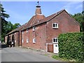
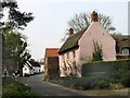
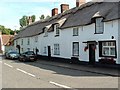

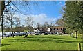
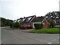
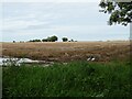
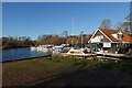
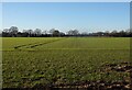
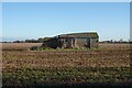
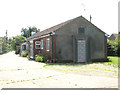
28 photos from this area
Area Information
Key information about the NR29 5RA including its size, population, and administrative classification.
- Area Type
- Postcode
- Area Size
- 2.0 hectares
- Population
- 1814
- Population Density
- 122 people/km²
House Prices in NR29 5RA
38
Properties
£230,464
Average Sold Price
£55,500
Lowest Price
£425,000
Highest Price
Showing 38 properties
| Address | Type | Beds | Baths | Last Sale Price | Last Sale Date | |
|---|---|---|---|---|---|---|
| 25 Latchmoor Park, Ludham, NR29 5RA | Detached | 3 | 1 | £263,000 | Oct 2025 | |
| 14 Latchmoor Park, Ludham, NR29 5RA | Detached | 3 | 1 | £425,000 | Mar 2023 | |
| 39 Latchmoor Park, Ludham, NR29 5RA | house | - | - | £400,000 | Jul 2022 | |
| 5 Latchmoor Park, Ludham, NR29 5RA | house | - | - | £285,000 | May 2021 | |
| 21 Latchmoor Park, Ludham, NR29 5RA | house | - | - | £285,000 | Mar 2021 | |
| 35 Latchmoor Park, Ludham, NR29 5RA | Detached | 3 | 1 | £265,000 | Feb 2021 | |
| 13 Latchmoor Park, Ludham, NR29 5RA | Detached | 4 | 1 | £335,000 | Nov 2020 | |
| 17 Latchmoor Park, Ludham, NR29 5RA | Bungalow | 2 | 1 | £202,000 | Oct 2019 | |
| 30 Latchmoor Park, Ludham, NR29 5RA | Detached | 4 | 2 | £315,000 | Sep 2019 | |
| 27 Latchmoor Park, Ludham, NR29 5RA | Detached | 3 | 1 | £224,500 | Nov 2018 |
Page 1 of 4
Energy Efficiency in NR29 5RA
Amenities
Schools
| Rank | School | Type | Entry gender | Ages |
|---|
Explore more schools in this area
Go to Schools tabDemographics
Household Size
Two person
most common
Accommodation Type
Houses
most common
Tenure
82
majority
Ethnic Group
White
most common
Religion
N/A
most common
Household Composition
N/A
most common
Age
47
median
Elderly (65+ years)
most common
Household Deprivation
N/A
with no deprivation
NS-SEC
29
in Lower managerial occupations
Explore more demographic insights in this area
Go to Demographics tabPlanning
Planning Constraints
- Flood RiskPremium
- Ramsar Wetland SitesPremium
- Area of Outstanding Natural BeautyPremium
- Protected Nature ReservePremium
- Protected WoodlandPremium