Area Overview for NR29 5QU
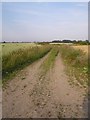
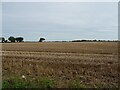
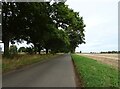
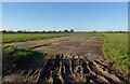
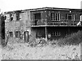
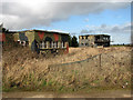
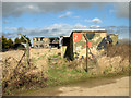
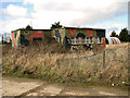
Photos of NR29 5QU
Area Information
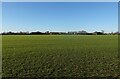
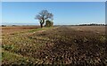
This postcode covers a specific residential cluster covering 15.7 hectares in rural Norfolk. It is home to 1814 people, creating a population density of 122 people per square kilometre. Living in NR29 5QU means navigating a very low-density environment compared to the wider Norwich metropolitan area. The setting is defined by its spacious layout rather than high-rise density. You are in a small, tightly defined geographical zone where every resident likely knows their neighbours. The area exists within the historic heart of Norfolk's agricultural landscape, far removed from the congestion of urban centres like Norwich or Great Yarmouth. Your daily life revolves around the quiet rhythm of the countryside rather than the pace of city living. This cluster offers a distinct lifestyle choice for those prioritising space and tranquillity. Homes here sit within a landscape designed for seclusion rather than dense urban interaction. The sheer size of the postcode relative to its population underscores the prevalence of gardens and open space. Prospective buyers should expect a slower pace of life where local access to amenities requires travel. This neighbourhood represents a dedicated slice of rural living within the broader county structure.
- Area Type
- Postcode
- Area Size
- 15.7 hectares
- Population
- 1814
- Population Density
- 122 people/km²
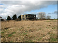
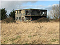
Buying homes in NR29 5QU involves entering a market heavily skewed towards owner-occupation. Eighty-two per cent of the housing stock is in owner-occupied homes, meaning rental availability is minimal. The accommodation type is exclusively Houses, so you will not find flats or apartments as part of this inventory. This structure indicates a market dominated by family estates and retirement properties rather than investment-led developments. With a population of 1814 spread across 15.7 hectares, the housing supply is naturally limited by the physical space available. Prospective buyers should recognise that this is not a volatile rental market but a stable ownership community. The high ownership rate of 82% suggests sellers are likely local people with strong ties to the region. Transaction speeds may reflect the diminished urgency often seen in dedicated owner-occupier markets. You are competing for a finite number of properties within a very small geographical footprint. The absence of flats means your options are restricted to standalone residential buildings. This market dynamic requires patience and significant research, as new listings are rare events. The 122 people per square kilometre density confirms that land value is high relative to total property count. Buyers looking for investment opportunities in this specific postcode may find fewer short-term let possibilities compared to urban equivalents.
House Prices in NR29 5QU
Showing 1 properties
| Address | Type | Beds | Baths | Last Sale Price | Last Sale Date | |
|---|---|---|---|---|---|---|
| Eversley, Catfield Road, Ludham, NR29 5QU | Detached | - | - | £165,000 | Mar 2002 |
Energy Efficiency in NR29 5QU
Daily life for residents involves practical trips to nearby retail and transport hubs. You have limited choices for retail, with specific stores like Morrisons Daily, the East of England Co-operative Co, and Tesco Norwich located within practical reach. These supermarkets form the backbone of your weekly shop routine despite being just outside the immediate 15.7 hectare zone. Transport links connect you to Wroxham, a metro hub, via the nearest railway stations. Hoveton and Wroxham Railway Station serves as a near rail option, while Acle Railway Station is the second accessible point. This rail network allows you to access Norwich and other regional centres without driving everywhere. Leisure and transport activities centre around these stations with no dedicated leisure venues listed directly inside the postcode. Your lifestyle depends on the ability to drive or take train to find entertainment and dining. The proximity of Wroxham suggests easy access to natural waterways and local attractions. Shopping trips to Morrisons or the Co-operative are standard fixtures of the routine. This lifestyle is functional and grounded, relying on the wider network of Norfolk rather than internal facilities. The lack of on-site leisure means you plan your week around travel to specific towns. Convenience is defined by distance to these named amenities rather than immediate walking access.
Amenities
Schools
Families considering schools near NR29 5QU look to Potter Heigham First School in their vicinity. This is a primary school listed in the database for the area. It provides education for younger children before they transition to secondary education further away. The presence of this single primary institution highlights the residential rather than educational focus of the postcode. There are no secondary schools or third-level institutions listed directly within the immediate coverage of NR29 5QU. Parents will need to consider transport arrangements for children moving from this primary foundation to secondary providers outside the immediate radius. The limited school data underscores the rural nature of the settlement where children often commute to larger towns for their intermediate and secondary education. Potter Heigham First School represents the main educational anchor for families residing here. Its classification as a primary school dictates the typical age range of the young population in the neighbourhood. Other educational options require travel beyond the 15.7 hectare boundary covering this cluster. This single-school snapshot suggests a quiet academic environment driven by local commitment rather than multiple competing academies. Families accept that education is a service accessed from the wider county rather than confined to the immediate street.
| Rank | School | Type | Entry gender | Ages |
|---|
Explore more schools in this area
Go to Schools tabDemographics
The community profile reflects an area matured over decades with a median age of 47 years. The most common age bracket is the elderly population aged 65 years and over. You are looking at a neighbourhood defined by long-term residents rather than a transient workforce. Eighty-two per cent of households own their property outright or via mortgage. This high ownership rate of 82% indicates a stable residential base with deep roots in the location. The accommodation stock consists almost entirely of Houses, meaning flat living is absent from this demographic snapshot. The predominant ethnic group within the boundaries is White, consistent with the broader rural Norfolk demographic make-up. There are no large student populations or young professional clusters distorting these figures. The population density of 122 people per square kilometre supports the picture of a low-density, family-led community. Housing age and tenure suggest a period of stable occupation rather than frequent moves. This demographic mix creates a settled environment where local traditions likely hold significant weight. Families here have stayed for generations, passing down property knowledge and local history. The lack of significant rental sector presence further confirms this established character. You are entering a market defined by permanence and deep community bonds rather than new migration waves.
Household Size
Accommodation Type
Tenure
Ethnic Group
Religion
Household Composition
Age
Household Deprivation
NS-SEC
Explore more demographic insights in this area
Go to Demographics tabPlanning
Planning Constraints
- Flood RiskPremium
- Ramsar Wetland SitesPremium
- Area of Outstanding Natural BeautyPremium
- Protected Nature ReservePremium
- Protected WoodlandPremium