Area Overview for NR12 8LD
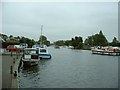
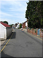
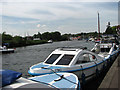
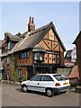
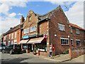
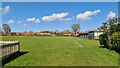
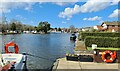
Photos of NR12 8LD

Area Information
NR12 8LD represents a specific residential cluster situated within England, defined by its limited footprint and intimate scale. This postcode covers an area size of 3,310 square metres, resulting in a population density of only 71 people per square kilometre. Such low density creates a quiet environment where you will encounter far fewer neighbours than in larger urban districts. The total population stands at 2,061 individuals, forming a tightly knit community where local knowledge is readily shared. Living in NR12 8LD means enjoying immediate access to the broader Horning station vicinity without the congestion associated with Norwich city centre. The setting offers a distinct separation from busy motorways, allowing for a slower, more measured pace of daily life. You are not in a bustling suburb but rather a focused residential zone designed for tranquility and space. The small geographical boundary ensures that local routes are well-known and easy to navigate. This compact nature means that residents rely heavily on local connections and established patterns for their everyday movements. The area functions as a quiet satellite, offering peace while remaining connected to essential services in nearby towns. ### The community in NR12 8LD is characterised by a mature demographic profile with a median age of 47 years. The most common age range among residents falls between 30 and 64 years, indicating a household population that has largely accumulated financial stability. Home ownership is exceptionally high within this locality, reaching a figure of 78%. This statistic confirms that the area is predominantly owner-occupied rather than a rental market. With 78% of households owning their property, you will find long-term residents who have deep roots in the neighbourhood. The accommodation type is almost exclusively houses, reflecting the demand for private outdoor space and larger living areas. You will not find apartments or flats as significant housing options here. The predominant ethnic group is White, which aligns with broader regional patterns in coastal Norfolk. This ethnic composition contributes to a culturally familiar environment for many homebuyers moving to the region. The age profile suggests that families with older children or retirees seeking a stop might be the primary movers. However, the presence of adults aged 30 to 64 ensures there remains a steady cohort of individuals requiring school-run distances or local medical services. ### The housing market in NR12 8LD is defined by a heavy concentration of private homes. With 78% of the population owning their residences, you are entering a neighbourhood where properties are generally held by long-term families rather than transient tenants. The accommodation type consists of houses, meaning buyers should expect detached, semi-detached, or terraced family dwellings rather than flats or studio apartments. This ownership mix usually results in stable neighbourhoods where house prices reflect the value of established properties rather than speculative developments. When searching for homes in NR12 8LD, you will find a stock that has served families for decades. The low population density of 71 people per square kilometre further supports the prevalence of traditional housing formats. You are unlikely to encounter high-rise developments or large物业管理有限公司 conversions. The 78% ownership rate also implies that some properties may be shared ownership or inherited, adding variety to tenure types. Buyers looking at this small area must appreciate that resale value often depends on individual property conditions rather than new build incentives. The market operates on the basis of replacing existing homes rather than filling empty space. Consequently, competition centres on specific houses up for sale within this limited geographical cluster. ### Families residing in NR12 8LD have access to two primary schools with recognised quality ratings. Horning Community Primary School sits nearby and holds an Ofsted rating of good. This school offers a standard level of educational provision suitable for many young learners. Additionally, you can find Neatishead Church of England Primary School in the surrounding catchment area. This institution carries an outstanding Ofsted rating, representing the highest standard of education available in that zone. The proximity of these schools means you do not need to travel far to secure a place for your child. Having both a good and an outstanding rated school nearby provides parents with choice depending on their educational priorities. The mix of primary institutions suggests that this postcode falls within the catchment for early education rather than secondary or special needs provision. Both schools fall under the primary category, suitable for children from early years up to age 11. Living in NR12 8LD ensures that school runs are short and manageable within the local network. Parents can compare the curriculum and ethos of Horning Community Primary School against the religious orientation of Neatishead Church of England Primary School before making decisions. ### Digital connectivity for residents of NR12 8LD presents a mixed picture suited to specific needs. Mobile coverage scores highly with a quality index of 77 out of 100. This level indicates excellent mobile phone service, making it easy to stay connected while walking or driving in the neighbourhood. Fixed broadband, however, presents a different reality with a quality score of 38 out of 100. This score falls into a fair to poor range, which may impact heavy users of high-speed internet. If you plan to work from home requiring large file downloads or video conferencing, this lower broadband score is a factor to weigh carefully. Daily internet use for streaming or general browsing remains functional but may lack the speed found in urban centres. Connectivity issues are less likely to affect your mobile phone usage but could delay upload speeds for work or leisure. You can rely on strong signal reception for voice calls and basic apps. Residents often rely on this robust mobile coverage to bridge the gaps where fixed lines are slower. Before committing to a purchase, you should test the specific location for fixed-line performance if remote work is central to your lifestyle. ### Your daily life in NR12 8LD relies on a practical network of amenities located within easy reach. Wroxham serves as the nearest metro hub, offering broader access to cultural and shopping options beyond the immediate locality. You can reach Wroxham by rail, as there are five railway stations nearby including Hoveton and Wroxham, Salhouse, and Worsted. These rail links integrate your local life with the wider county transport network. For essential shopping, Tesco Norwich, Morrisons Daily, and Co-op stores are all within practical reach. These supermarkets provide groceries and household essentials without requiring a lengthy commute into Norwich city. Co-op 122 is another specific outlet available to support your weekly household budget. The presence of multiple retail options means you can compare prices and stock levels across different chains. Your lifestyle balances the quiet of the residential cluster with the convenience of established high street retailers. You will not need to travel far for basics, preserving time for leisure activities. The combination of rail access and local supermarkets ensures that your errands remain efficient and low-stress. ### Living in NR12 8LD involves a high degree of security and environmental safety. The crime risk assessment shows a low threat level with a score of 93 out of 100. This high score indicates that the area has below-average crime rates compared to the national picture. You can expect a neighbourhood where property crime is rare and residents feel comfortable walking outside at various times of day. Flood risk presents no significant concern, carrying a score of 0 on the risk scale. This zero score confirms low flood risk coverage, meaning you are unlikely to face water-related damage during severe weather events. Planning constraints related to nature also do not limit development potential. There is no Ramsar wetland site coverage, no Area of Outstanding Natural Beauty designation, and no protected nature reserve or woodland coverage within the property records. These clear assessments mean you can build or modify properties without breaching specific environmental protections. The absence of these constraints simplifies the planning process for any future works on your home. Overall, the safety profile is robust, offering peace of mind regarding both crime and environmental hazards. ### Who is the main demographic living in NR12 8LD?The median age is 47 years, with the most common residents falling into the 30-64 age range. Home ownership is very high at 78%, and the predominantly White ethnic group lives here. The area consists mainly of houses with minimal rental activity. What schools are available to families in NR12 8LD?Local families have access to Horning Community Primary School, which has a good Ofsted rating. Neatishead Church of England Primary School is also nearby, holding an outstanding Ofsted rating. Both are standard primary institutions serving the catchment. How safe is the area for residents of NR12 8LD?Safety is high with a crime risk score of 93 out of 100 against low risk. There is no flood risk, and there are no environmental planning constraints like protected woodlands or wetland sites. How good is the internet and mobile connection?Mobile coverage is good with a score of 77/100. Fixed broadband is weaker, scoring 38/100. This means you can rely on phones for calls but might find fixed internet speeds limited for heavy working-from-home use.
- Area Type
- Postcode
- Area Size
- 3310 m²
- Population
- 2061
- Population Density
- 71 people/km²
The housing market in NR12 8LD is defined by a heavy concentration of private homes. With 78% of the population owning their residences, you are entering a neighbourhood where properties are generally held by long-term families rather than transient tenants. The accommodation type consists of houses, meaning buyers should expect detached, semi-detached, or terraced family dwellings rather than flats or studio apartments. This ownership mix usually results in stable neighbourhoods where house prices reflect the value of established properties rather than speculative developments. When searching for homes in NR12 8LD, you will find a stock that has served families for decades. The low population density of 71 people per square kilometre further supports the prevalence of traditional housing formats. You are unlikely to encounter high-rise developments or large物业管理有限公司 conversions. The 78% ownership rate also implies that some properties may be shared ownership or inherited, adding variety to tenure types. Buyers looking at this small area must appreciate that resale value often depends on individual property conditions rather than new build incentives. The market operates on the basis of replacing existing homes rather than filling empty space. Consequently, competition centres on specific houses up for sale within this limited geographical cluster. ### Families residing in NR12 8LD have access to two primary schools with recognised quality ratings. Horning Community Primary School sits nearby and holds an Ofsted rating of good. This school offers a standard level of educational provision suitable for many young learners. Additionally, you can find Neatishead Church of England Primary School in the surrounding catchment area. This institution carries an outstanding Ofsted rating, representing the highest standard of education available in that zone. The proximity of these schools means you do not need to travel far to secure a place for your child. Having both a good and an outstanding rated school nearby provides parents with choice depending on their educational priorities. The mix of primary institutions suggests that this postcode falls within the catchment for early education rather than secondary or special needs provision. Both schools fall under the primary category, suitable for children from early years up to age 11. Living in NR12 8LD ensures that school runs are short and manageable within the local network. Parents can compare the curriculum and ethos of Horning Community Primary School against the religious orientation of Neatishead Church of England Primary School before making decisions. ### Digital connectivity for residents of NR12 8LD presents a mixed picture suited to specific needs. Mobile coverage scores highly with a quality index of 77 out of 100. This level indicates excellent mobile phone service, making it easy to stay connected while walking or driving in the neighbourhood. Fixed broadband, however, presents a different reality with a quality score of 38 out of 100. This score falls into a fair to poor range, which may impact heavy users of high-speed internet. If you plan to work from home requiring large file downloads or video conferencing, this lower broadband score is a factor to weigh carefully. Daily internet use for streaming or general browsing remains functional but may lack the speed found in urban centres. Connectivity issues are less likely to affect your mobile phone usage but could delay upload speeds for work or leisure. You can rely on strong signal reception for voice calls and basic apps. Residents often rely on this robust mobile coverage to bridge the gaps where fixed lines are slower. Before committing to a purchase, you should test the specific location for fixed-line performance if remote work is central to your lifestyle. ### Your daily life in NR12 8LD relies on a practical network of amenities located within easy reach. Wroxham serves as the nearest metro hub, offering broader access to cultural and shopping options beyond the immediate locality. You can reach Wroxham by rail, as there are five railway stations nearby including Hoveton and Wroxham, Salhouse, and Worsted. These rail links integrate your local life with the wider county transport network. For essential shopping, Tesco Norwich, Morrisons Daily, and Co-op stores are all within practical reach. These supermarkets provide groceries and household essentials without requiring a lengthy commute into Norwich city. Co-op 122 is another specific outlet available to support your weekly household budget. The presence of multiple retail options means you can compare prices and stock levels across different chains. Your lifestyle balances the quiet of the residential cluster with the convenience of established high street retailers. You will not need to travel far for basics, preserving time for leisure activities. The combination of rail access and local supermarkets ensures that your errands remain efficient and low-stress. ### Living in NR12 8LD involves a high degree of security and environmental safety. The crime risk assessment shows a low threat level with a score of 93 out of 100. This high score indicates that the area has below-average crime rates compared to the national picture. You can expect a neighbourhood where property crime is rare and residents feel comfortable walking outside at various times of day. Flood risk presents no significant concern, carrying a score of 0 on the risk scale. This zero score confirms low flood risk coverage, meaning you are unlikely to face water-related damage during severe weather events. Planning constraints related to nature also do not limit development potential. There is no Ramsar wetland site coverage, no Area of Outstanding Natural Beauty designation, and no protected nature reserve or woodland coverage within the property records. These clear assessments mean you can build or modify properties without breaching specific environmental protections. The absence of these constraints simplifies the planning process for any future works on your home. Overall, the safety profile is robust, offering peace of mind regarding both crime and environmental hazards. ### Who is the main demographic living in NR12 8LD?The median age is 47 years, with the most common residents falling into the 30-64 age range. Home ownership is very high at 78%, and the predominantly White ethnic group lives here. The area consists mainly of houses with minimal rental activity. What schools are available to families in NR12 8LD?Local families have access to Horning Community Primary School, which has a good Ofsted rating. Neatishead Church of England Primary School is also nearby, holding an outstanding Ofsted rating. Both are standard primary institutions serving the catchment. How safe is the area for residents of NR12 8LD?Safety is high with a crime risk score of 93 out of 100 against low risk. There is no flood risk, and there are no environmental planning constraints like protected woodlands or wetland sites. How good is the internet and mobile connection?Mobile coverage is good with a score of 77/100. Fixed broadband is weaker, scoring 38/100. This means you can rely on phones for calls but might find fixed internet speeds limited for heavy working-from-home use.
House Prices in NR12 8LD
Showing 4 properties
| Address | Type | Beds | Baths | Last Sale Price | Last Sale Date | |
|---|---|---|---|---|---|---|
| The Croft, Norwich Road, Horning, NR12 8LD | house | 4 | - | £499,000 | Dec 2012 | |
| Ropes Hill Cottage, Norwich Road, Horning, NR12 8LD | Semi-detached | - | - | - | - | |
| Knots Cottage, Norwich Road, Horning, NR12 8LD | house | - | - | - | - | |
| Glebe House, Norwich Road, Horning, NR12 8LD | Detached | - | - | - | - |
Energy Efficiency in NR12 8LD
Your daily life in NR12 8LD relies on a practical network of amenities located within easy reach. Wroxham serves as the nearest metro hub, offering broader access to cultural and shopping options beyond the immediate locality. You can reach Wroxham by rail, as there are five railway stations nearby including Hoveton and Wroxham, Salhouse, and Worsted. These rail links integrate your local life with the wider county transport network. For essential shopping, Tesco Norwich, Morrisons Daily, and Co-op stores are all within practical reach. These supermarkets provide groceries and household essentials without requiring a lengthy commute into Norwich city. Co-op 122 is another specific outlet available to support your weekly household budget. The presence of multiple retail options means you can compare prices and stock levels across different chains. Your lifestyle balances the quiet of the residential cluster with the convenience of established high street retailers. You will not need to travel far for basics, preserving time for leisure activities. The combination of rail access and local supermarkets ensures that your errands remain efficient and low-stress. ### Living in NR12 8LD involves a high degree of security and environmental safety. The crime risk assessment shows a low threat level with a score of 93 out of 100. This high score indicates that the area has below-average crime rates compared to the national picture. You can expect a neighbourhood where property crime is rare and residents feel comfortable walking outside at various times of day. Flood risk presents no significant concern, carrying a score of 0 on the risk scale. This zero score confirms low flood risk coverage, meaning you are unlikely to face water-related damage during severe weather events. Planning constraints related to nature also do not limit development potential. There is no Ramsar wetland site coverage, no Area of Outstanding Natural Beauty designation, and no protected nature reserve or woodland coverage within the property records. These clear assessments mean you can build or modify properties without breaching specific environmental protections. The absence of these constraints simplifies the planning process for any future works on your home. Overall, the safety profile is robust, offering peace of mind regarding both crime and environmental hazards. ### Who is the main demographic living in NR12 8LD?The median age is 47 years, with the most common residents falling into the 30-64 age range. Home ownership is very high at 78%, and the predominantly White ethnic group lives here. The area consists mainly of houses with minimal rental activity. What schools are available to families in NR12 8LD?Local families have access to Horning Community Primary School, which has a good Ofsted rating. Neatishead Church of England Primary School is also nearby, holding an outstanding Ofsted rating. Both are standard primary institutions serving the catchment. How safe is the area for residents of NR12 8LD?Safety is high with a crime risk score of 93 out of 100 against low risk. There is no flood risk, and there are no environmental planning constraints like protected woodlands or wetland sites. How good is the internet and mobile connection?Mobile coverage is good with a score of 77/100. Fixed broadband is weaker, scoring 38/100. This means you can rely on phones for calls but might find fixed internet speeds limited for heavy working-from-home use.
Amenities
Schools
Families residing in NR12 8LD have access to two primary schools with recognised quality ratings. Horning Community Primary School sits nearby and holds an Ofsted rating of good. This school offers a standard level of educational provision suitable for many young learners. Additionally, you can find Neatishead Church of England Primary School in the surrounding catchment area. This institution carries an outstanding Ofsted rating, representing the highest standard of education available in that zone. The proximity of these schools means you do not need to travel far to secure a place for your child. Having both a good and an outstanding rated school nearby provides parents with choice depending on their educational priorities. The mix of primary institutions suggests that this postcode falls within the catchment for early education rather than secondary or special needs provision. Both schools fall under the primary category, suitable for children from early years up to age 11. Living in NR12 8LD ensures that school runs are short and manageable within the local network. Parents can compare the curriculum and ethos of Horning Community Primary School against the religious orientation of Neatishead Church of England Primary School before making decisions. ### Digital connectivity for residents of NR12 8LD presents a mixed picture suited to specific needs. Mobile coverage scores highly with a quality index of 77 out of 100. This level indicates excellent mobile phone service, making it easy to stay connected while walking or driving in the neighbourhood. Fixed broadband, however, presents a different reality with a quality score of 38 out of 100. This score falls into a fair to poor range, which may impact heavy users of high-speed internet. If you plan to work from home requiring large file downloads or video conferencing, this lower broadband score is a factor to weigh carefully. Daily internet use for streaming or general browsing remains functional but may lack the speed found in urban centres. Connectivity issues are less likely to affect your mobile phone usage but could delay upload speeds for work or leisure. You can rely on strong signal reception for voice calls and basic apps. Residents often rely on this robust mobile coverage to bridge the gaps where fixed lines are slower. Before committing to a purchase, you should test the specific location for fixed-line performance if remote work is central to your lifestyle. ### Your daily life in NR12 8LD relies on a practical network of amenities located within easy reach. Wroxham serves as the nearest metro hub, offering broader access to cultural and shopping options beyond the immediate locality. You can reach Wroxham by rail, as there are five railway stations nearby including Hoveton and Wroxham, Salhouse, and Worsted. These rail links integrate your local life with the wider county transport network. For essential shopping, Tesco Norwich, Morrisons Daily, and Co-op stores are all within practical reach. These supermarkets provide groceries and household essentials without requiring a lengthy commute into Norwich city. Co-op 122 is another specific outlet available to support your weekly household budget. The presence of multiple retail options means you can compare prices and stock levels across different chains. Your lifestyle balances the quiet of the residential cluster with the convenience of established high street retailers. You will not need to travel far for basics, preserving time for leisure activities. The combination of rail access and local supermarkets ensures that your errands remain efficient and low-stress. ### Living in NR12 8LD involves a high degree of security and environmental safety. The crime risk assessment shows a low threat level with a score of 93 out of 100. This high score indicates that the area has below-average crime rates compared to the national picture. You can expect a neighbourhood where property crime is rare and residents feel comfortable walking outside at various times of day. Flood risk presents no significant concern, carrying a score of 0 on the risk scale. This zero score confirms low flood risk coverage, meaning you are unlikely to face water-related damage during severe weather events. Planning constraints related to nature also do not limit development potential. There is no Ramsar wetland site coverage, no Area of Outstanding Natural Beauty designation, and no protected nature reserve or woodland coverage within the property records. These clear assessments mean you can build or modify properties without breaching specific environmental protections. The absence of these constraints simplifies the planning process for any future works on your home. Overall, the safety profile is robust, offering peace of mind regarding both crime and environmental hazards. ### Who is the main demographic living in NR12 8LD?The median age is 47 years, with the most common residents falling into the 30-64 age range. Home ownership is very high at 78%, and the predominantly White ethnic group lives here. The area consists mainly of houses with minimal rental activity. What schools are available to families in NR12 8LD?Local families have access to Horning Community Primary School, which has a good Ofsted rating. Neatishead Church of England Primary School is also nearby, holding an outstanding Ofsted rating. Both are standard primary institutions serving the catchment. How safe is the area for residents of NR12 8LD?Safety is high with a crime risk score of 93 out of 100 against low risk. There is no flood risk, and there are no environmental planning constraints like protected woodlands or wetland sites. How good is the internet and mobile connection?Mobile coverage is good with a score of 77/100. Fixed broadband is weaker, scoring 38/100. This means you can rely on phones for calls but might find fixed internet speeds limited for heavy working-from-home use.
| Rank | School | Type | Entry gender | Ages |
|---|
Explore more schools in this area
Go to Schools tabDemographics
The community in NR12 8LD is characterised by a mature demographic profile with a median age of 47 years. The most common age range among residents falls between 30 and 64 years, indicating a household population that has largely accumulated financial stability. Home ownership is exceptionally high within this locality, reaching a figure of 78%. This statistic confirms that the area is predominantly owner-occupied rather than a rental market. With 78% of households owning their property, you will find long-term residents who have deep roots in the neighbourhood. The accommodation type is almost exclusively houses, reflecting the demand for private outdoor space and larger living areas. You will not find apartments or flats as significant housing options here. The predominant ethnic group is White, which aligns with broader regional patterns in coastal Norfolk. This ethnic composition contributes to a culturally familiar environment for many homebuyers moving to the region. The age profile suggests that families with older children or retirees seeking a stop might be the primary movers. However, the presence of adults aged 30 to 64 ensures there remains a steady cohort of individuals requiring school-run distances or local medical services. ### The housing market in NR12 8LD is defined by a heavy concentration of private homes. With 78% of the population owning their residences, you are entering a neighbourhood where properties are generally held by long-term families rather than transient tenants. The accommodation type consists of houses, meaning buyers should expect detached, semi-detached, or terraced family dwellings rather than flats or studio apartments. This ownership mix usually results in stable neighbourhoods where house prices reflect the value of established properties rather than speculative developments. When searching for homes in NR12 8LD, you will find a stock that has served families for decades. The low population density of 71 people per square kilometre further supports the prevalence of traditional housing formats. You are unlikely to encounter high-rise developments or large物业管理有限公司 conversions. The 78% ownership rate also implies that some properties may be shared ownership or inherited, adding variety to tenure types. Buyers looking at this small area must appreciate that resale value often depends on individual property conditions rather than new build incentives. The market operates on the basis of replacing existing homes rather than filling empty space. Consequently, competition centres on specific houses up for sale within this limited geographical cluster. ### Families residing in NR12 8LD have access to two primary schools with recognised quality ratings. Horning Community Primary School sits nearby and holds an Ofsted rating of good. This school offers a standard level of educational provision suitable for many young learners. Additionally, you can find Neatishead Church of England Primary School in the surrounding catchment area. This institution carries an outstanding Ofsted rating, representing the highest standard of education available in that zone. The proximity of these schools means you do not need to travel far to secure a place for your child. Having both a good and an outstanding rated school nearby provides parents with choice depending on their educational priorities. The mix of primary institutions suggests that this postcode falls within the catchment for early education rather than secondary or special needs provision. Both schools fall under the primary category, suitable for children from early years up to age 11. Living in NR12 8LD ensures that school runs are short and manageable within the local network. Parents can compare the curriculum and ethos of Horning Community Primary School against the religious orientation of Neatishead Church of England Primary School before making decisions. ### Digital connectivity for residents of NR12 8LD presents a mixed picture suited to specific needs. Mobile coverage scores highly with a quality index of 77 out of 100. This level indicates excellent mobile phone service, making it easy to stay connected while walking or driving in the neighbourhood. Fixed broadband, however, presents a different reality with a quality score of 38 out of 100. This score falls into a fair to poor range, which may impact heavy users of high-speed internet. If you plan to work from home requiring large file downloads or video conferencing, this lower broadband score is a factor to weigh carefully. Daily internet use for streaming or general browsing remains functional but may lack the speed found in urban centres. Connectivity issues are less likely to affect your mobile phone usage but could delay upload speeds for work or leisure. You can rely on strong signal reception for voice calls and basic apps. Residents often rely on this robust mobile coverage to bridge the gaps where fixed lines are slower. Before committing to a purchase, you should test the specific location for fixed-line performance if remote work is central to your lifestyle. ### Your daily life in NR12 8LD relies on a practical network of amenities located within easy reach. Wroxham serves as the nearest metro hub, offering broader access to cultural and shopping options beyond the immediate locality. You can reach Wroxham by rail, as there are five railway stations nearby including Hoveton and Wroxham, Salhouse, and Worsted. These rail links integrate your local life with the wider county transport network. For essential shopping, Tesco Norwich, Morrisons Daily, and Co-op stores are all within practical reach. These supermarkets provide groceries and household essentials without requiring a lengthy commute into Norwich city. Co-op 122 is another specific outlet available to support your weekly household budget. The presence of multiple retail options means you can compare prices and stock levels across different chains. Your lifestyle balances the quiet of the residential cluster with the convenience of established high street retailers. You will not need to travel far for basics, preserving time for leisure activities. The combination of rail access and local supermarkets ensures that your errands remain efficient and low-stress. ### Living in NR12 8LD involves a high degree of security and environmental safety. The crime risk assessment shows a low threat level with a score of 93 out of 100. This high score indicates that the area has below-average crime rates compared to the national picture. You can expect a neighbourhood where property crime is rare and residents feel comfortable walking outside at various times of day. Flood risk presents no significant concern, carrying a score of 0 on the risk scale. This zero score confirms low flood risk coverage, meaning you are unlikely to face water-related damage during severe weather events. Planning constraints related to nature also do not limit development potential. There is no Ramsar wetland site coverage, no Area of Outstanding Natural Beauty designation, and no protected nature reserve or woodland coverage within the property records. These clear assessments mean you can build or modify properties without breaching specific environmental protections. The absence of these constraints simplifies the planning process for any future works on your home. Overall, the safety profile is robust, offering peace of mind regarding both crime and environmental hazards. ### Who is the main demographic living in NR12 8LD?The median age is 47 years, with the most common residents falling into the 30-64 age range. Home ownership is very high at 78%, and the predominantly White ethnic group lives here. The area consists mainly of houses with minimal rental activity. What schools are available to families in NR12 8LD?Local families have access to Horning Community Primary School, which has a good Ofsted rating. Neatishead Church of England Primary School is also nearby, holding an outstanding Ofsted rating. Both are standard primary institutions serving the catchment. How safe is the area for residents of NR12 8LD?Safety is high with a crime risk score of 93 out of 100 against low risk. There is no flood risk, and there are no environmental planning constraints like protected woodlands or wetland sites. How good is the internet and mobile connection?Mobile coverage is good with a score of 77/100. Fixed broadband is weaker, scoring 38/100. This means you can rely on phones for calls but might find fixed internet speeds limited for heavy working-from-home use.
Household Size
Accommodation Type
Tenure
Ethnic Group
Religion
Household Composition
Age
Household Deprivation
NS-SEC
Explore more demographic insights in this area
Go to Demographics tabPlanning
Planning Constraints
- Flood RiskPremium
- Ramsar Wetland SitesPremium
- Area of Outstanding Natural BeautyPremium
- Protected Nature ReservePremium
- Protected WoodlandPremium