Area Overview for NR12 8LG
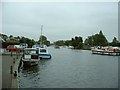
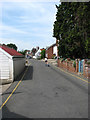
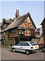
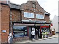
Photos of NR12 8LG


Area Information
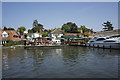
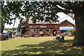
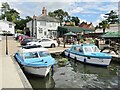
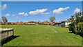
NR12 8LG represents a quiet residential cluster covering just 1.1 hectares. This small area accommodates 2,061 residents, resulting in a low population density of 71 people per square kilometre. Living in NR12 8LG offers solitude without total isolation. The layout supports a peaceful existence where property disputes are rare due to the limited footprint. You will find mostly houses within this boundary rather than high-rise blocks or dense flats. The environment feels established and settled. Most people here own their homes, which stabilises the local community. Daily life revolves around the immediate surroundings and nearby towns. Wroxham lies nearby, providing a larger village centre within practical reach. Local transport links connect you to Hoveton & Wroxham Railway Station, Worstead Railway Station, and Salhouse Railway Station. Retail options include Tesco Norwich, Morrisons Daily, and Co-op 122. You do not find grand estates or commercial hubs directly in this postcode. Instead, you access essential services from a short distance. The area maintains a distinct character as a residential enclave on England's coast. It suits those who value space and quiet. The mix of ownership suggests families and long-term residents dominate the market. You will not encounter transient housing developments here. The absence of protected natural sites like AONB or Ramsar wetlands means planning remains straightforward for future additions. Yet the current focus remains on housing existing families.
- Area Type
- Postcode
- Area Size
- 1.1 hectares
- Population
- 2061
- Population Density
- 71 people/km²
NR12 8LG operates as an almost exclusively owner-occupied market. As 78 per cent of residents own their properties, rental demand remains minimal. This market structure stabilises prices and reduces vacancy rates. Houses dominate the housing stock, meaning you rarely see converted offices or new build apartments. The low area size of 1.1 hectares restricts new supply. Buyers looking at homes in NR12 8LG should expect established properties rather than regeneration projects. The accommodation type data confirms a traditional suburban landscape. You will find semi-detached homes or detached bungalows suitable for families or retirees. The high ownership percentage suggests residents are likely upgrading within the same boundary or selling to attract other owners. Investors may struggle here as the market resists short-term letting. Demand for properties near schools drives valuation stability. Since most people buy to live, mortgage rates influence transactions more than speculative activity. The lack of private sector new builds means the available stock remains fixed. You cannot assume fresh developments will appear soon. Prices likely reflect the cost of land and the scarcity of available lots. The immediate surroundings share this ownership profile. Commuter buyers might consider this area if they work locally. The market remains fluid to genuine residents seeking a house in a safe neighbourhood. You will not find luxury penthouses or micro-apartments. Every transaction involves a traditional house sale.
House Prices in NR12 8LG
Showing 15 properties
| Address | Type | Beds | Baths | Last Sale Price | Last Sale Date | |
|---|---|---|---|---|---|---|
| 22 Broadwater Way, Horning, NR12 8LG | Detached | 3 | 1 | £407,500 | Sep 2024 | |
| 20 Broadwater Way, Horning, NR12 8LG | Bungalow | 3 | 2 | £380,000 | Jul 2018 | |
| 21 Broadwater Way, Horning, NR12 8LG | Bungalow | - | - | £280,000 | Sep 2016 | |
| 13 Broadwater Way, Horning, NR12 8LG | Bungalow | 3 | - | £220,000 | Jun 2016 | |
| 18 Broadwater Way, Horning, NR12 8LG | Bungalow | - | - | £244,950 | Aug 2014 | |
| 11 Broadwater Way, Horning, NR12 8LG | Bungalow | 3 | 1 | £220,000 | Sep 2013 | |
| 20A Broadwater Way, Horning, NR12 8LG | house | - | - | £227,500 | Sep 2011 | |
| 24 Broadwater Way, Horning, NR12 8LG | Detached | - | - | £230,000 | Jun 2008 | |
| 23 Broadwater Way, Horning, NR12 8LG | Detached | - | - | £225,500 | Jul 2007 | |
| 15 Broadwater Way, Horning, NR12 8LG | Detached | - | - | £196,750 | Mar 2003 |
Energy Efficiency in NR12 8LG
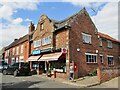
Living in NR12 8LG means relying on nearby towns for most daily needs. Wroxham serves as a local metro hub within practical reach. You access it easily for larger shopping trips or leisure outings. Rail links provide connection to broader networks via Hoveton & Wroxham Railway Station, Salhouse Railway Station, and Worstead Railway Station. Five nearby stations offer flexibility for occasional trips out of the county. The area hosts five notable retail outlets. Tesco Norwich, Morrisons Daily, and Co-op 122 stand out as your main shopping destinations. These venues cover groceries and essential household items. You do not find boutique retailers or cinemas within the immediate postcode. Daily life involves planning trips to the station or retail park. The proximity to these amenities reduces the need to travel far for basics. Families appreciate the variety of grocery options available. Co-op 122 offers Eastern or Mextry options alongside standard aisles. Tesco Norwich provides a full-scale supermarket experience nearby. Public transport frequency depends on the time of day. You will walk to shops or take a short drive. The five retail units mentioned denote a mix of DIY, grocery, and convenience stores. Dining options exist in surrounding villages rather than NR12 8LG itself. Parks and green spaces are scarce within the protected constraints of this postcode. Cleanup and maintenance of local roadways form part of the village upkeep. Life here balances self-reliance with accessible commerce.
Amenities
Schools
Families living in NR12 8LG benefit from two key schools nearby. Horning Community Primary School serves the local area with a good Ofsted rating. Neatishead Church of England Primary School holds an outstanding Ofsted rating. Both institutions fall within the primary education phase. You do not have secondary schools listed in this specific data set. The presence of two primary options means catchment areas are well defined. Parents can choose between a community school offering broad secular education or a Church of England school with religious integration. The outstanding rating at Neatishead suggests high academic standards and strong local reputation. Horning Community Primary School maintains solid support for student development. The mix of school types provides choice without overwhelming competition for places. Travel time to these schools remains short given the local geography. Commuters from NR12 8LG face minimal delays getting to class. You will find transport routes that connect the housing cluster to the school gates. The availability of rated schools supports the area's appeal to parents. Quality education access remains a core selling point. You do not rely on distant boarding schools. These provisions ensure continuity of education for local children. The ratings reflect consistent performance over multiple inspection cycles.
| Rank | School | Type | Entry gender | Ages |
|---|
Explore more schools in this area
Go to Schools tabDemographics
The community in NR12 8LG reflects an established demographic profile centred on mature adults. The median age stands at 47 years, with the 30-64 age range representing the most common group. This indicates a workforce that has settled down. House ownership accounts for 78 per cent of residents. Consequently, you see a market dominated by homeowners rather than tenants. This high ownership rate often correlates with stability and lower turnover. Houses form the predominant accommodation type, shaping the visual character of the neighbourhood. You find very few flats or terraced blocks. The ethnic composition is predominantly White, reflecting the typical makeup of many rural Norfolk villages. There are no indicators of significant deprivation affecting daily quality of life in this data set. The area feels stable because families have put down roots. Children aged under three make up a notable portion of the younger population, suggesting parents are still active in the community. Households consist mainly of married couples or single-person homes. You do not see large multi-generational complexes. The population density of 71 people per square kilometre ensures you avoid urban congestion. It allows for gardens and private spaces. The age profile means local shops cater to adults with young children or empty nesters rather than teenagers. This demographic cluster supports a steady demand for reliable utilities and standard retail.
Household Size
Accommodation Type
Tenure
Ethnic Group
Religion
Household Composition
Age
Household Deprivation
NS-SEC
Explore more demographic insights in this area
Go to Demographics tabPlanning
Planning Constraints
- Flood RiskPremium
- Ramsar Wetland SitesPremium
- Area of Outstanding Natural BeautyPremium
- Protected Nature ReservePremium
- Protected WoodlandPremium