Area Overview for NR12 8LW
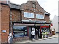
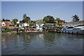
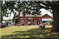
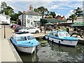
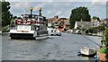
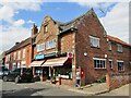
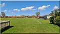
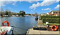
Photos of NR12 8LW
Area Information
Living in NR12 8LW means settling into a specific residential cluster defined by a postcode that covers an area of just 1.1 hectares. Despite its small footprint, this locality supports a population of 2061 dwellers. You will find that the presence of over two thousand residents within such a compact space creates a close-knit environment rather than an urban sprawl. The area is situated in England, offering a distinct sense of place away from the noise of major metropolitan zones. Daily life here is characterised by a lack of significant planning constraints, as the site passes assessments for flood risk and environmental protections. You do not face the restrictions that might come with land near protected woodlands or Ramsar wetland sites. The safety profile is equally robust, with low crime risk confirmed by recent metrics. This postcode offers a straightforward living experience without the complexities often found in older, more constrained neighbourhoods. Whether you are assessing the space for a family home or a retirement residence, the area provides a clear and contained setting. The population density of 71 people per square kilometre ensures you have neighbours but maintain a degree of quiet.
- Area Type
- Postcode
- Area Size
- 1.1 hectares
- Population
- 2061
- Population Density
- 71 people/km²
The housing market in NR12 8LW is distinctly shaped by the fact that 78 per cent of residents own their properties. This statistic proves that the area is primarily an owner-occupied zone rather than a rental hub. You are looking at a stock that consists almost entirely of houses, with very few flats available within this specific notification area. The concentration of houses aligns with the small physical size of 1.1 hectares, suggesting a leafy, detached or semi-detached character for the homes in NR12 8LW. Buyers seeking to live in this postcode will find more likely to purchase existing property than rent. The low population density of 71 people per square kilometre implies that the housing does not include high-density apartments. If you are searching for homes in NR12 8LW, expect standard family homes designed for the local climate and lifestyle. The market is driven by residents who have stayed long-term, providing stability to the local economy. There is little indication of speculative build sites or temporary rental blocks dominating the landscape.
House Prices in NR12 8LW
Showing 16 properties
| Address | Type | Beds | Baths | Last Sale Price | Last Sale Date | |
|---|---|---|---|---|---|---|
| 30 Norwich Road, Horning, NR12 8LW | Detached | 3 | 1 | £337,500 | Mar 2025 | |
| 28 Norwich Road, Horning, NR12 8LW | Detached | 3 | 1 | £275,000 | Dec 2019 | |
| 10 Norwich Road, Horning, NR12 8LW | house | - | - | £186,500 | Jun 2019 | |
| 14 Norwich Road, Horning, NR12 8LW | Semi-detached | 4 | 2 | £200,000 | Aug 2018 | |
| 6 Norwich Road, Horning, NR12 8LW | Semi-detached | 3 | 2 | £146,000 | Apr 2012 | |
| 22 Norwich Road, Horning, NR12 8LW | house | - | - | £170,000 | Nov 2010 | |
| 20 Norwich Road, Horning, NR12 8LW | Semi-detached | - | - | £108,500 | Apr 2007 | |
| 4 Norwich Road, Horning, NR12 8LW | Semi-detached | - | - | £164,000 | Nov 2006 | |
| 16 Norwich Road, Horning, NR12 8LW | house | - | - | £40,000 | May 1997 | |
| 26 Norwich Road, Horning, NR12 8LW | Semi-detached | 3 | 1 | - | - |
Energy Efficiency in NR12 8LW
Amenities
Schools
Families living near NR12 8LW have access to two specific primary schools listed in the immediate vicinity. Horning Community Primary School serves as a local option with a Ofsted rating of good. Neatishead Church of England Primary School is also nearby and holds an outstanding Ofsted rating. This combination of school types ensures that parents have choices within the primary education sector without needing to travel far to NR12 8LW. The presence of a Church of England school indicates religious education is available, while the community primary school offers a standard secular alternative. Both institutions are rated above the basic level, ensuring quality education for children growing up in the area. There are no secondary schools specifically named or attached to this postcode data, meaning older children may travel further for secondary education. For young families considering schools near NR12 8LW, the options are solid and officially recognised. The mix of good and outstanding ratings provides confidence regardless of which institution you choose.
| Rank | School | Type | Entry gender | Ages |
|---|
Explore more schools in this area
Go to Schools tabDemographics
The community in NR12 8LW reflects a mature demographic with a median age of 47 years. Most of the population falls into the adult bracket between 30 and 64 years old. This profile suggests a stable neighbourhood where families and established professionals have put down roots. You will find that 78 per cent of residents own their homes. This high level of ownership indicates that the area is not dominated by short-term renters or speculative investment. The predominant ethnic group is White, which contributes to a culturally consistent community atmosphere. Almost all accommodation consists of houses rather than flats or terraced units. There are no towering blocks or multi-storey developments in this small postcode. The age distribution and accommodation type mean that the streets are likely quiet during school hours and maintain a consistent character throughout the day. Higher health deprivation indices might exist elsewhere in the region, but within NR12 8LW, the structural demographics point towards a settled, owner-occupied village environment.
Household Size
Accommodation Type
Tenure
Ethnic Group
Religion
Household Composition
Age
Household Deprivation
NS-SEC
Explore more demographic insights in this area
Go to Demographics tabPlanning
Planning Constraints
- Flood RiskPremium
- Ramsar Wetland SitesPremium
- Area of Outstanding Natural BeautyPremium
- Protected Nature ReservePremium
- Protected WoodlandPremium