Area Overview for NR10 3GA
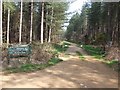
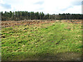
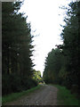
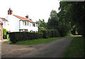
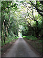
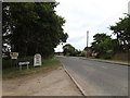
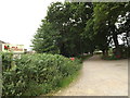
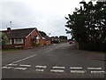
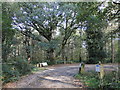
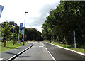
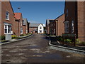
Photos of NR10 3GA

Area Information
Living in NR10 3GA offers a distinctly quiet residential experience within a small, defined cluster covering 8,838 square metres. This compact area houses a population of 2,320 people, creating a setting where neighbours are likely to know one another. The combination of limited space and a stable population size fosters an intimate community atmosphere rather than the anonymity of larger urban districts. Residents here enjoy a consistent environment away from the unpredictability of major traffic corridors or sprawling commercial developments. Daily life in this postcode is characterised by a pronounced sense of place. The area functions as a self-contained residential hub where the boundaries are clear and the character remains steady. You will find a high concentration of homes rather than commercial sprawl, which suggests a community focused on settled living. The sheer size of the area, measured in thousands of square metres yet supporting over two thousand inhabitants, indicates a balanced density that avoids overcrowding while preventing isolation. For those considering homes in NR10 3GA, the environment promises stability. The existing infrastructure is designed to support the current population without strain. This makes the area attractive to individuals seeking a predictable lifestyle where the rhythm of daily life is not interrupted by sudden demographic shifts or rapid development projects. The specific location offers a clear definition of what living here entails: a balanced, low-key residential zone with a well-established structure.
- Area Type
- Postcode
- Area Size
- 8838 m²
- Population
- 2320
- Population Density
- 235 people/km²
The property market in NR10 3GA is overwhelmingly dominated by owner-occupied homes. With a home ownership rate of 73%, the area functions primarily as a market for existing residents rather than a rental hub. This dynamic creates a stable environment where property prices are influenced more by ownership tenure and long-term value retention than by short-term rental yields. You will find that the majority of houses in NR10 3GA are owned by their occupants, which often leads to greater care for the external appearance and maintenance of individual properties. The accommodation type data confirms that houses, rather than flats or developments, are the standard housing stock. This structural diversity is absent from the local landscape, meaning you will not encounter high-rise blocks or mixed-use commercial blocks within the immediate vicinity. The focus remains squarely on detached or semi-detached properties suitable for families or individuals seeking a traditional suburban lifestyle. This uniformity in housing type means that any buyer entering the market in NR10 3GA is looking for specific property types that cater to settled living. High ownership levels can sometimes imply competition among sellers looking to upgrade or downsize, but the consistent nature of the stock provides reliability. The market here is not volatile in terms of occupant types; the prevalence of owner-occupiers suggests a robust local economy capable of supporting significant numbers of households. For those seeking homes in NR10 3GA, the market offers a predictable environment where property values are deeply tied to the stability of the local house-owning community.
House Prices in NR10 3GA
Showing 26 properties
| Address | Type | Beds | Baths | Last Sale Price | Last Sale Date | |
|---|---|---|---|---|---|---|
| 17 Beech Grove, Horsford, NR10 3GA | house | - | - | £807,993 | Mar 2019 | |
| 8 Beech Grove, Horsford, NR10 3GA | house | - | - | - | - | |
| 9 Beech Grove, Horsford, NR10 3GA | house | - | - | - | - | |
| 13 Beech Grove, Horsford, NR10 3GA | house | - | - | - | - | |
| 19 Beech Grove, Horsford, NR10 3GA | Maisonette | - | - | - | - | |
| 26 Beech Grove, Horsford, NR10 3GA | Maisonette | - | - | - | - | |
| 1 Beech Grove, Horsford, NR10 3GA | Maisonette | - | - | - | - | |
| 18 Beech Grove, Horsford, NR10 3GA | house | - | - | - | - | |
| 10 Beech Grove, Horsford, NR10 3GA | house | - | - | - | - | |
| 11 Beech Grove, Horsford, NR10 3GA | Maisonette | - | - | - | - |
Energy Efficiency in NR10 3GA
Residents of NR10 3GA have access to a selection of amenities within practical reach, ensuring daily errands do not require long commutes to city centres. The retail landscape includes five notable locations, featuring options such as East of England Co-operative Co, Tesco Thorpe Mariott, and Tesco Taverham. These supermarkets provide all necessary groceries and household essentials, meaning you can manage your weekly shopping without travelling far. Transport links are supported by proximity to Aylsham, which serves as the nearest metro station. This rail connection offers a direct route to larger towns, facilitating travel for work or leisure without relying solely on personal vehicles. Additionally, Norwich International Airport is nearby, providing international and domestic travel options for residents who need to fly. The character of NR10 3GA is defined by convenience rather than nightlife or entertainment districts. The focus is on essential services and transport gateways. You will find that daily life revolves around the practicalities of suburban living, with shops handling retail needs and trains handling long-distance connectivity. This balance ensures that you have everything you need locally while retaining easy access to broader regional hubs when necessary.
Amenities
Schools
Education for children living in NR10 3GA is supported by two primary institutions nearby. The closest option is Horsford Church of England Junior School, which serves the younger students in the area. Also available is Horsford CofE VA Primary School, which holds a specific Ofsted rating of Good. This rating provides verified assurance on the quality of education provided at the primary level for local families. The mix of these two primary schools offers a choice for parents depending on their religious preferences and catchment areas. Both schools are dedicated to primary education, indicating that secondary education requires travel to other towns. This setup is typical for smaller residential clusters like NR10 3GA, where children often attend school in neighbouring villages before moving to larger towns for secondary education. For families considering this area, the presence of two rated primary schools is a significant practical benefit. Horsford CofE VA Primary School's Good rating ensures that a baseline of quality in primary education is available without needing to travel far to Norwich. The existence of these specific facilities means that residents do not face a lack of educational provision for young children. The area supports early childhood development with established, regulated schools that meet statutory standards for safety and curriculum delivery.
| Rank | School | Type | Entry gender | Ages |
|---|
Explore more schools in this area
Go to Schools tabDemographics
The community in NR10 3GA reflects a mature and stable demographic profile, with a median age of 47 years. The most common age range consists of adults between 30 and 64 years, indicating that families and established professionals form the core of the local population. This age distribution suggests an environment where residents have likely put down roots and prioritise long-term stability over transient living arrangements. Home ownership stands at an impressive 73%, which shapes the social fabric of the neighbourhood. A strong majority of households own their properties outright, creating a sense of permanence and investment in the local community. This high rate of ownership often correlates with lower turnover, meaning you are likely to live amongst residents who have settled for the long haul. The accommodation type is predominantly houses, further reinforcing a family-oriented and suburban character. Ethnically, the area is predominantly White, contributing to a homogeneous community feel that is common in many established English residential zones. With a population density of 235 people per square kilometre, the area maintains a low-density feel where privacy is valued. These statistics paint a clear picture of a settled, owner-occupied neighbourhood where the average resident is likely over thirty-five and invested in their local surroundings. The demographic data confirms this is not a student town or a retirement hotspot, but a balanced adult community.
Household Size
Accommodation Type
Tenure
Ethnic Group
Religion
Household Composition
Age
Household Deprivation
NS-SEC
Explore more demographic insights in this area
Go to Demographics tabPlanning
Planning Constraints
- Flood RiskPremium
- Ramsar Wetland SitesPremium
- Area of Outstanding Natural BeautyPremium
- Protected Nature ReservePremium
- Protected WoodlandPremium