Area Overview for NR10 3EF
Photos of NR10 3EF
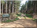
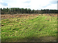
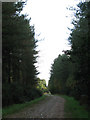
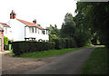
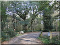
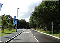
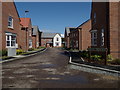

56 photos from this area
Area Information
Key information about the NR10 3EF including its size, population, and administrative classification.
- Area Type
- Postcode
- Area Size
- 2.7 hectares
- Population
- 2320
- Population Density
- 235 people/km²
House Prices in NR10 3EF
39
Properties
£150,821
Average Sold Price
£49,000
Lowest Price
£325,000
Highest Price
Showing 39 properties
| Address | Type | Beds | Baths | Last Sale Price | Last Sale Date | |
|---|---|---|---|---|---|---|
| 43 Olive Crescent, Horsford, NR10 3EF | house | 3 | - | £211,000 | May 2021 | |
| 15 Olive Crescent, Horsford, NR10 3EF | Bungalow | 2 | - | £325,000 | Nov 2019 | |
| 12 Olive Crescent, Horsford, NR10 3EF | Bungalow | - | - | £230,000 | Aug 2018 | |
| 13 Olive Crescent, Horsford, NR10 3EF | Bungalow | 4 | - | £240,000 | May 2015 | |
| 25 Olive Crescent, Horsford, NR10 3EF | Bungalow | 2 | 1 | £125,000 | Apr 2012 | |
| 17 Olive Crescent, Horsford, NR10 3EF | Bungalow | - | - | £245,000 | May 2010 | |
| 26 Olive Crescent, Horsford, NR10 3EF | Detached | 3 | - | £185,000 | May 2006 | |
| 24 Olive Crescent, Horsford, NR10 3EF | Detached | - | - | £150,000 | Oct 2005 | |
| 18 Olive Crescent, Horsford, NR10 3EF | Bungalow | 2 | - | £122,500 | Feb 2003 | |
| 39 Olive Crescent, Horsford, NR10 3EF | Semi-detached | - | - | £65,000 | Dec 2000 |
Page 1 of 4
Energy Efficiency in NR10 3EF
Amenities
Schools
| Rank | School | Type | Entry gender | Ages |
|---|
Explore more schools in this area
Go to Schools tabDemographics
Household Size
Two person
most common
Accommodation Type
Houses
most common
Tenure
73
majority
Ethnic Group
White
most common
Religion
N/A
most common
Household Composition
N/A
most common
Age
47
median
Adults (30-64 years)
most common
Household Deprivation
N/A
with no deprivation
NS-SEC
31
in Lower managerial occupations
Explore more demographic insights in this area
Go to Demographics tabPlanning
Planning Constraints
- Flood RiskPremium
- Ramsar Wetland SitesPremium
- Area of Outstanding Natural BeautyPremium
- Protected Nature ReservePremium
- Protected WoodlandPremium