Area Overview for NR10 3FB
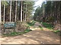
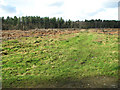
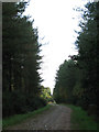
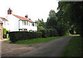
Photos of NR10 3FB

Area Information
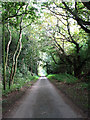
NR10 3FB occupies a small residential cluster spanning 58.5 hectares, situated within the Norfolk countryside. You will find a quiet community where daily life moves at a manageable pace, distinct from the busier towns nearby. With a population of 2,320, this postcode represents a tight-knit neighbourhood rather than a sprawling urban expansion. The area's density stands at 235 people per square kilometre, indicating spacious living without the isolation of remote rural locations. Most residents live within houses, creating an environment defined by residential comfort and stability. This setting appeals to those seeking a balance between country tranquility and access to regional services. You do not need to travel far for essentials, as key amenities lie within practical reach. The character of NR10 3FB remains consistent, offering a predictable quality of life for those prioritising a calm domestic routine. It serves as a solid base for individuals who value the built-up density of small settlements over the openness of vast rural expanses.
- Area Type
- Postcode
- Area Size
- 58.5 hectares
- Population
- 2320
- Population Density
- 235 people/km²
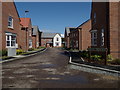
The housing market in NR10 3FB is dominated by households that own their dwellings, as 73% of residents are owner-occupiers. This figure signals that the local property landscape consists largely of purchased homes rather than rental apartments provided by large private landlords. The predominant accommodation type is houses, which aligns with the singlebroadband households living in their own properties. You are looking primarily at a stock of detached or semi-detached residences suitable for families and couples. This contrasts sharply with urban areas where rental percentages are often high among recent migrants or students. The consistency of home ownership suggests that much of the housing stock has been established for decades or spans generations. For a potential buyer, this means entering a market where transactions are typically managed by estate agents selling existing stock rather than developers or large corporate landlords renting to fleets of tenants. The prevalence of houses also offers more options regarding garden size and parking arrangements compared to flats or terraced properties found in denser environments.
House Prices in NR10 3FB
Showing 6 properties
| Address | Type | Beds | Baths | Last Sale Price | Last Sale Date | |
|---|---|---|---|---|---|---|
| Brackenwood, Sandy Lane, Horsford, NR10 3FB | Detached | - | - | £1,600,000 | Apr 2023 | |
| Oaklands, Sandy Lane, Horsford, NR10 3FB | Detached | - | - | £1,600,000 | Apr 2023 | |
| Medivet Group Ltd, Veterinary Practice, Brackenwood, Sandy Lane, Horsford, NR10 3FB | hospital_care_home | - | - | - | - | |
| Countryside Products, Sandy Lane, Horsford, NR10 3FB | Farm | - | - | - | - | |
| Caravan, Oaklands, Sandy Lane, Horsford, NR10 3FB | Mobile Home | - | - | - | - | |
| Arum Cottage, Brackenwood, Sandy Lane, Horsford, NR10 3FB | Semi-detached | - | - | - | - |
Energy Efficiency in NR10 3FB
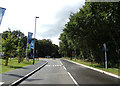
Daily life in NR10 3FB extends easily to nearby amenities without requiring long commutes. Five retail outlets serve the immediate vicinity, offering practical shopping solutions. You will find specific locations such as East of England Co-operative Co, Tesco Thorpe Mariott, and Tesco Taverham within reachable distance. A trip to any of these supermarkets provides groceries, household essentials, and everyday fresh provisions. Transport links connect you to Aylsham, one nearby metro station, allowing access to wider regional networks if your travel plans extend beyond the local cluster. Norwich International Airport lies nearby, offering comfortable air travel options for holidays or business trips without needing to travel great distances. The presence of these amenities means you can manage weekly errands locally while retaining access to major city facilities when necessary. The mix of supermarkets ensures you do not rely on a single source for your shopping needs. This network supports a self-sufficient lifestyle while maintaining the convenience of being close to larger transport hubs.
Amenities
Schools
Families living in NR10 3FB have access to two primary education options within close proximity. These include Horsford Church of England Junior School and Horsford CofE VA Primary School. Both institutions serve the local community and provide foundational education for young children in the catchment area. No data is provided regarding the Ofsted ratings for Horsford Church of England Junior School, so you cannot verify its current performance level using the available information. However, Horsford CofE VA Primary School holds an Ofsted rating of good, which confirms it meets the standards expected for primary education excellence in England. While secondary school options are not listed in the provided data, these primary schools form the first educational step for residents aged roughly five to eleven years. The concentration of Church of England schools indicates that religious education plays a structural role within the local learning environment. Parents researching schools near NR10 3FB will find these two venues as the principal choices for their youngest children.
| Rank | School | Type | Entry gender | Ages |
|---|
Explore more schools in this area
Go to Schools tabDemographics
The community profile of NR10 3FB reflects stability, with a median age of 47 years. The most common age range consists of adults between 30 and 64 years old, suggesting a neighbourhood anchored by established families and long-term residents rather than transient student housing or young professionals alone. Home ownership stands at a high 73%, meaning the vast majority of people here live in their own properties. This high level of ownership typically indicates residents who are settled in the area for the long term and have invested significantly in their local surroundings. The accommodation is almost exclusively comprised of houses, supporting families and multi-person households. The predominant ethnic group is White, aligning with the broader demographic trends of rural Norfolk. There is a significant proportion of older residents within the population, particularly those over 65 years old, who contribute to the area's established feel. No data on deprivation is provided, so any assessment of economic vulnerability relies solely on the strong indicators of home ownership and age profiles presented. Generally, a high home ownership rate correlates with lower financial stress and community stability.
Household Size
Accommodation Type
Tenure
Ethnic Group
Religion
Household Composition
Age
Household Deprivation
NS-SEC
Explore more demographic insights in this area
Go to Demographics tabPlanning
Planning Constraints
- Flood RiskPremium
- Ramsar Wetland SitesPremium
- Area of Outstanding Natural BeautyPremium
- Protected Nature ReservePremium
- Protected WoodlandPremium