Area Overview for NR10 3EE
Photos of NR10 3EE
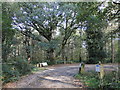
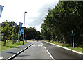
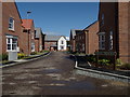

56 photos from this area
Area Information
Key information about the NR10 3EE including its size, population, and administrative classification.
- Area Type
- Postcode
- Area Size
- 2.6 hectares
- Population
- 2320
- Population Density
- 235 people/km²
House Prices in NR10 3EE
25
Properties
£216,590
Average Sold Price
£45,950
Lowest Price
£325,000
Highest Price
Showing 25 properties
| Address | Type | Beds | Baths | Last Sale Price | Last Sale Date | |
|---|---|---|---|---|---|---|
| 324 Holt Road, Horsford, NR10 3EE | Bungalow | 2 | 1 | £255,000 | May 2024 | |
| 338 Holt Road, Horsford, NR10 3EE | Semi-detached | 2 | 1 | £220,000 | Feb 2021 | |
| 350 Holt Road, Horsford, NR10 3EE | Detached | 4 | - | £325,000 | Nov 2018 | |
| 360 Holt Road, Horsford, NR10 3EE | Detached | - | - | £225,000 | Apr 2018 | |
| 326 Holt Road, Horsford, NR10 3EE | Bungalow | 4 | 1 | £285,000 | Mar 2017 | |
| 354 Holt Road, Horsford, NR10 3EE | Detached | 4 | 1 | £249,950 | Dec 2014 | |
| 352 Holt Road, Horsford, NR10 3EE | Detached | 4 | - | £260,000 | Oct 2014 | |
| 318 Holt Road, Horsford, NR10 3EE | Detached | - | - | £190,000 | Feb 2008 | |
| 300 Holt Road, Horsford, NR10 3EE | Semi-detached | 2 | 1 | £110,000 | Dec 2005 | |
| 336 Holt Road, Horsford, NR10 3EE | Bungalow | - | - | £45,950 | Aug 1998 |
Page 1 of 3
Energy Efficiency in NR10 3EE
Amenities
Schools
| Rank | School | Type | Entry gender | Ages |
|---|
Explore more schools in this area
Go to Schools tabDemographics
Household Size
Two person
most common
Accommodation Type
Houses
most common
Tenure
73
majority
Ethnic Group
White
most common
Religion
N/A
most common
Household Composition
N/A
most common
Age
47
median
Adults (30-64 years)
most common
Household Deprivation
N/A
with no deprivation
NS-SEC
31
in Lower managerial occupations
Explore more demographic insights in this area
Go to Demographics tabPlanning
Planning Constraints
- Flood RiskPremium
- Ramsar Wetland SitesPremium
- Area of Outstanding Natural BeautyPremium
- Protected Nature ReservePremium
- Protected WoodlandPremium