Area Overview for Epping Forest District
Photos of Epping Forest District


Area Information
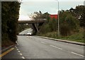
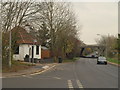
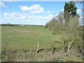
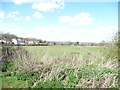
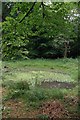
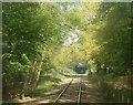
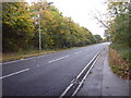
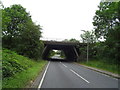
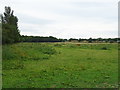
Epping Forest District covers a vast expanse of 339.0 km² in southern England. Living in this district offers a stark contrast to typical urban environments because of its size and rural character. The area is defined by its exceptional green space rather than dense city living. You will find yourself far from the congestion of central London while still benefiting from proximity to major metropolitan centres. The sheer scale of the district dictates that daily commutes and local exploration feel different here compared to smaller boroughs. The district unitary authority manages local services across this large territory, which can impact how quickly infrastructure upgrades reach specific neighbourhoods. Residents here often describe a slower pace of life that suits families and retirees seeking tranquility. The expansive nature of the land means that every community feels somewhat isolated unless you are dedicated drivers. This isolation is double-edged, providing peace for some but limiting immediate access to amenities for others. When you look at homes in Epping Forest District, you are purchasing land with significant historical and environmental significance attached to it. Daily life centres around managing distances and valuing the open surroundings. The presence of protected woodlands and nature reserves shapes most local activities. You cannot overlook the impact of planning constraints when considering where to live or build within the district. The area stands apart from more developed regions through its commitment to preserving large swathes of untouched wilderness. Whether you seek silence or recreation, the district provides these elements in abundance across its 339.0 km² footprint.
- Area Type
- District/Borough
- Area Size
- 339.0 km²
- Population
- Not available
- Population Density
- Not available
Demographics
The community profile within Epping Forest District reveals a heavily skewed age distribution. The median age stands at 70, marking this as one of the oldest local authority districts in the country. This figure indicates that the population is dominated by seniors rather than young families or university students. When living in Epping Forest District, you are joining a mature community where mature residents form the bulk of the demographic landscape. You will encounter fewer children playing in public spaces compared to younger boroughs, reflecting this significant age gap. Home ownership acts as a defining feature of the local economy and social structure. A lofty 70% of households in the district own their residences outright. This figure suggests stability and long-term residency, with owners having vested interests in maintaining their properties and neighbourhoods. You are unlikely to struggle with rising rental costs or tenant turnover when viewing homes in Epping Forest District because the rental sector represents a minority of the market. This high ownership rate correlates with lower overall rental demand and a quiet suburban atmosphere. Accommodation types and household compositions align with an older population profile. The data shows that total household composition accommodates the needs of this older demographic effectively. While specific breakdowns of ethnic groups or religious affiliations are not available, the structural data points to established community patterns. Living here means navigating a society built primarily around fixed-income retirees and established homeowners. The lack of younger buyers or renters suggests a settled, self-reinforcing community dynamic that values tradition and security above rapid growth or demographic shifts.
Household Size
Accommodation Type
Tenure
Ethnic Group
Religion
Household Composition
Age
Household Deprivation
NS-SEC
Explore more demographic insights in this area
Go to Demographics tabPlanning
Planning Constraints
- Flood RiskPremium
- Ramsar Wetland SitesPremium
- Area of Outstanding Natural BeautyPremium
- Protected Nature ReservePremium
- Protected WoodlandPremium