Area Overview for East Hertfordshire District
Photos of East Hertfordshire District
Area Information
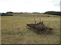
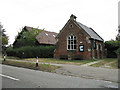
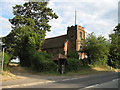
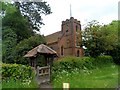
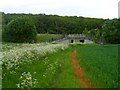
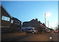
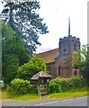
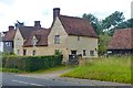
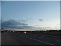
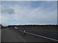
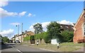
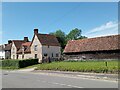
East Hertfordshire District occupies a vast rural expanse of 475.8 km² across southeastern England. As the largest of ten districts in Hertfordshire, it covers approximately one-third of the historic county. The administrative seat is Hertford, which shares status with Bishop's Stortford as the largest town. Other significant settlements include Ware, Buntingford, and Sawbridgeworth. The landscape is undulating countryside drained by the River Lea and River Stort. This territory sits at the northern edge of the Greater London Green Belt. It borders North Hertfordshire, Stevenage, Welwyn Hatfield, and Broxbourne within Hertfordshire. To the east, it meets Epping Forest and Harlow, while Uttlesford in Essex forms the southern boundary. The district features rolling topography, medieval manor houses, thatched cottages, and dispersed settlements. Residents survey the area highly, ranking it seventh-best in the UK for district living according to Channel 4 in 2006. It also held the position of the ninth most desirable area in a 2012 Halifax survey. The first-place ranking came from Halifax in 2020. Daily life involves navigating green belts and small-to-medium towns interwoven with village settings. The area offers a general feel of countryside mixed with urban amenities. Prospective buyers can explore regional attractions like Panshanger Park and the Henry Moore Foundation at Perry Green.
- Area Type
- District/Borough
- Area Size
- 475.8 km²
- Population
- Not available
- Population Density
- Not available
Demographics
The community in East Hertfordshire District reflects an older population profile than many other regions. The median age stands at 70 years. No specific age breakdown data exists beyond this central figure. Nevertheless, the district clearly skews towards older retirees rather than young families. Home ownership dominates the housing landscape, with 71% of residents owning their property outright or with a mortgage. This high ownership rate suggests stability and a deep-rooted community structure. Household composition details are not explicitly quantified beyond general categories. Accommodation types similarly lack specific breakdown percentages in the available records. The area also features the lowest population density among Hertfordshire's districts, recorded at 290 people per km² during the 2011 Census. This sparse distribution of inhabitants supports a quiet lifestyle. The total population reached 137,687 based on 2011 Census figures. While specific ethnic diversity data is not detailed, the area maintains a distinct character defined by its rural nature. Religious adherence levels remain unpublished in the current dataset. The demographic reality points to an established, older demographic living in spacious, owner-occupied properties across a low-density environment.
Household Size
Accommodation Type
Tenure
Ethnic Group
Religion
Household Composition
Age
Household Deprivation
NS-SEC
Explore more demographic insights in this area
Go to Demographics tabPlanning
Planning Constraints
- Flood RiskPremium
- Ramsar Wetland SitesPremium
- Area of Outstanding Natural BeautyPremium
- Protected Nature ReservePremium
- Protected WoodlandPremium
- Crime RiskPremium