Area Overview for CM13 2QP
Photos of CM13 2QP
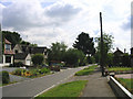
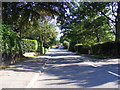
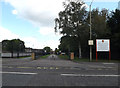
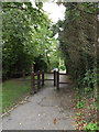
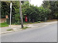
41 photos from this area
Area Information
Key information about the CM13 2QP including its size, population, and administrative classification.
- Area Type
- Postcode
- Area Size
- 2.6 hectares
- Population
- 2512
- Population Density
- 1300 people/km²
House Prices in CM13 2QP
24
Properties
£938,816
Average Sold Price
£180,000
Lowest Price
£1,625,000
Highest Price
Showing 24 properties
| Address | Type | Beds | Baths | Last Sale Price | Last Sale Date | |
|---|---|---|---|---|---|---|
| 54 Park Avenue, Hutton, CM13 2QP | house | 2 | 1 | £1,075,000 | Dec 2024 | |
| 49 Park Avenue, Hutton, CM13 2QP | Detached | 4 | 2 | £1,310,000 | Apr 2024 | |
| 56 Park Avenue, Hutton, CM13 2QP | Detached | 4 | 1 | £890,000 | Mar 2023 | |
| 44 Park Avenue, Hutton, CM13 2QP | Detached | 5 | - | £1,300,000 | Sep 2021 | |
| 39 Park Avenue, Hutton, CM13 2QP | house | - | - | £1,200,000 | Sep 2021 | |
| 57 Park Avenue, Hutton, CM13 2QP | house | - | - | £955,000 | Sep 2021 | |
| Delta House, 47 Park Avenue, Hutton, CM13 2QP | Detached | 2 | 1 | £1,550,000 | Jun 2021 | |
| Elden, 52A Park Avenue, Hutton, CM13 2QP | house | - | - | £1,625,000 | Feb 2020 | |
| The Birches, 52 Park Avenue, Hutton, CM13 2QP | house | - | - | £1,600,000 | Feb 2020 | |
| 53 Park Avenue, Hutton, CM13 2QP | house | - | - | £1,120,000 | Jul 2019 |
Page 1 of 3
Energy Efficiency in CM13 2QP
Amenities
Schools
| Rank | School | Type | Entry gender | Ages |
|---|
Explore more schools in this area
Go to Schools tabDemographics
Household Size
Family (3-5 people)
most common
Accommodation Type
Houses
most common
Tenure
89
majority
Ethnic Group
White
most common
Religion
N/A
most common
Household Composition
N/A
most common
Age
47
median
Adults (30-64 years)
most common
Household Deprivation
N/A
with no deprivation
NS-SEC
51
in Lower managerial occupations
Explore more demographic insights in this area
Go to Demographics tabPlanning
Planning Constraints
- Flood RiskPremium
- Ramsar Wetland SitesPremium
- Area of Outstanding Natural BeautyPremium
- Protected Nature ReservePremium
- Protected WoodlandPremium