Area Overview for CM13 2RD
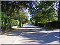
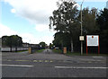
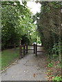
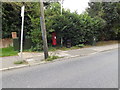
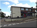
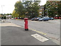
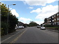
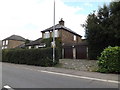
Photos of CM13 2RD
Area Information
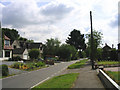
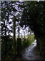
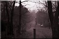
Living in CM13 2RD means being part of a small, tightly knit residential cluster in the suburb of Hutton, Essex. Situated 3 miles east of Brentwood town centre, the area blends historic charm with modern convenience. With a population of 2,512 and a density of 1,300 people per square kilometre, it’s a compact community where the past meets the present. The area’s roots trace back to the Domesday Book, with Hutton All Saints’ Church, a Grade II* listed building, anchoring the village’s heritage. Residents benefit from proximity to Shenfield Railway Station, just 1 mile away, offering easy access to Central London and beyond. The nearby Hutton Country Park provides green space, while the conservation area around All Saints’ Church preserves the village’s character. This is a place where families, professionals, and retirees coexist, with a median age of 47 and a strong focus on home ownership. Daily life here balances quiet rural surroundings with practical urban connectivity, making CM13 2RD a compelling choice for those seeking stability and community.
- Area Type
- Postcode
- Area Size
- Not available
- Population
- 2512
- Population Density
- 1300 people/km²
The property market in CM13 2RD is dominated by owner-occupied homes, with 89% of properties in private hands. This high rate of home ownership suggests a community of long-term residents who have invested in their homes, likely contributing to a stable and established housing market. The accommodation type is primarily houses, which is typical for suburban areas and reflects the area’s appeal to families and professionals seeking space and privacy. Given the small size of the postcode area, the housing stock is limited but concentrated, making it a niche market for buyers seeking specific properties. The focus on owner-occupied homes may mean fewer rental options, which could be a consideration for those looking for flexibility. The presence of historic and conservation areas, such as the village core around All Saints’ Church, may also influence property values and desirability. For buyers, this area offers a blend of traditional housing with suburban convenience.
House Prices in CM13 2RD
No properties found in this postcode.
Energy Efficiency in CM13 2RD
The lifestyle in CM13 2RD is shaped by its mix of historic charm and suburban practicality. Residents have access to retail outlets such as Tesco Brentwood, Co-op Rayleigh, and M&S Hutton Mount BP, ensuring everyday shopping needs are met. The nearby Hutton Country Park offers green space for recreation, while the conservation area around All Saints’ Church preserves the village’s heritage. The area’s proximity to rail stations and the wider Brentwood town centre provides easy access to leisure, dining, and cultural amenities. The blend of local parks, historic sites, and modern retail makes daily life both convenient and rooted in tradition. This balance of amenities supports a lifestyle that values community, nature, and accessibility.
Amenities
Schools
Residents of CM13 2RD have access to a range of educational options, including St Martin’s School, a primary school serving the local community. For independent education, Herington House School offers a private alternative, while St Martin’s School Brentwood, an academy with a ‘good’ Ofsted rating, provides state-funded secondary education. This mix of school types ensures families can choose between public, private, and specialist institutions. The presence of a high-performing academy suggests strong academic provision for secondary students, while the primary school caters to younger children. The proximity of these schools to the area makes CM13 2RD an attractive choice for families prioritising education. The variety of options reflects the area’s commitment to supporting diverse educational needs, from early years to secondary schooling.
| Rank | School | Type | Entry gender | Ages |
|---|
Explore more schools in this area
Go to Schools tabDemographics
CM13 2RD is predominantly inhabited by adults aged 30–64, with a median age of 47. The community is largely composed of homeowners, with 89% of properties owner-occupied, reflecting a stable, long-term resident base. Accommodation is primarily houses, which aligns with the area’s suburban character. The predominant ethnic group is White, though specific diversity data is not detailed in the available information. The age profile suggests a mature demographic, with fewer young families or retirees compared to other areas. This demographic mix influences the local culture, with a focus on established households and community continuity. The high home ownership rate indicates a preference for settled living, which may impact local services and amenities tailored to long-term residents. The absence of specific data on deprivation means the area’s socioeconomic profile remains largely unexplored in this context.
Household Size
Accommodation Type
Tenure
Ethnic Group
Religion
Household Composition
Age
Household Deprivation
NS-SEC
Explore more demographic insights in this area
Go to Demographics tabPlanning
Planning Constraints
- Flood RiskPremium
- Ramsar Wetland SitesPremium
- Area of Outstanding Natural BeautyPremium
- Protected Nature ReservePremium
- Protected WoodlandPremium