Area Overview for CM13 2QT
Photos of CM13 2QT
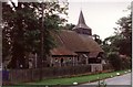
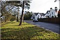
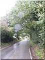
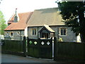
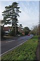
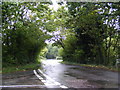
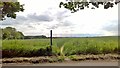
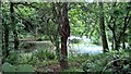

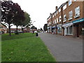
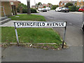
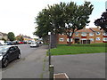
37 photos from this area
Area Information
Key information about the CM13 2QT including its size, population, and administrative classification.
- Area Type
- Postcode
- Area Size
- 7.6 hectares
- Population
- 2512
- Population Density
- 1300 people/km²
House Prices in CM13 2QT
20
Properties
£730,769
Average Sold Price
£475,000
Lowest Price
£1,165,000
Highest Price
Showing 20 properties
| Address | Type | Beds | Baths | Last Sale Price | Last Sale Date | |
|---|---|---|---|---|---|---|
| St Anns, 65A Hall Green Lane, Hutton, CM13 2QT | house | - | - | £1,100,000 | Nov 2020 | |
| 78 Hall Green Lane, Hutton, CM13 2QT | house | - | - | £815,000 | Jul 2020 | |
| Badgers Cross, 65 Hall Green Lane, Hutton, CM13 2QT | house | 4 | - | £1,075,000 | Dec 2019 | |
| Leyborn, 59 Hall Green Lane, Hutton, CM13 2QT | house | - | - | £1,165,000 | Feb 2018 | |
| Tregonnick, 63 Hall Green Lane, Hutton, CM13 2QT | Detached | 6 | 4 | £665,000 | Apr 2016 | |
| 74 Hall Green Lane, Hutton, CM13 2QT | Bungalow | 4 | - | £510,000 | Nov 2013 | |
| Holly Cottage, 57 Hall Green Lane, Hutton, CM13 2QT | house | 5 | - | £775,000 | Aug 2012 | |
| Crofts, 67 Hall Green Lane, Hutton, CM13 2QT | house | - | - | £600,000 | May 2012 | |
| 66 Hall Green Lane, Hutton, CM13 2QT | house | - | - | £475,000 | Jan 2011 | |
| Wensbury, 68 Hall Green Lane, Hutton, CM13 2QT | house | 5 | - | £499,995 | Oct 2010 |
Page 1 of 2
Energy Efficiency in CM13 2QT
Amenities
Schools
| Rank | School | Type | Entry gender | Ages |
|---|
Explore more schools in this area
Go to Schools tabDemographics
Household Size
Family (3-5 people)
most common
Accommodation Type
Houses
most common
Tenure
89
majority
Ethnic Group
White
most common
Religion
N/A
most common
Household Composition
N/A
most common
Age
47
median
Adults (30-64 years)
most common
Household Deprivation
N/A
with no deprivation
NS-SEC
51
in Lower managerial occupations
Explore more demographic insights in this area
Go to Demographics tabPlanning
Planning Constraints
- Flood RiskPremium
- Ramsar Wetland SitesPremium
- Area of Outstanding Natural BeautyPremium
- Protected Nature ReservePremium
- Protected WoodlandPremium