Area Overview for CB9 7LF
Photos of CB9 7LF
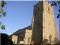
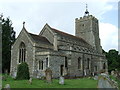
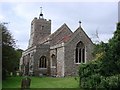
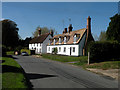
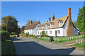
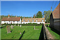
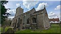
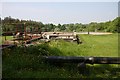
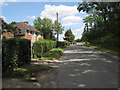
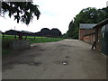
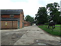
20 photos from this area
Area Information
Key information about the CB9 7LF including its size, population, and administrative classification.
- Area Type
- Postcode
- Area Size
- 59.4 hectares
- Population
- 2581
- Population Density
- 44 people/km²
House Prices in CB9 7LF
30
Properties
£524,500
Average Sold Price
£424,000
Lowest Price
£625,000
Highest Price
Showing 30 properties
| Address | Type | Beds | Baths | Last Sale Price | Last Sale Date | |
|---|---|---|---|---|---|---|
| Wheatsheaf House, Bury Road, Great Thurlow, CB9 7LF | Detached | 4 | 2 | £625,000 | Jul 2017 | |
| The Rectory, Bury Road, Great Thurlow, CB9 7LF | house | - | - | £424,000 | Jul 2006 | |
| 112A Bury Road, Great Thurlow, CB9 7LF | Detached | - | - | - | - | |
| 113A Bury Road, Great Thurlow, CB9 7LF | Semi-detached | - | - | - | - | |
| 2, Hall Cottages, Bury Road, Great Thurlow, CB9 7LF | Terraced | - | - | - | - | |
| Church Farm, Bury Road, Great Thurlow, CB9 7LF | Farm | - | - | - | - | |
| Tennis 107M From Thurlow Hall, Bury Road 121M From Unnamed Road, Access Road From C 667 To And Around Great Thurlow Hall, Great Thurlow, CB9 7LF | Leisure | - | - | - | - | |
| Cemetery, Bury Road, Great Thurlow, CB9 7LF | commercial | - | - | - | - | |
| Tennis 90M From 93 School Terrace, Wratting Road 75M From B1061, Wratting Road, Great Thurlow, CB9 7LF | Leisure | - | - | - | - | |
| Stonebridge House, 114 Bury Road, Great Thurlow, CB9 7LF | Cottage | 4 | 3 | - | - |
Page 1 of 3
Energy Efficiency in CB9 7LF
Amenities
Schools
| Rank | School | Type | Entry gender | Ages |
|---|
Explore more schools in this area
Go to Schools tabDemographics
Household Size
Two person
most common
Accommodation Type
Houses
most common
Tenure
70
majority
Ethnic Group
White
most common
Religion
N/A
most common
Household Composition
N/A
most common
Age
47
median
Adults (30-64 years)
most common
Household Deprivation
N/A
with no deprivation
NS-SEC
42
in Lower managerial occupations
Explore more demographic insights in this area
Go to Demographics tabPlanning
Planning Constraints
- Flood RiskPremium
- Ramsar Wetland SitesPremium
- Area of Outstanding Natural BeautyPremium
- Protected Nature ReservePremium
- Protected WoodlandPremium