Area Overview for CB9 7JH
Photos of CB9 7JH
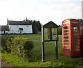
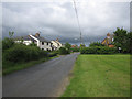
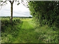
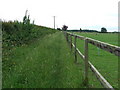
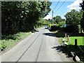
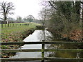
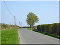
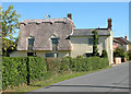

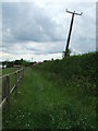
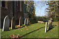
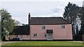
12 photos from this area
Area Information
Key information about the CB9 7JH including its size, population, and administrative classification.
- Area Type
- Postcode
- Area Size
- 52.7 hectares
- Population
- 2581
- Population Density
- 44 people/km²
House Prices in CB9 7JH
18
Properties
£353,329
Average Sold Price
£119,000
Lowest Price
£650,000
Highest Price
Showing 18 properties
| Address | Type | Beds | Baths | Last Sale Price | Last Sale Date | |
|---|---|---|---|---|---|---|
| White Cottage, The Green, Little Thurlow, CB9 7JH | Retail | 3 | 1 | £650,000 | Apr 2022 | |
| 2, Holme Cottages, The Green, Little Thurlow, CB9 7JH | Semi-detached | 3 | 1 | £328,000 | Nov 2021 | |
| 1, Holme Cottages, The Green, Little Thurlow, CB9 7JH | Semi-detached | 3 | 1 | £285,000 | Oct 2021 | |
| Cherryripe, The Green, Little Thurlow, CB9 7JH | Semi-detached | 2 | - | £285,000 | Oct 2021 | |
| Coronation Villas, 1 The Green, Little Thurlow, CB9 7JH | house | 3 | - | £380,000 | Jun 2021 | |
| Saffron House, The Green, Little Thurlow, CB9 7JH | Detached | 4 | 3 | £585,000 | Feb 2018 | |
| Wyatt Cottage, The Green, Little Thurlow, CB9 7JH | Detached | 4 | 2 | £512,500 | Oct 2017 | |
| Ainslark, The Green, Little Thurlow, CB9 7JH | Bungalow | 4 | - | £290,000 | Aug 2013 | |
| Brora, The Green, Little Thurlow, CB9 7JH | Detached | 5 | - | £432,500 | Mar 2013 | |
| Faraway, The Green, Little Thurlow, CB9 7JH | Detached | 2 | 1 | £119,000 | May 2001 |
Page 1 of 2
Energy Efficiency in CB9 7JH
Amenities
Schools
| Rank | School | Type | Entry gender | Ages |
|---|
Explore more schools in this area
Go to Schools tabDemographics
Household Size
Two person
most common
Accommodation Type
Houses
most common
Tenure
70
majority
Ethnic Group
White
most common
Religion
N/A
most common
Household Composition
N/A
most common
Age
47
median
Adults (30-64 years)
most common
Household Deprivation
N/A
with no deprivation
NS-SEC
42
in Lower managerial occupations
Explore more demographic insights in this area
Go to Demographics tabPlanning
Planning Constraints
- Flood RiskPremium
- Ramsar Wetland SitesPremium
- Area of Outstanding Natural BeautyPremium
- Protected Nature ReservePremium
- Protected WoodlandPremium