Area Overview for CB9 7LA
Photos of CB9 7LA
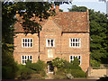
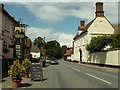
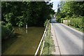
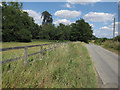
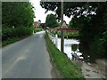
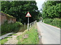
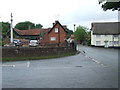
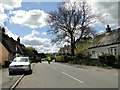
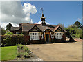
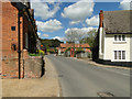
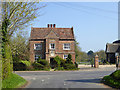
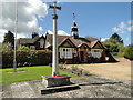
46 photos from this area
Area Information
Key information about the CB9 7LA including its size, population, and administrative classification.
- Area Type
- Postcode
- Area Size
- 45.0 hectares
- Population
- 2581
- Population Density
- 44 people/km²
House Prices in CB9 7LA
50
Properties
£482,458
Average Sold Price
£111,000
Lowest Price
£1,040,000
Highest Price
Showing 50 properties
| Address | Type | Beds | Baths | Last Sale Price | Last Sale Date | |
|---|---|---|---|---|---|---|
| Driftside, The Street, Little Thurlow, CB9 7LA | Semi-detached | 4 | 2 | £565,000 | Oct 2024 | |
| Cuylers, The Street, Little Thurlow, CB9 7LA | house | - | - | £1,040,000 | Jan 2023 | |
| Grange Barn, The Street, Little Thurlow, CB9 7LA | Bungalow | - | - | £480,000 | Aug 2022 | |
| Trellis Cottage, The Street, Great Thurlow, CB9 7LA | Semi-detached | 4 | 2 | £430,000 | Jun 2021 | |
| Mill View, The Street, Little Thurlow, CB9 7LA | house | - | - | £418,500 | May 2020 | |
| The Coach House, The Street, Great Thurlow, CB9 7LA | Detached | 3 | 2 | £427,500 | Jul 2018 | |
| Hallside, The Street, Little Thurlow, CB9 7LA | Detached | 4 | 3 | £685,000 | Apr 2018 | |
| The Grange, The Street, Little Thurlow, CB9 7LA | Detached | - | - | £447,500 | Sep 2015 | |
| The Old Rose And Crown, The Street, Great Thurlow, CB9 7LA | Detached | 6 | 5 | £565,000 | Aug 2015 | |
| Larkspur Cottage, The Street, Little Thurlow, CB9 7LA | Cottage | 3 | - | £385,000 | Aug 2014 |
Page 1 of 5
Energy Efficiency in CB9 7LA
Amenities
Schools
| Rank | School | Type | Entry gender | Ages |
|---|
Explore more schools in this area
Go to Schools tabDemographics
Household Size
Two person
most common
Accommodation Type
Houses
most common
Tenure
70
majority
Ethnic Group
White
most common
Religion
N/A
most common
Household Composition
N/A
most common
Age
47
median
Adults (30-64 years)
most common
Household Deprivation
N/A
with no deprivation
NS-SEC
42
in Lower managerial occupations
Explore more demographic insights in this area
Go to Demographics tabPlanning
Planning Constraints
- Flood RiskPremium
- Ramsar Wetland SitesPremium
- Area of Outstanding Natural BeautyPremium
- Protected Nature ReservePremium
- Protected WoodlandPremium