Area Overview for CB6 1NP
Photos of CB6 1NP


Area Information
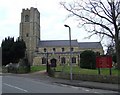
CB6 1NP is a small residential postcode in East Cambridgeshire, encompassing the village of Littleport. Nestled six miles north of Ely, it lies along the River Great Ouse, near Burnt Fen and Mare Fen. The area covers just 2.4 hectares, housing 2,286 residents in a compact, low-density setting. With a population density of 238 people per square kilometre, it retains a quiet, village-like character. Historically, Littleport was a hub for eel fishing and manufacturing, with ties to figures like William Harley, father of the Harley-Davidson founder. Today, it balances heritage with modern amenities. Residents benefit from proximity to Ely’s cultural and commercial centres, while the area’s low crime rate and minimal environmental constraints make it a stable place to live. The postcode includes parts of Littleport’s civil parish, where landmarks like the Adams Heritage Centre and the lowest trig point in Britain add to its distinct charm.
- Area Type
- Postcode
- Area Size
- 2.4 hectares
- Population
- 2286
- Population Density
- 238 people/km²
CB6 1NP is a predominantly owner-occupied area, with 73% of homes owned by residents rather than rented. The accommodation type is primarily houses, which is typical for small rural postcodes. This suggests a market skewed towards family homes and long-term residency, with limited rental properties. The small size of the postcode—just 2.4 hectares—means the housing stock is concentrated, potentially limiting availability for buyers. However, the area’s proximity to Ely and its railway connections may attract those seeking a quieter alternative to larger towns. For buyers, this means competition for existing properties and a need to consider nearby areas for additional options. The high home ownership rate also indicates a stable market with fewer speculative investments, offering security for those seeking a permanent residence.
House Prices in CB6 1NP
Showing 59 properties
| Address | Type | Beds | Baths | Last Sale Price | Last Sale Date | |
|---|---|---|---|---|---|---|
| 48 Hempfield Place, Littleport, CB6 1NP | house | 3 | - | £237,500 | Oct 2024 | |
| 35 Hempfield Place, Littleport, CB6 1NP | house | - | - | £230,000 | Feb 2024 | |
| 33 Hempfield Place, Littleport, CB6 1NP | house | - | - | £260,000 | Jan 2022 | |
| 22 Hempfield Place, Littleport, CB6 1NP | Retail | 3 | 1 | £239,000 | Nov 2021 | |
| 11 Hempfield Place, Littleport, CB6 1NP | house | 3 | 1 | £236,500 | Jun 2021 | |
| 24 Hempfield Place, Littleport, CB6 1NP | Semi-detached | 3 | 1 | £208,000 | Jan 2021 | |
| 32 Hempfield Place, Littleport, CB6 1NP | Semi-detached | 3 | 1 | £215,000 | Sep 2019 | |
| 14 Hempfield Place, Littleport, CB6 1NP | Semi-detached | 3 | 1 | £215,000 | Apr 2019 | |
| 4 Hempfield Place, Littleport, CB6 1NP | Semi-detached | 3 | 1 | £227,500 | Oct 2017 | |
| 29 Hempfield Place, Littleport, CB6 1NP | Semi-detached | 3 | 1 | £196,000 | Feb 2017 |
Energy Efficiency in CB6 1NP
Residents of CB6 1NP have access to a range of amenities within practical reach. Retail options include Co-op Main, Co-op Wisbech, and M&S Littleport BP, providing everyday shopping needs. The area’s proximity to Ely and its railway stations enhances access to larger urban centres for dining, entertainment, and services. While the data does not list parks or leisure facilities explicitly, the village’s historical and cultural sites—such as the Adams Heritage Centre and the lowest trig point in Britain—add to its unique character. The quiet, low-density environment supports a relaxed lifestyle, with opportunities for outdoor activities along the River Great Ouse. The combination of local shops, rail connectivity, and heritage sites creates a convenient yet distinct living experience.
Amenities
Schools
The nearest school to CB6 1NP is Millfield Primary School, which serves the local community with a primary education offering. The school holds an Ofsted rating of “good,” reflecting its quality of teaching and student outcomes. As the only school listed in the data, it is the primary educational institution for children in the area. The absence of secondary schools nearby means families may need to commute to Ely or other towns for higher education. However, the presence of a well-rated primary school is a significant draw for families prioritising early education. The school’s performance suggests a focus on foundational learning, though parents seeking a broader range of educational options may need to look beyond the immediate vicinity.
| Rank | School | Type | Entry gender | Ages |
|---|
Explore more schools in this area
Go to Schools tabDemographics
The population of CB6 1NP has a median age of 47, with the majority of residents aged between 30 and 64. This suggests a mature, established community, likely with strong family ties. Home ownership is high at 73%, indicating a stable housing market and long-term residency. The area is predominantly composed of houses, reflecting a preference for single-family homes over flats or apartments. The predominant ethnic group is White, with no data provided on other demographics. The population density of 238 people per square kilometre implies a close-knit, low-rise residential environment. This profile aligns with a community that values stability, with fewer transient residents and a focus on long-term property investment. The absence of specific data on deprivation or diversity means the area’s social dynamics remain largely defined by its historical and economic context.
Household Size
Accommodation Type
Tenure
Ethnic Group
Religion
Household Composition
Age
Household Deprivation
NS-SEC
Explore more demographic insights in this area
Go to Demographics tabPlanning
Planning Constraints
- Flood RiskPremium
- Ramsar Wetland SitesPremium
- Area of Outstanding Natural BeautyPremium
- Protected Nature ReservePremium
- Protected WoodlandPremium