Area Overview for CB6 1HT
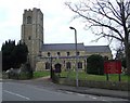
Photos of CB6 1HT


Area Information
Living in CB6 1HT means being part of a small, tightly knit residential cluster in East Cambridgeshire, just six miles north of Ely. The area covers 2.0 hectares, with a population of 2,286 people, resulting in a moderate density of 238 people per square kilometre. This postcode is steeped in history, from its Domesday Book origins to the Littleport Riots of 1816, and is home to notable figures like William Harley, father of the Harley-Davidson founder. Daily life here balances rural tranquillity with practical connectivity, with four railway stations within reach, including Littleport and Ely, and proximity to the A10 road. The area’s compact size means it’s ideal for those seeking a quiet, community-oriented lifestyle, with easy access to nearby towns and natural features like the River Great Ouse. Whether you’re drawn to its historical legacy or its modern amenities, CB6 1HT offers a distinct blend of tradition and convenience.
- Area Type
- Postcode
- Area Size
- 2.0 hectares
- Population
- 2286
- Population Density
- 238 people/km²
The property market in CB6 1HT is characterised by high home ownership (73%) and a predominance of houses over flats or other accommodation types. This suggests a community of long-term residents with a preference for private, family-oriented living spaces. The small area size (2.0 hectares) means the housing stock is limited, likely concentrated within the village itself. Buyers should consider the immediate surroundings for additional options, as the postcode covers a compact residential cluster. The high proportion of owner-occupied homes indicates a stable market with potential for long-term value retention. However, the limited number of properties may mean competition for available homes, particularly for those seeking specific features like proximity to schools or transport links. The area’s charm and historical character could appeal to buyers looking for a traditional, low-maintenance lifestyle.
House Prices in CB6 1HT
Showing 42 properties
| Address | Type | Beds | Baths | Last Sale Price | Last Sale Date | |
|---|---|---|---|---|---|---|
| 41A Millpit Furlong, Littleport, CB6 1HT | Detached | 4 | 3 | £410,000 | Oct 2025 | |
| 17 Millpit Furlong, Littleport, CB6 1HT | house | 2 | 1 | £195,000 | Jun 2022 | |
| 22 Millpit Furlong, Littleport, CB6 1HT | Semi-detached | 3 | 1 | £235,000 | Jun 2022 | |
| 12 Millpit Furlong, Littleport, CB6 1HT | Bungalow | - | - | £300,000 | Dec 2021 | |
| 29 Millpit Furlong, Littleport, CB6 1HT | Bungalow | - | - | £257,500 | Dec 2018 | |
| 51 Millpit Furlong, Littleport, CB6 1HT | Semi-detached | 2 | 2 | £267,000 | Oct 2018 | |
| 51A Millpit Furlong, Littleport, CB6 1HT | Semi-detached | 2 | 2 | £210,000 | Oct 2017 | |
| 16 Millpit Furlong, Littleport, CB6 1HT | Bungalow | 3 | - | £240,000 | May 2017 | |
| 47 Millpit Furlong, Littleport, CB6 1HT | Bungalow | 3 | - | £260,000 | May 2017 | |
| 45 Millpit Furlong, Littleport, CB6 1HT | Bungalow | - | - | £255,000 | Nov 2016 |
Energy Efficiency in CB6 1HT
The lifestyle in CB6 1HT is shaped by its compact size and proximity to local amenities. Within practical reach are five retail outlets, including Co-op Main, Co-op Wisbech, and M&S Littleport BP, offering everyday shopping needs. The area’s railway stations—Littleport, Ely, and Shippea Hill—provide access to broader networks, enhancing convenience for commuters and shoppers. While the data does not list parks or leisure facilities explicitly, the village’s historical character, including landmarks like the Adams Heritage Centre, adds cultural value. The small-scale nature of the area fosters a close-knit community, with local shops and transport links contributing to a self-contained lifestyle. For those who enjoy a mix of rural and urban elements, CB6 1HT offers a balance of practicality and charm, with amenities tailored to daily living without the need for long journeys.
Amenities
Schools
The nearest school to CB6 1HT is Millfield Primary School, a primary school with an Ofsted rating of ‘good’. This rating indicates that the school meets national standards in teaching quality and student outcomes. The presence of a primary school nearby is a significant advantage for families, offering convenience for daily commutes and reducing the need for long-distance travel. However, the data does not mention secondary schools or other educational institutions in the immediate vicinity, so families may need to look further afield for secondary education. The availability of a well-rated primary school enhances the area’s appeal for households with young children, though prospective buyers should investigate secondary school options separately.
| Rank | School | Type | Entry gender | Ages |
|---|
Explore more schools in this area
Go to Schools tabDemographics
The community in CB6 1HT is predominantly middle-aged, with a median age of 47 and the most common age range being adults aged 30–64. This suggests a stable population with strong family ties and a focus on long-term residency. Home ownership is high, at 73%, with houses making up the majority of accommodation types. The predominant ethnic group is White, reflecting a relatively homogeneous demographic. The population density of 238 people per square kilometre indicates a low-rise, spread-out settlement pattern typical of rural or semi-rural areas. This profile aligns with a community that prioritises stability and familiarity, with fewer transient residents. The absence of specific data on deprivation means the area likely benefits from the advantages of lower population density, such as reduced congestion and a slower pace of life.
Household Size
Accommodation Type
Tenure
Ethnic Group
Religion
Household Composition
Age
Household Deprivation
NS-SEC
Explore more demographic insights in this area
Go to Demographics tabPlanning
Planning Constraints
- Flood RiskPremium
- Ramsar Wetland SitesPremium
- Area of Outstanding Natural BeautyPremium
- Protected Nature ReservePremium
- Protected WoodlandPremium