Area Overview for CB6 1HE
Photos of CB6 1HE


Area Information
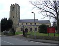
Living in CB6 1HE, a small residential cluster in East Cambridgeshire, offers a quiet, low-density lifestyle. The area spans just 2.0 hectares, housing 2,286 people with a population density of 238 per square kilometre. This compact postcode is part of Littleport, a village with historical roots dating to the Domesday Book and a legacy of manufacturing, including the Hope Brothers tailoring factory and Jim Burns guitar production. The community is predominantly composed of adults aged 30–64, with a median age of 47, reflecting a mature, stable demographic. Daily life here is characterised by proximity to Littleport’s railway stations, the A10 road, and a mix of retail and historical sites. The area’s low population density and focus on single-family homes create a sense of space and privacy, ideal for those seeking a slower pace without sacrificing access to nearby towns like Ely. With 73% home ownership, the area leans towards owner-occupied properties, fostering a sense of permanence.
- Area Type
- Postcode
- Area Size
- 2.0 hectares
- Population
- 2286
- Population Density
- 238 people/km²
The property market in CB6 1HE is characterised by high home ownership (73%) and a focus on houses rather than flats or apartments. This suggests a predominantly owner-occupied area with a suburban feel, where larger properties are more common. Given the postcode’s small size (2.0 hectares) and low population density, the housing stock is likely limited, with few new developments. Buyers should consider the immediate surrounding areas for more options, as the core postcode is a compact residential cluster. The emphasis on houses may appeal to families or those seeking space, though the limited size of CB6 1HE means property choices are constrained. The area’s proximity to Ely and Littleport’s rail links could also make it attractive for commuters or those seeking a base near transport hubs.
House Prices in CB6 1HE
Showing 52 properties
| Address | Type | Beds | Baths | Last Sale Price | Last Sale Date | |
|---|---|---|---|---|---|---|
| 13-15 High Street, Littleport, CB6 1HE | house | - | - | £370,000 | Sep 2025 | |
| 44 High Street, Littleport, CB6 1HE | Bungalow | 5 | 2 | £467,000 | Jan 2025 | |
| 42 High Street, Littleport, CB6 1HE | Terraced | 2 | 1 | £210,000 | Jun 2023 | |
| 46 High Street, Littleport, CB6 1HE | Retail | 3 | - | £532,000 | Mar 2023 | |
| 33 High Street, Littleport, CB6 1HE | Retail | 2 | 1 | £260,000 | Nov 2022 | |
| 23 High Street, Littleport, CB6 1HE | Semi-detached | 5 | 2 | £242,500 | Nov 2022 | |
| 21 High Street, Littleport, CB6 1HE | Terraced | 2 | - | £224,950 | Oct 2022 | |
| 27 High Street, Littleport, CB6 1HE | Semi-detached | 5 | - | £475,000 | Sep 2021 | |
| 30 High Street, Littleport, CB6 1HE | house | - | - | £160,000 | Sep 2021 | |
| 9 High Street, Littleport, CB6 1HE | house | - | - | £230,000 | Jun 2021 |
Energy Efficiency in CB6 1HE
The lifestyle in CB6 1HE is shaped by its proximity to retail and transport hubs. Nearby shops include Co-op Main, Co-op Wisbech, and M&S Littleport BP, offering everyday essentials and convenience. The area’s railway stations provide access to Ely and other towns, facilitating shopping, dining, and leisure activities beyond Littleport. While the postcode itself is small, the surrounding region includes historical sites like the Adams Heritage Centre, a Grade II-listed ironmonger’s shop, and the lowest trig point in Britain near Little Ouse. These features add cultural and geographical interest. The mix of local retail and transport links creates a balance between self-sufficiency and connectivity, ideal for those who enjoy a blend of quiet living and easy access to amenities.
Amenities
Schools
The nearest school to CB6 1HE is Millfield Primary School, which has an Ofsted rating of ‘good’. This primary school serves the local community, offering education for younger children. The absence of secondary schools in the data means families may need to look further afield for secondary education, though the proximity to Ely and nearby towns could provide alternatives. The presence of a well-rated primary school is a significant draw for families, ensuring accessible early education. The school’s ‘good’ rating suggests a reliable standard of teaching and facilities, which is crucial for parents prioritising quality education. However, the lack of data on secondary schools means prospective buyers should investigate nearby options when considering long-term needs.
| Rank | School | Type | Entry gender | Ages |
|---|
Explore more schools in this area
Go to Schools tabDemographics
The community in CB6 1HE is predominantly composed of adults aged 30–64, with a median age of 47. This suggests a mature population, likely with established careers and family ties. Home ownership is high, at 73%, indicating a strong presence of long-term residents. The accommodation type is primarily houses, reflecting a suburban, low-density residential pattern. The predominant ethnic group is White, though no specific data on diversity or deprivation is provided. The population density of 238 people per square kilometre is low, which aligns with the area’s small size and residential focus. This density level implies limited pressure on local services and a quieter, more private living environment. The absence of specific deprivation data means the area’s quality of life is inferred from its safety scores, infrastructure, and amenities.
Household Size
Accommodation Type
Tenure
Ethnic Group
Religion
Household Composition
Age
Household Deprivation
NS-SEC
Explore more demographic insights in this area
Go to Demographics tabPlanning
Planning Constraints
- Flood RiskPremium
- Ramsar Wetland SitesPremium
- Area of Outstanding Natural BeautyPremium
- Protected Nature ReservePremium
- Protected WoodlandPremium