Area Overview for CB6 1FT
Photos of CB6 1FT


Area Information
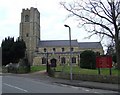
CB6 1FT is a small residential cluster in East Cambridgeshire, encompassing the village of Littleport and surrounding areas. With a population of 2,286 spread across 997 m², it is a compact community with a population density of 238 people per km². The area’s charm lies in its historical roots, including its medieval origins and connections to figures like William Harley, founder of the Harley-Davidson motorcycle company. Littleport sits on the River Great Ouse, near Burnt Fen and Mare Fen, and is six miles north of Ely. The village retains a quiet, rural character, with amenities like the Adams Heritage Centre, a Grade II-listed Victorian shop, and a notable trig point marking the lowest point in Britain. Residents benefit from proximity to Ely’s cultural and commercial hubs, while the area’s low crime rate and flood risk make it a stable place to live. Daily life here is shaped by a mix of local traditions, historic sites, and practical connectivity via nearby rail links and the A10 road.
- Area Type
- Postcode
- Area Size
- 997 m²
- Population
- 2286
- Population Density
- 238 people/km²
The property market in CB6 1FT is characterised by a high rate of home ownership (73%) and a predominance of houses. This suggests a community where long-term residency and family-oriented living are the norm, with limited rental activity. The focus on houses rather than flats or apartments reflects a preference for larger, private properties, which may appeal to buyers seeking space and stability. As a small area, CB6 1FT’s housing stock is likely to be limited in volume, meaning properties may be in high demand. For buyers, this could mean competitive pricing and the need to consider nearby areas for alternative options. The absence of planning constraints, such as protected woodlands or AONB designations, may also make the area more attractive for those seeking development flexibility.
House Prices in CB6 1FT
Showing 6 properties
| Address | Type | Beds | Baths | Last Sale Price | Last Sale Date | |
|---|---|---|---|---|---|---|
| 6, Regal Terrace, Hempfield Road, Littleport, CB6 1FT | Terraced | 3 | 2 | £200,000 | May 2018 | |
| 4, Regal Terrace, Hempfield Road, Littleport, CB6 1FT | Terraced | 2 | 1 | - | - | |
| 2, Regal Terrace, Hempfield Road, Littleport, CB6 1FT | Terraced | 2 | 1 | - | - | |
| 1, Regal Terrace, Hempfield Road, Littleport, CB6 1FT | house | - | - | - | - | |
| 5, Regal Terrace, Hempfield Road, Littleport, CB6 1FT | Terraced | 2 | 1 | - | - | |
| 3, Regal Terrace, Hempfield Road, Littleport, CB6 1FT | Flat | - | - | - | - |
Energy Efficiency in CB6 1FT
Residents of CB6 1FT have access to a range of nearby amenities, including five retail outlets such as Co-op Main, Co-op Wisbech, and M&S Littleport BP. These provide essential shopping and services within practical reach. The area’s rail links, including Littleport and Ely stations, offer convenient travel options for commuting or leisure. While specific details on dining or leisure facilities are not provided, the proximity to the River Great Ouse and historic sites like the Adams Heritage Centre suggests opportunities for outdoor activities and cultural engagement. The village’s small size fosters a close-knit community, with amenities designed to meet daily needs without requiring long journeys. The combination of retail access, rail connectivity, and historical attractions contributes to a lifestyle that balances practicality with local character.
Amenities
Schools
The nearest school to CB6 1FT is Millfield Primary School, which serves the local community with primary education. The school holds a ‘good’ Ofsted rating, indicating a satisfactory standard of teaching and facilities. As the only named school in the area, it is the primary educational option for young families in the vicinity. The presence of a primary school with a good rating is a key consideration for parents, though no secondary schools are listed in the data. This suggests that families may need to look beyond the immediate area for secondary education, potentially affecting commuting times or school choice. The school’s rating reflects a baseline level of quality, but further details on its curriculum or extracurricular offerings are not available.
| Rank | School | Type | Entry gender | Ages |
|---|
Explore more schools in this area
Go to Schools tabDemographics
The population of CB6 1FT has a median age of 47, with the majority of residents aged 30–64 years. This suggests a mature, established community with a strong presence of middle-aged adults. Home ownership is high at 73%, indicating a stable, long-term resident base. The area is predominantly composed of houses, reflecting a preference for single-family living over flats or apartments. The predominant ethnic group is White, though specific data on diversity is not provided. The age profile and home ownership rate imply a community focused on family stability and long-term residency. With no data on deprivation levels, it is reasonable to infer that the area’s low crime risk and absence of environmental constraints contribute to a quality of life that supports homeownership and family-oriented living.
Household Size
Accommodation Type
Tenure
Ethnic Group
Religion
Household Composition
Age
Household Deprivation
NS-SEC
Explore more demographic insights in this area
Go to Demographics tabPlanning
Planning Constraints
- Flood RiskPremium
- Ramsar Wetland SitesPremium
- Area of Outstanding Natural BeautyPremium
- Protected Nature ReservePremium
- Protected WoodlandPremium