Area Overview for Eaton Bray
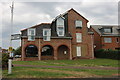
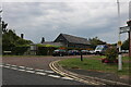
Photos of Eaton Bray

Area Information
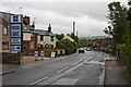
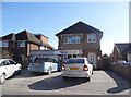
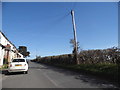
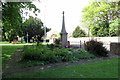
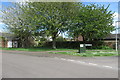
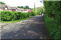
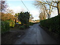
Living in Eaton Bray means residing in a civil parish and village situated in Central Bedfordshire, England. This district covers 9.4 square kilometres, placing it between the towns of Dunstable and Leighton Buzzard on the border of Bedfordshire and Buckinghamshire. The village sits approximately three and three-quarter miles west by south of Dunstable and lies near Stanbridgeford railway station. Historical records show the area appeared as Eitone in the Domesday Book of 1086 before evolving through feudal baronies and manor rights. Locals often interact with governance structures managed by Eaton Bray Parish Council and Central Bedfordshire Council, a setup established in 2009. The physical landscape includes approximately 2,650 acres of land, which defines the rural character of the parish. Key landmarks such as Eaton Bray Castle Manor House at Park Farm offer historical context, while feats like the scheduled moated site provide visible connections to the 13th to 16th centuries. St Mary's Church stands as another significant local feature with notable medieval ironwork on its door. Residents here navigate a landscape where place names like Castle Field preserve remnants of past structures. Daily life unfolds against the backdrop of this deep historical setting, offering a distinct environment for those seeking a village life within reachable distance of larger towns.
- Area Type
- Parish
- Area Size
- 9.4 km²
- Population
- Not available
- Population Density
- Not available
Demographics
The community in Eaton Bray is predominantly shaped by an older demographic profile. Data indicates a median age of 70 for the total population, suggesting the area attracts or retains older residents. The most common age range falls under the category of Total Age without further specific breakdowns provided in the dataset. With 78% home ownership rates, the majority of households in Eaton Bray own their properties outright or with a mortgage. This high level of ownership typically reflects a long-term settlement pattern common in rural villages. Accommodation type statistics are available only as a total category without detailed splits into detached, semi-detached, or terraced housing. The house composition figures are similarly recorded for the total population without specific single-person or family unit distinctions. The predominant ethnic group data exists as a total figure without further ethnic categorisation. Religious affiliation is also recorded as a single total entry. This demographic makeup creates a neighbourhood where established ownership values the peace of a rural setting. Buyers looking at Eaton Bray will find a community where stability and established roots define the social fabric.
Household Size
Accommodation Type
Tenure
Ethnic Group
Religion
Household Composition
Age
Household Deprivation
NS-SEC
Explore more demographic insights in this area
Go to Demographics tabPlanning
Planning Constraints
- Flood RiskPremium
- Ramsar Wetland SitesPremium
- Area of Outstanding Natural BeautyPremium
- Protected Nature ReservePremium
- Protected WoodlandPremium