Area Overview for Central Bedfordshire
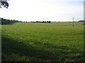
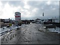
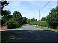
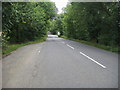
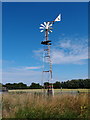
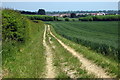
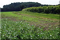
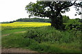
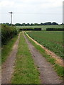
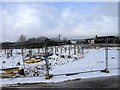
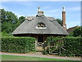
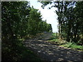
Photos of Central Bedfordshire
Area Information
Central Bedfordshire is a unitary authority local government district situated in the East of England region. This large district covers an area of 716.0 km² and includes towns like Leighton Buzzard, Dunstable, Houghton Regis, Ampthill, Sandy, and Cranfield. The administrative centre lies at Chicksands. You will find it bounded by Bedford to the north, Cambridgeshire to the northeast, Hertfordshire and Luton to the southeast, Buckinghamshire to the southwest, and Milton Keynes to the northwest. Established on 1 April 2009 through structural reform, the area replaced the former Mid Bedfordshire and South Bedfordshire districts. Living in Central Bedfordshire means navigating a region defined by its establishment date in 2009 and its position within the ceremonial county of Bedfordshire. The coordinates place it approximately at 52.0067°N, 0.4360°W. Daily life here is shaped by its size and location in the southeastern Midlands. You can expect communities to be spread across this significant land mass. While no specific population total appears in the current data, the area's physical boundaries and history define the residential experience. Prospective buyers often consider the distance to neighbouring major towns when evaluating life in this district. The region offers a mix of rural and urban environments based on the specific town you choose to call home. Understanding the layout of Central Bedfordshire helps you decide if this location fits your needs. The community in Central Bedfordshire is defined by an older population profile. Data indicates a median age of 70 years for residents. This suggests the area holds a significant number of older adults compared to the national average. Home ownership levels stand at 73%, indicating that a majority of households own their property outright or with a mortgage. This high ownership rate points to a settled community where long-term residents form the core of the neighbourhood. The household composition data is listed as total, requiring you to look at specific local reports for single-penetration or family breakdowns beyond aggregate figures. Accommodation type data is also recorded as total, meaning specific counts of detached villas or terraced houses are not detailed here. However, the high ownership percentage implies a stock rich in owner-occupied homes rather than private rentals. Ethnic diversity and religious demographics are listed as total in the available records, so you cannot make specific claims about the breakdown of these groups without external sources. The area does not explicitly signal high deprivation in the provided metrics, allowing you to focus on the stability of the homeownership sector. When evaluating homes in Central Bedfordshire, the age profile suggests services may cater heavily to mature residents. This demographic reality influences the local park, healthcare, and amenity landscape you will encounter. The property market in Central Bedfordshire reflects a predominantly owner-occupied landscape. With 73% of households owning their homes, the area leans heavily towards ownership rather than renting. This statistic shapes the inventory of homes available for purchase within districts like Leighton Buzzard or Dunstable. If you are looking to buy, expect a market where existing owners often list their properties rather than landlords seeking tenants. The accommodation type data is categorised as total, which prevents a precise breakdown of semi-detached versus terraced stock in the current overview. However, the high ownership figure suggests a stable market where people stay put for long periods. Buying a home in Central Bedfordshire often means accepting the characteristics of a settled community with fewer transient tenancies. This environment can offer more stable neighbourhood values and established routines. You may find competition lower than in cities where rental demand drives prices. Whether you seek a flat or a house, the 73% ownership rate indicates that seller demand will reflect owner priorities. The lack of specific private rental data means the market is not heavily skewed towards short-term letting. For buyers, this creates an environment focused on long-term residency. The administrative centre at Chicksands likely hosts some of these properties, alongside the listed towns. Understanding this ownership dominance helps you gauge the pace of the market when buying Central Bedfordshire real estate. Connectivity for residents of Central Bedfordshire varies significantly between fixed broadband and mobile networks. Mobile coverage scores 84 out of 100, which rates as excellent. This strong performance ensures reliable phone and data services across the 716.0 km² district. You can expect consistent mobile signal quality in towns like Sandy or Cranfield. In contrast, fixed broadband quality scores 32 out of 100. This score indicates poor or fair broadband performance compared to national standards. If you rely on the internet for working from home, this limitation requires careful planning. A score of 32/100 suggests significant constraints for heavy downloaders or video callers in your home. You may need to invest in additional hardware or fibre upgrades to meet professional needs. Living in Central Bedfordshire therefore involves managing a dual reality of strong mobile connectivity but weaker fixed line speeds. Daily internet use for streaming, gaming, or teleworking could be challenging without specific interventions. The discrepancy between mobile and fixed scores is notable for remote workers. While you can stay connected via phone easily, home-based business activities might suffer from speed issues. When viewing homes in Central Bedfordshire, always check the provider's local footprint before signing. Do not assume the excellent mobile score translates to a fast home connection. Your ability to work from home depends entirely on that fixed line performance. Pair this with the area's size, and access to high-speed internet becomes a critical factor in choosing your specific postcode. Safety and environmental factors in Central Bedfordshire present a mixed picture for residents. Crime risk assessment shows a pass level with a score of 73 out of 100. This indicates low crime risk and below-average crime rates compared to other areas. Residents can generally expect a safer neighbourhood environment. However, flood risk presents a warning level with a score of 11.91. This medium flood risk coverage means you must check individual property history carefully. Water management could be a concern during heavy weather events in Central Bedfordshire. Environmental constraints also factor into planning and buying decisions. The district contains areas of outstanding natural beauty with a warning score of 8.83. This AONB designation affects development potential and could influence local conservation rules. Protected woodland covers part of the area, scoring 2.3 for planning constraints. These areas limit where new construction might occur. Conversely, the district passes on Ramsar wetland sites and protected nature reserve assessments, both scoring 0. You do not face those specific ecological restrictions. When buying a home, the flood risk is the primary environmental concern to address. The low crime rate offers reassurance for families moving to towns like Leighton Buzzard or ampthill. Balancing the safe crime statistics against potential flood zones is essential. Always verify if your chosen plot falls within the medium risk coverage before committing to a purchase. What is the age profile of people living in Central Bedfordshire?The median age of residents is 70 years, making Central Bedfordshire one of the oldest districts in the UK. Homeownership stands at 73%, suggesting a stable community of older owners. This high average age means local amenities tend to cater to mature residents rather than a youthful demographic. When buying, look for homes established for long-term living. Is the broadband connection in Central Bedfordshire reliable for working from home?Fixed broadband performance scores 32 out of 100, which indicates poor to fair quality for home users. While mobile coverage is excellent at 84, the fixed line may struggle with heavy usage. Residents working remotely should consider upgrading connection infrastructure or checking provider reliability in their specific town before moving. Are there safety concerns regarding crime and flooding in Central Bedfordshire?Crime risk is low with a safety score of 73, placing Central Bedfordshire below average for offences. However, flood risk is a genuine concern, rated as a warning level due to medium flood risk coverage. You must inspect individual properties for flood history. The area also contains protected woodlands and areas of outstanding natural beauty, which influence local planning constraints.
- Area Type
- District/Borough
- Area Size
- 716.0 km²
- Population
- Not available
- Population Density
- Not available
Demographics
The community in Central Bedfordshire is defined by an older population profile. Data indicates a median age of 70 years for residents. This suggests the area holds a significant number of older adults compared to the national average. Home ownership levels stand at 73%, indicating that a majority of households own their property outright or with a mortgage. This high ownership rate points to a settled community where long-term residents form the core of the neighbourhood. The household composition data is listed as total, requiring you to look at specific local reports for single-penetration or family breakdowns beyond aggregate figures. Accommodation type data is also recorded as total, meaning specific counts of detached villas or terraced houses are not detailed here. However, the high ownership percentage implies a stock rich in owner-occupied homes rather than private rentals. Ethnic diversity and religious demographics are listed as total in the available records, so you cannot make specific claims about the breakdown of these groups without external sources. The area does not explicitly signal high deprivation in the provided metrics, allowing you to focus on the stability of the homeownership sector. When evaluating homes in Central Bedfordshire, the age profile suggests services may cater heavily to mature residents. This demographic reality influences the local park, healthcare, and amenity landscape you will encounter. The property market in Central Bedfordshire reflects a predominantly owner-occupied landscape. With 73% of households owning their homes, the area leans heavily towards ownership rather than renting. This statistic shapes the inventory of homes available for purchase within districts like Leighton Buzzard or Dunstable. If you are looking to buy, expect a market where existing owners often list their properties rather than landlords seeking tenants. The accommodation type data is categorised as total, which prevents a precise breakdown of semi-detached versus terraced stock in the current overview. However, the high ownership figure suggests a stable market where people stay put for long periods. Buying a home in Central Bedfordshire often means accepting the characteristics of a settled community with fewer transient tenancies. This environment can offer more stable neighbourhood values and established routines. You may find competition lower than in cities where rental demand drives prices. Whether you seek a flat or a house, the 73% ownership rate indicates that seller demand will reflect owner priorities. The lack of specific private rental data means the market is not heavily skewed towards short-term letting. For buyers, this creates an environment focused on long-term residency. The administrative centre at Chicksands likely hosts some of these properties, alongside the listed towns. Understanding this ownership dominance helps you gauge the pace of the market when buying Central Bedfordshire real estate. Connectivity for residents of Central Bedfordshire varies significantly between fixed broadband and mobile networks. Mobile coverage scores 84 out of 100, which rates as excellent. This strong performance ensures reliable phone and data services across the 716.0 km² district. You can expect consistent mobile signal quality in towns like Sandy or Cranfield. In contrast, fixed broadband quality scores 32 out of 100. This score indicates poor or fair broadband performance compared to national standards. If you rely on the internet for working from home, this limitation requires careful planning. A score of 32/100 suggests significant constraints for heavy downloaders or video callers in your home. You may need to invest in additional hardware or fibre upgrades to meet professional needs. Living in Central Bedfordshire therefore involves managing a dual reality of strong mobile connectivity but weaker fixed line speeds. Daily internet use for streaming, gaming, or teleworking could be challenging without specific interventions. The discrepancy between mobile and fixed scores is notable for remote workers. While you can stay connected via phone easily, home-based business activities might suffer from speed issues. When viewing homes in Central Bedfordshire, always check the provider's local footprint before signing. Do not assume the excellent mobile score translates to a fast home connection. Your ability to work from home depends entirely on that fixed line performance. Pair this with the area's size, and access to high-speed internet becomes a critical factor in choosing your specific postcode. Safety and environmental factors in Central Bedfordshire present a mixed picture for residents. Crime risk assessment shows a pass level with a score of 73 out of 100. This indicates low crime risk and below-average crime rates compared to other areas. Residents can generally expect a safer neighbourhood environment. However, flood risk presents a warning level with a score of 11.91. This medium flood risk coverage means you must check individual property history carefully. Water management could be a concern during heavy weather events in Central Bedfordshire. Environmental constraints also factor into planning and buying decisions. The district contains areas of outstanding natural beauty with a warning score of 8.83. This AONB designation affects development potential and could influence local conservation rules. Protected woodland covers part of the area, scoring 2.3 for planning constraints. These areas limit where new construction might occur. Conversely, the district passes on Ramsar wetland sites and protected nature reserve assessments, both scoring 0. You do not face those specific ecological restrictions. When buying a home, the flood risk is the primary environmental concern to address. The low crime rate offers reassurance for families moving to towns like Leighton Buzzard or ampthill. Balancing the safe crime statistics against potential flood zones is essential. Always verify if your chosen plot falls within the medium risk coverage before committing to a purchase. What is the age profile of people living in Central Bedfordshire?The median age of residents is 70 years, making Central Bedfordshire one of the oldest districts in the UK. Homeownership stands at 73%, suggesting a stable community of older owners. This high average age means local amenities tend to cater to mature residents rather than a youthful demographic. When buying, look for homes established for long-term living. Is the broadband connection in Central Bedfordshire reliable for working from home?Fixed broadband performance scores 32 out of 100, which indicates poor to fair quality for home users. While mobile coverage is excellent at 84, the fixed line may struggle with heavy usage. Residents working remotely should consider upgrading connection infrastructure or checking provider reliability in their specific town before moving. Are there safety concerns regarding crime and flooding in Central Bedfordshire?Crime risk is low with a safety score of 73, placing Central Bedfordshire below average for offences. However, flood risk is a genuine concern, rated as a warning level due to medium flood risk coverage. You must inspect individual properties for flood history. The area also contains protected woodlands and areas of outstanding natural beauty, which influence local planning constraints.
Household Size
Accommodation Type
Tenure
Ethnic Group
Religion
Household Composition
Age
Household Deprivation
NS-SEC
Explore more demographic insights in this area
Go to Demographics tabPlanning
Planning Constraints
- Flood RiskPremium
- Ramsar Wetland SitesPremium
- Area of Outstanding Natural BeautyPremium
- Protected Nature ReservePremium
- Protected WoodlandPremium