Area Overview for Huntingdonshire District
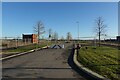
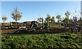
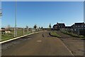
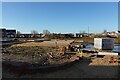
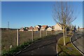
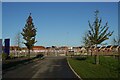
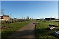
Photos of Huntingdonshire District

Area Information
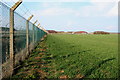
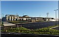
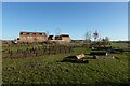
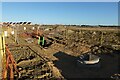
Living in Huntingdonshire District offers access to a landscape defined by its distinct division between low limestone uplands in the west and the reclaimed Fens in the east. This local government district covers an area of 912.9 km² and centres its administration in Huntingdon, a town situated on the north bank of the River Ouse. The land historically supported significant medieval abbeys and Roman settlements at Godmanchester and Chesterton, proving valuable as depth for your understanding of the region's character. Today, the district spans approximately 350 to 354 square miles and remains primarily rural and agricultural, though light industries have expanded in key towns such as St Ives, St Neots, Ramsey, and Godmanchester. The administrative centre in Huntingdon has served as a focal point for the region since the district's formation on 1 April 1974 under the Local Government Act 1972. Merging eight former districts, this local authority now manages the daily needs of a population reaching around 184,052 as recorded in recent data. Your experience living in this area will likely involve navigating countryside paths and industrial zones within a relatively compact geographical footprint. The geography descends from the west towards the east, creating a diverse environment for homes in Huntingdonshire District. Whether you choose a property near the historic stone bridges of St Neots or the agricultural fields, the area's history of drainage and settlement shapes the modern neighbourhoods you will inhabit.
- Area Type
- District/Borough
- Area Size
- 912.9 km²
- Population
- Not available
- Population Density
- Not available
Demographics
The community within Huntingdonshire District presents a distinct demographic profile driven largely by an older population. Data indicates a median age of 70 years, with the age range data reflecting a "Total" distribution across all ages, yet the high median suggests a significant proportion of mature residents. Consequently, the daily rhythm of life often centres around the needs and lifestyles of seniors rather than young families or workers. With 70% of the population owning their homes, this area exemplifies a high rate of home ownership compared to many other regions. This figure confirms that the vast majority of households possess equity and long-term stability within their residences. When evaluating quality of life and community dynamics, you should consider how this age profile influences local services and social infrastructure. The high home ownership rate of 70% implies a stable residential base where residents are less likely to move frequently. While specific data on ethnicity and religion are not detailed in current records, the dominant household composition reflects these broader societal trends. The area feels settled, with most accommodation types likely catering to established rather than transient populations. For someone considering homes in Huntingdonshire District, it is wise to expect a quiet, mature atmosphere rather than a scene filled with young professionals or students seeking urban amenities.
Household Size
Accommodation Type
Tenure
Ethnic Group
Religion
Household Composition
Age
Household Deprivation
NS-SEC
Explore more demographic insights in this area
Go to Demographics tabPlanning
Planning Constraints
- Flood RiskPremium
- Ramsar Wetland SitesPremium
- Area of Outstanding Natural BeautyPremium
- Protected Nature ReservePremium
- Protected WoodlandPremium
- Crime RiskPremium