Area Overview for Fenland District
Photos of Fenland District


Area Information
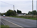
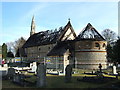
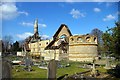
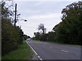
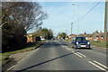
Living in Fenland District offers a distinct experience defined by its vast open spaces and rural character. This unitary authority district covers 547.5 km², making it one of the larger local areas in the country. You will find yourself in a landscape that prioritises wide horizons over high-density urban living. The sheer size of the area means daily life revolves around accessing key towns rather than relying on local high streets for everything. It is an environment where quiet stretches of countryside dominate the view from your windows. This setting suits residents who value space and separation from busy city centres. The district functions as a self-contained community where distance plays a significant role in how you navigate your routine. While modern amenities are accessible, the scale of Fenland District ensures that a journey to the next major town or shopping hub involves some travel time. This layout has shaped a lifestyle that balances peaceful rural isolation with practical connectivity to regional centres. You are trading the convenience of walking to shops for the benefit of expansive views and a slower pace of life. The area attracts those seeking stability and a connection to nature without the constraints of strict development. Your home here sits within a district designating itself as a borough, indicating a focus on local governance and community planning. The character of Fenland District remains consistent across its boundaries, offering a unified feel regardless of which corner you call home. This is a place where you live, not just pass through.
- Area Type
- District/Borough
- Area Size
- 547.5 km²
- Population
- Not available
- Population Density
- Not available
Demographics
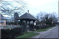
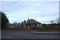
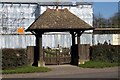
The community fabric of Fenland District is heavily weighted towards an older demographic. With a median age of 70, this area serves primarily as a retirement destination or a final stop for those moving to a quieter life. You will find that the population skews significantly older than the national average. This age profile influences local services, amenities, and the general pace of social interaction within your neighbourhood. Most residents fall into the 'Age: Total' category, reflecting a mature population structure across the district. Home ownership stands at 67 per cent, which is a substantial majority of all households in this unitary authority. This figure indicates that buying into Fenland District represents a commitment to long-term residency rather than temporary renting. The high rate of ownership suggests stability in the community and a population invested in their local surroundings. You are far more likely to meet neighbours who have lived here for decades rather than tenants on short-term contracts. Household composition and accommodation types reflect this settled nature, with single levels and detached homes predominating the stock. The area does not show significant ethnic diversity metrics or religious affiliations beyond general totals, pointing to a relatively homogeneous community. If you are looking for the thrill of a young, renter-heavy market, Fenland District is not that environment. Instead, you get a stable, older cohort that values peace and private space over youthful vibrancy.
Household Size
Accommodation Type
Tenure
Ethnic Group
Religion
Household Composition
Age
Household Deprivation
NS-SEC
Explore more demographic insights in this area
Go to Demographics tabPlanning
Planning Constraints
- Ramsar Wetland SitesPremium
- Area of Outstanding Natural BeautyPremium
- Protected Nature ReservePremium
- Protected WoodlandPremium
- Crime RiskPremium