Area Overview for NN3 8YD
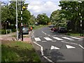
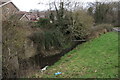
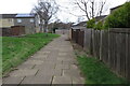
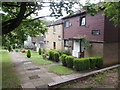
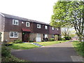
Photos of NN3 8YD


Area Information
Living in NN3 8YD means inhabiting a compact, residential cluster in England with a population of 1700 spread over 2329 square metres. This small area is densely populated, with 729,934 people per square kilometre, reflecting a tightly knit community. The area is characterised by its mix of older and newer housing stock, catering to a predominantly middle-aged demographic. Residents benefit from proximity to essential services, including a primary school with a good Ofsted rating and transport links to Northampton. While the area is small, it offers a balance of local amenities and access to nearby urban centres. The high broadband score of 100 ensures seamless digital connectivity, supporting both work and leisure. However, the medium crime risk score of 41 means residents should take standard security precautions. NN3 8YD is ideal for those seeking a quiet, community-oriented environment with practical access to retail, transport, and education.
- Area Type
- Postcode
- Area Size
- 2329 m²
- Population
- 1700
- Population Density
- 2455 people/km²
The property market in NN3 8YD is defined by a 43% home ownership rate, with houses forming the predominant accommodation type. This suggests a mix of owner-occupied homes and rental properties, though the exact proportion of rentals is not specified. The small area size and high population density imply limited land availability, which could restrict new developments. For buyers, the focus is likely on existing houses, which may range from older family homes to more modern builds. Given the area’s compact nature, property values may reflect local demand rather than broader regional trends. The presence of nearby retail and transport hubs, such as Northampton Railway Station, adds to the area’s appeal for those prioritising convenience. However, the small size of NN3 8YD means the market is niche, requiring careful consideration of local factors like school quality and crime risk.
House Prices in NN3 8YD
Showing 10 properties
| Address | Type | Beds | Baths | Last Sale Price | Last Sale Date | |
|---|---|---|---|---|---|---|
| 5 Pindar Rise, Northampton, NN3 8YD | Terraced | 4 | 1 | £220,000 | Jul 2024 | |
| 10 Pindar Rise, Northampton, NN3 8YD | house | - | - | £200,000 | Feb 2021 | |
| 2 Pindar Rise, Northampton, NN3 8YD | Terraced | 3 | - | £167,500 | Sep 2019 | |
| 4 Pindar Rise, Northampton, NN3 8YD | Terraced | 4 | - | £157,000 | Sep 2018 | |
| 8 Pindar Rise, Northampton, NN3 8YD | Terraced | 3 | - | £128,500 | Jun 2016 | |
| 7 Pindar Rise, Northampton, NN3 8YD | house | - | - | £80,000 | Jan 2012 | |
| 3 Pindar Rise, Northampton, NN3 8YD | Terraced | - | - | £65,000 | Nov 2002 | |
| 9 Pindar Rise, Northampton, NN3 8YD | Terraced | - | - | £24,380 | Nov 2001 | |
| 6 Pindar Rise, Northampton, NN3 8YD | house | - | - | - | - | |
| 1 Pindar Rise, Northampton, NN3 8YD | Bungalow | - | - | - | - |
Energy Efficiency in NN3 8YD
You have access to a range of amenities within NN3 8YD and its immediate surroundings. Retail options include Aldi Overstone, Co-op Bushland, and Tesco Northampton, ensuring everyday shopping needs are met. Transport links are convenient, with two bus interchanges and Northampton Railway Station providing connections to urban centres. While the area itself is small, its proximity to Northampton offers additional leisure and dining opportunities. The presence of Thorplands Primary School adds to the community’s appeal for families. The compact nature of NN3 8YD means amenities are closely clustered, reducing travel time for essentials. However, the lack of local parks or recreational spaces within the postcode suggests that residents may need to venture to nearby areas for outdoor activities. Overall, the lifestyle here balances practicality with access to nearby urban conveniences.
Amenities
Schools
The nearest school to NN3 8YD is Thorplands Primary School, which has an Ofsted rating of 'good'. This primary school serves the local community, offering education for younger children. The absence of secondary schools in the immediate vicinity means families may need to consider nearby towns for secondary education. However, the 'good' rating at Thorplands Primary indicates a reliable foundation for early learning. For parents, the proximity of a well-rated primary school is a significant advantage, reducing the need for long commutes. The single school listed suggests a focus on primary education, which aligns with the area’s demographic of adults aged 30–64, many of whom may have children in primary school. This makes NN3 8YD appealing to families seeking a stable, education-focused environment.
| Rank | School | Type | Entry gender | Ages |
|---|
Explore more schools in this area
Go to Schools tabDemographics
The community in NN3 8YD is predominantly composed of adults aged 30–64, with a median age of 47. This suggests a mature, stable population, likely with established careers and family ties. Home ownership stands at 43%, indicating a mix of owner-occupied properties and rental units. The accommodation type is primarily houses, reflecting a suburban or semi-rural character. The predominant ethnic group is White, though no specific diversity statistics are provided. The age profile and home ownership rate suggest a community focused on long-term residency rather than transient populations. With 1700 residents in a small area, social networks may be close-knit, though the density could impact privacy. The absence of specific deprivation data means the quality of life remains to be fully contextualised, but the demographic stability points to a consistent, low-turnover environment.
Household Size
Accommodation Type
Tenure
Ethnic Group
Religion
Household Composition
Age
Household Deprivation
NS-SEC
Explore more demographic insights in this area
Go to Demographics tabPlanning
Planning Constraints
- Flood RiskPremium
- Ramsar Wetland SitesPremium
- Area of Outstanding Natural BeautyPremium
- Protected Nature ReservePremium
- Protected WoodlandPremium