Area Overview for NN3 8YB
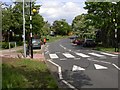
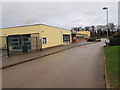
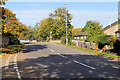
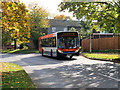
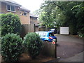
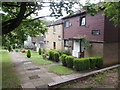
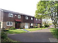
Photos of NN3 8YB

Area Information
NN3 8YB is a small, tightly knit residential cluster in England, covering 4,717 square metres and home to 1,700 residents. Its compact size means the area feels intimate, with a high population density of 360,377 people per square kilometre. This postcode is typical of suburban or semi-rural settings, where housing is closely packed but not densely urban. Daily life here is shaped by proximity to essential services and transport links. The area’s appeal lies in its balance of accessibility and quietude, with residents able to reach nearby towns and amenities without long commutes. While it lacks the vibrancy of a major city, it offers a stable, low-maintenance lifestyle. The presence of a primary school and basic retail options nearby suggests a community focused on family needs. However, the high population density may mean limited space for expansion or new developments, which could influence property availability and prices. For those prioritising convenience over sprawling landscapes, NN3 8YB provides a functional, if modest, living environment.
- Area Type
- Postcode
- Area Size
- 4717 m²
- Population
- 1700
- Population Density
- 2455 people/km²
The property market in NN3 8YB is characterised by a 43% home ownership rate, indicating that nearly half of the housing stock is rented. This suggests a rental market that may cater to younger professionals, students, or those seeking temporary accommodation. The predominant accommodation type is houses, which are likely to be older, smaller properties given the area’s compact size. With only 1,700 residents, the housing stock is limited, and the small area size may mean properties are closely spaced. Buyers should consider that the market is unlikely to have a wide range of options, with homes potentially being older or requiring renovation. The high population density could also mean that land for new developments is scarce, limiting future growth. For those seeking a house in this area, the focus should be on existing properties rather than new builds, with attention to location within the cluster for proximity to amenities.
House Prices in NN3 8YB
Showing 8 properties
| Address | Type | Beds | Baths | Last Sale Price | Last Sale Date | |
|---|---|---|---|---|---|---|
| 7 Sulby Road, Northampton, NN3 8YB | Terraced | 2 | 1 | £195,000 | Dec 2025 | |
| 4 Sulby Road, Northampton, NN3 8YB | house | - | - | £84,500 | Sep 2012 | |
| 8 Sulby Road, Northampton, NN3 8YB | Terraced | 4 | 1 | £94,000 | Jul 2004 | |
| 1 Sulby Road, Northampton, NN3 8YB | house | - | - | £95,000 | May 2004 | |
| 5 Sulby Road, Northampton, NN3 8YB | house | - | - | £37,995 | May 2001 | |
| 6 Sulby Road, Northampton, NN3 8YB | Terraced | 3 | 1 | - | - | |
| 3 Sulby Road, Northampton, NN3 8YB | house | - | - | - | - | |
| 2 Sulby Road, Northampton, NN3 8YB | Bungalow | - | - | - | - |
Energy Efficiency in NN3 8YB
The lifestyle in NN3 8YB is shaped by its proximity to basic amenities. Retail options include Aldi Overstone, Co-op Bushland, and Tesco Spinny, providing essential shopping for groceries and household items. These stores are likely to serve the immediate community, reducing the need for long trips to larger towns. Public transport hubs like the University Bus Interchange and Northampton Bus Interchange connect residents to broader networks, while Northampton Railway Station offers rail access for longer journeys. The absence of named parks or leisure facilities in the data suggests that recreational options may be limited to nearby green spaces or community areas. However, the presence of a primary school and retail outlets indicates a focus on practical daily needs over luxury amenities. For residents, the area offers convenience and accessibility, though those prioritising extensive leisure or natural environments may need to look further afield.
Amenities
Schools
The nearest school to NN3 8YB is Thorplands Primary School, which serves the local community with a primary education offering. The school holds a ‘good’ Ofsted rating, indicating it meets national standards for teaching quality and student outcomes. As the only named school in the area, it is the primary educational resource for families in NN3 8YB. The absence of secondary schools nearby means students may need to travel to adjacent areas for further education. For parents, this necessitates planning for transport or relocation to a secondary school catchment zone. The presence of a single primary school with a positive rating suggests a focus on early education, but the lack of diversity in school types may limit choices for older children. Families should consider the logistical challenges of accessing secondary education when evaluating the area.
| Rank | School | Type | Entry gender | Ages |
|---|
Explore more schools in this area
Go to Schools tabDemographics
The median age in NN3 8YB is 47, with the majority of residents falling into the 30–64 age range. This indicates a mature, established community, likely with a significant proportion of working-age adults and older households. Home ownership stands at 43%, suggesting a mix of owner-occupied and rental properties. The predominant accommodation type is houses, which may reflect a preference for detached or semi-detached homes in a residential cluster. The predominant ethnic group is White, though no data is provided on other ethnicities or diversity metrics. The population density, at 360,377 per square kilometre, is exceptionally high, which may impact living conditions, such as noise levels or green space availability. This density also implies a tightly woven social fabric, where neighbours are likely to be familiar with one another. However, it may limit opportunities for new residents to integrate into the community without existing local connections.
Household Size
Accommodation Type
Tenure
Ethnic Group
Religion
Household Composition
Age
Household Deprivation
NS-SEC
Explore more demographic insights in this area
Go to Demographics tabPlanning
Planning Constraints
- Flood RiskPremium
- Ramsar Wetland SitesPremium
- Area of Outstanding Natural BeautyPremium
- Protected Nature ReservePremium
- Protected WoodlandPremium