Area Overview for NN3 8YP
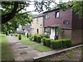
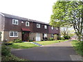
Photos of NN3 8YP


Area Information
NN3 8YP is a small, densely populated residential cluster in England, covering just 4.9 hectares and home to 1700 residents. Its compact size means the area is tightly knit, with a high population density of 34,697 people per square kilometre. This postcode is positioned near Northampton, offering proximity to urban amenities while retaining a distinct local character. Daily life here is shaped by its proximity to retail hubs, transport links, and schools. The area’s mix of retail options, including Aldi Overstone and Tesco Spinny, ensures residents have access to essential shopping. Public transport is practical, with Northampton Railway Station and nearby bus interchanges providing connectivity to the city and beyond. While the community is small, it is served by Thorplands Primary School, which has a good Ofsted rating, making it a family-friendly option for those prioritising education. The area’s compact nature means residents are likely to know their neighbours, though the high density could mean limited space for larger gardens or private outdoor areas.
- Area Type
- Postcode
- Area Size
- 4.9 hectares
- Population
- 1700
- Population Density
- 2455 people/km²
The property market in NN3 8YP is characterised by a 43% home ownership rate, with houses making up the majority of accommodation types. This suggests a focus on family homes rather than high-density flats or apartments, which is unusual for an area of this size. The relatively low home ownership rate indicates that a significant portion of the housing stock is rented, potentially attracting both long-term tenants and investors. The compact nature of the area means properties are likely to be smaller, with limited scope for expansion or redevelopment. For buyers, this presents a challenge: the small footprint of the postcode means competition for available homes, and the proximity to urban centres may drive up prices. However, the presence of essential amenities within walking distance could make it appealing to those seeking convenience over space.
House Prices in NN3 8YP
Showing 18 properties
| Address | Type | Beds | Baths | Last Sale Price | Last Sale Date | |
|---|---|---|---|---|---|---|
| 8 Clock Tower Court, Northampton, NN3 8YP | house | - | - | £299,000 | Nov 2020 | |
| 18 Clock Tower Court, Northampton, NN3 8YP | Detached | 3 | 1 | £213,000 | Nov 2020 | |
| 10 Clock Tower Court, Northampton, NN3 8YP | Terraced | 3 | - | £245,000 | Nov 2016 | |
| 7 Clock Tower Court, Northampton, NN3 8YP | Bungalow | 3 | 1 | £195,000 | Jul 2016 | |
| 17 Clock Tower Court, Northampton, NN3 8YP | house | - | - | £133,000 | Jan 2014 | |
| 16 Clock Tower Court, Northampton, NN3 8YP | Retail | 3 | 1 | £150,000 | Aug 2013 | |
| 5 Clock Tower Court, Northampton, NN3 8YP | house | - | - | £230,000 | Dec 2009 | |
| 6 Clock Tower Court, Northampton, NN3 8YP | Semi-detached | 3 | - | £245,000 | Nov 2007 | |
| 15 Clock Tower Court, Northampton, NN3 8YP | house | 3 | - | £114,995 | Feb 2004 | |
| 11 Clock Tower Court, Northampton, NN3 8YP | house | - | - | £109,000 | Nov 2000 |
Energy Efficiency in NN3 8YP
Living in NN3 8YP offers access to a range of practical amenities within easy reach. Retail options include Aldi Overstone, Co-op Moulton, and Tesco Spinny, providing essential shopping for daily needs. The area’s proximity to Northampton Bus Interchange and University Bus Interchange ensures convenient travel to the city centre, while Northampton Railway Station offers direct links to regional destinations. For leisure, the compact nature of the area means residents are likely to rely on nearby urban centres for larger entertainment options. The presence of Thorplands Primary School adds to the community feel, with families forming a significant portion of the population. While the area lacks expansive parks or recreational spaces, its density fosters a sense of closeness, with local shops and transport hubs shaping a lifestyle centred on convenience rather than sprawling suburban comforts.
Amenities
Schools
The nearest school to NN3 8YP is Thorplands Primary School, which serves the area’s younger residents. This primary school holds a good Ofsted rating, reflecting its quality of education and facilities. The absence of secondary schools in the immediate vicinity means families may need to consider commuting to nearby towns for secondary education. However, the presence of a well-rated primary school is a strong draw for families prioritising early education. The school’s good rating suggests it meets or exceeds national standards in teaching, safety, and pupil outcomes. For those with young children, this could be a decisive factor in choosing NN3 8YP as a place to live, though the lack of secondary schooling may require additional planning for older children.
| Rank | School | Type | Entry gender | Ages |
|---|
Explore more schools in this area
Go to Schools tabDemographics
The median age in NN3 8YP is 47, with the majority of residents falling in the 30-64 age range. This suggests a community of mostly working-age adults, many of whom may be in their peak earning years. Home ownership stands at 43%, slightly below the national average, indicating a mix of owner-occupied properties and rental homes. The area is predominantly composed of houses, which is uncommon in densely populated zones, suggesting a focus on family-oriented housing. The predominant ethnic group is White, with no data provided on other demographics. The high population density, combined with a relatively small area, means living spaces are likely to be closely packed. While the data does not specify deprivation levels, the presence of essential amenities and services implies a baseline quality of life, though the high density may impact privacy or green space availability.
Household Size
Accommodation Type
Tenure
Ethnic Group
Religion
Household Composition
Age
Household Deprivation
NS-SEC
Explore more demographic insights in this area
Go to Demographics tabPlanning
Planning Constraints
- Flood RiskPremium
- Ramsar Wetland SitesPremium
- Area of Outstanding Natural BeautyPremium
- Protected Nature ReservePremium
- Protected WoodlandPremium