Area Overview for NN3 8RJ
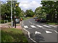
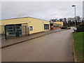
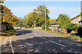
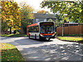
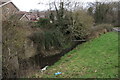
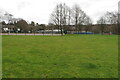
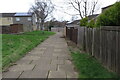
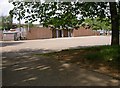
Photos of NN3 8RJ

Area Information
Living in NN3 8RJ means inhabiting a compact, residential cluster in England that balances density with a sense of community. The area covers 10.5 hectares and is home to 1,700 people, translating to a population density of 16,133 people per square kilometre. This high density suggests a tightly knit environment, where proximity to neighbours is a defining feature. The area’s small size means amenities and services are likely within walking distance, though its limited footprint also implies a focus on established, long-term residents. With a median age of 47, the community skews towards adults aged 30–64, indicating a mature demographic that may prioritise stability over rapid change. Daily life here is likely characterised by a mix of routine and local engagement, with the area’s proximity to transport hubs and retail options offering practical convenience. While the postcode’s size restricts expansion, its existing infrastructure and services cater to a population that values accessibility over sprawling development. For buyers, NN3 8RJ presents a niche opportunity: a small, defined area where the character of the community is shaped by its compact nature and the demographics of its residents.
- Area Type
- Postcode
- Area Size
- 10.5 hectares
- Population
- 1700
- Population Density
- 2455 people/km²
The property market in NN3 8RJ is defined by its small scale and the predominance of houses. With 43% of residents owning their homes, the area is not heavily reliant on rental properties, though the lower home ownership rate suggests a significant portion of the housing stock is let out. The focus on houses rather than flats or apartments indicates a market that may appeal to those seeking more space or a traditional property type. Given the area’s compact size of 10.5 hectares, the housing stock is likely limited, which could make the market competitive for buyers. The high population density of 16,133 people per square kilometre further implies that properties are closely spaced, with little room for new development. For buyers, this means that available homes may be few, and the immediate surroundings could be the primary source of options. The mix of owner-occupied and rented properties may also influence pricing dynamics, with demand potentially driving up costs in a constrained market.
House Prices in NN3 8RJ
Showing 11 properties
| Address | Type | Beds | Baths | Last Sale Price | Last Sale Date | |
|---|---|---|---|---|---|---|
| Front Warehouse, 8 Gate Lodge Close, Northampton, NN3 8RJ | warehouse | - | - | - | - | |
| Rear Warehouse, 8 Gate Lodge Close, Northampton, NN3 8RJ | warehouse | - | - | - | - | |
| Unit 1, 11A Gate Lodge Close, Northampton, NN3 8RJ | Industrial | - | - | - | - | |
| Saab Gb Ltd, 13 Gate Lodge Close, Northampton, NN3 8RJ | shop | - | - | - | - | |
| 9-10 Gate Lodge Close, Northampton, NN3 8RJ | office_workshop | - | - | - | - | |
| Suite 4, 7 Gate Lodge Close, Northampton, NN3 8RJ | Office | - | - | - | - | |
| Ground Floor, 7 Gate Lodge Close, Northampton, NN3 8RJ | office_workshop | - | - | - | - | |
| Suite 1, 7 Gate Lodge Close, Northampton, NN3 8RJ | Office | - | - | - | - | |
| Suite 2, 7 Gate Lodge Close, Northampton, NN3 8RJ | Office | - | - | - | - | |
| Suite 3, 7 Gate Lodge Close, Northampton, NN3 8RJ | Office | - | - | - | - |
Energy Efficiency in NN3 8RJ
The lifestyle in NN3 8RJ is shaped by its proximity to essential amenities and services. Within practical reach are five retail outlets, including Aldi Overstone, Co-op Moulton, and Tesco Spinny, providing access to groceries, household goods, and other daily necessities. These shops are likely to be the primary sources of supply for residents, given the area’s compact size and high population density. The presence of two bus interchanges—University Bus Interchange and Northampton Bus Interchange—offers reliable public transport options, while Northampton Railway Station provides rail connectivity to further destinations. Though the data does not specify parks or leisure facilities, the absence of environmental constraints like AONB or protected woodland suggests that open spaces may be limited. However, the area’s high density may foster a community-focused lifestyle, where local shops, transport links, and social hubs play a central role. The mix of retail and transport infrastructure ensures that daily life is both practical and accessible, though residents may need to look beyond the immediate area for more extensive leisure or recreational options.
Amenities
Schools
The nearest school to NN3 8RJ is Thorplands Primary School, which serves the area’s primary education needs. The school is explicitly listed twice in the data, both times with the same name, type, and an Ofsted rating of ‘good’. This consistency suggests that the school is a key local institution, likely catering to the children of the area’s 30–64 age demographic. The absence of secondary schools in the data means that families may need to look beyond NN3 8RJ for secondary education, though the primary school’s ‘good’ rating provides a baseline of quality for younger children. The presence of a single primary school with a solid rating could be a deciding factor for families prioritising education, though the lack of additional schools may limit options for older children. The school’s proximity to the area’s high population density suggests it is a central hub for local families, reinforcing the community’s focus on education and family life.
| Rank | School | Type | Entry gender | Ages |
|---|
Explore more schools in this area
Go to Schools tabDemographics
The community in NN3 8RJ is predominantly composed of adults aged 30–64, with a median age of 47. This suggests a population that is largely settled, with fewer young families or retirees compared to other areas. Home ownership stands at 43%, indicating that nearly half of residents rent their homes, which may reflect the area’s limited housing stock or its status as a secondary market. The accommodation type is primarily houses, which aligns with the higher home ownership rate in rural or semi-rural settings. The predominant ethnic group is White, with no data provided on other demographics, though this does not necessarily imply a lack of diversity. The population density of 16,133 per square kilometre is exceptionally high, which may impact living conditions, such as space per household or access to private outdoor areas. For quality of life, this density could mean a vibrant, active community but also potential challenges in terms of congestion or limited green space. The data does not specify deprivation levels, but the high density and mature age profile may correlate with a stable, though possibly aging, population.
Household Size
Accommodation Type
Tenure
Ethnic Group
Religion
Household Composition
Age
Household Deprivation
NS-SEC
Explore more demographic insights in this area
Go to Demographics tabPlanning
Planning Constraints
- Flood RiskPremium
- Ramsar Wetland SitesPremium
- Area of Outstanding Natural BeautyPremium
- Protected Nature ReservePremium
- Protected WoodlandPremium