Area Overview for NN3 8RF
Photos of NN3 8RF

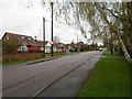
Area Information
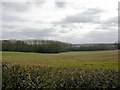
NN3 8RF is a compact residential postcode in England, covering just 4.3 hectares and home to 1,738 residents. Its high population density of 40,794 people per square kilometre reflects a tightly knit community, with homes clustered closely together. This area is distinct for its small-scale, suburban character, offering a mix of private residences and a relatively stable demographic. The median age of 47 suggests a mature population, with adults aged 30–64 forming the majority. Daily life here is shaped by proximity to nearby amenities, including retail outlets, transport hubs, and essential services. While the area lacks natural conservation designations, it benefits from practical connectivity to Northampton’s infrastructure. Residents here may find the balance between residential tranquillity and access to urban facilities appealing, though the compact size means the community is both intimate and densely populated.
- Area Type
- Postcode
- Area Size
- 4.3 hectares
- Population
- 1738
- Population Density
- 3575 people/km²
The property market in NN3 8RF is largely owner-occupied, with 62% of homes owned by residents. The accommodation type is predominantly houses, which is unusual for a small postcode area and suggests a focus on family homes or larger properties. This contrasts with areas where flats or apartments dominate, and may indicate a market more suited to buyers seeking private, standalone residences. The compact size of the area means the housing stock is limited, and buyers may need to consider nearby zones for additional options. The high home ownership rate also implies a stable market with lower rental demand, which could affect property availability for those seeking to rent. For those interested in purchasing, the prevalence of houses may appeal to families or individuals prioritising space and privacy.
House Prices in NN3 8RF
Showing 3 properties
| Address | Type | Beds | Baths | Last Sale Price | Last Sale Date | |
|---|---|---|---|---|---|---|
| Taurus House, Stone Circle Road, Northampton, NN3 8RF | Unknown | - | - | £15,000,000 | Mar 2020 | |
| Scientific Instruments Ltd, 2 Stone Circle Road, Northampton, NN3 8RF | general_industrial | - | - | - | - | |
| Dharmsee Parpia Overseas Ltd, 2 Stone Circle Road, Northampton, NN3 8RF | warehouse | - | - | - | - |
Energy Efficiency in NN3 8RF
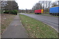
Living in NN3 8RF offers access to a range of local amenities within practical reach. Retail options include Aldi Overstone, Co-op Moulton, and Tesco Spinny, providing everyday shopping needs. The area’s transport links, such as the University Bus Interchange and Northampton Bus Interchange, connect residents to broader networks, while Northampton Railway Station offers direct rail access to nearby cities. Though the area is small, these amenities contribute to a convenient lifestyle, reducing the need for long commutes. The presence of multiple shops and transport hubs suggests a community that prioritises accessibility, making daily errands and travel efficient. While there are no named parks or leisure facilities in the data, the proximity to Northampton likely means residents can access larger recreational spaces nearby.
Amenities
Schools
| Rank | School | Type | Entry gender | Ages |
|---|
Explore more schools in this area
Go to Schools tabDemographics
The community in NN3 8RF is predominantly composed of adults aged 30–64, with a median age of 47. This suggests a population skewed towards middle-aged individuals, likely including families and professionals. Home ownership is strong, with 62% of residents owning their homes, compared to 38% renting. The accommodation type is primarily houses, indicating a focus on single-family dwellings rather than flats or apartments. The predominant ethnic group is White, though no specific data on diversity or deprivation is provided. The high proportion of homeowners and the age profile suggest a stable, long-term resident base. For buyers, this demographic implies a community with established routines and a low turnover of properties, which can influence both property values and the character of the area.
Household Size
Accommodation Type
Tenure
Ethnic Group
Religion
Household Composition
Age
Household Deprivation
NS-SEC
Explore more demographic insights in this area
Go to Demographics tabPlanning
Planning Constraints
- Flood RiskPremium
- Ramsar Wetland SitesPremium
- Area of Outstanding Natural BeautyPremium
- Protected Nature ReservePremium
- Protected WoodlandPremium